Hastings, County of

Taxonomía

Código

Nota(s) sobre el alcance

Nota(s) sobre el origen

Mostrar nota(s)

Términos jerárquicos

Hastings, County of

Término General Ontario

Hastings, County of

Términos equivalentes

Hastings, County of

Términos asociados

Hastings, County of

5602 Descripción archivística resultados para Hastings, County of

1099 resultados directamente relacionados Excluir términos relacionados

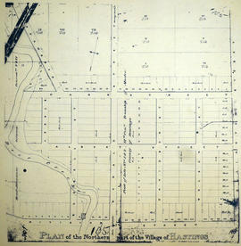
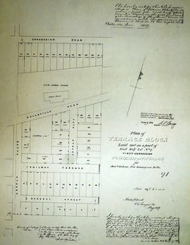
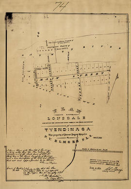
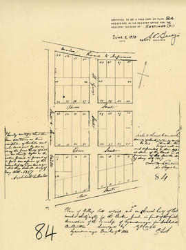
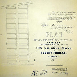
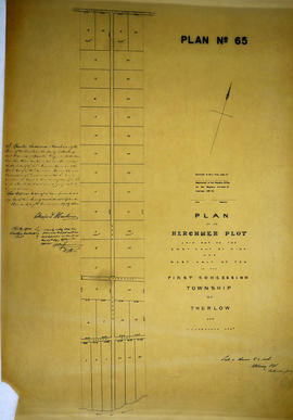
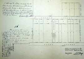
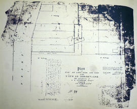
Plan of part of Lots 33-34 in the Town of Belleville

  • CA ON00156 M/M440-1697
  • Unidad documental simple
  • 1846
  • Parte deMap collection

A certified reproduction of the Plan of part of Lots # 33 & 34 in the Town of Belleville. Property of G. B. Spencer (Front St. East Side). Surveyed by John J. Haslett, P.L.S. in 1846.

This copy was made in 1972 of plan #99, as registered in the Hastings Land Registry Office.

Donated by Walter I. Watson, O.L.S.

Sin título

Plan of Lots 10-11 in the village of Stirling

  • CA ON00156 M/M430-1700
  • Unidad documental simple
  • c. 1860
  • Parte deMap collection

A certified reproduction of the Plan of part of the Village of Stirling, being part of Lot # 10 and east half of Lot # 11 in 1st Concession of Rawdon, for Edward Fidlar. Surveyed by John Emerson, P.L.S. circa 1860.

This copy was made in 1972 of plan #96, as registered in the Hastings Land Registry Office.

Donated by Walter I. Watson, O.L.S.

Sin título

Plan of the northern part of the village of Hastings c.1860

  • CA ON00156 M/M430-1703
  • Unidad documental simple
  • c. 1860
  • Parte deMap collection

A certified reproduction of the Plan of the northern part of the Village of Hastings. Includes parts of Lots # 1 & 2, 6th Concession of Township of Madoc (now Rawdon) and bounded by the Road Allowance Concessions V & VI, Division St. Wellington St. Surveyed by A. F. MacLeod, P.L.S., circa 1860.

This copy was made in 1972 of plan #105, as registered in the Hastings Land Registry Office.

Donated by Walter I. Watson, O.L.S.

Sin título

Plan of Terrace Block in the Township of Thurlow

  • CA ON00156 M/M430-1704
  • Unidad documental simple
  • May 1857
  • Parte deMap collection

A certified reproduction of the Plan of Terrace Block, the east half of Lot # 7, 1st Concession of Thurlow, for Messrs Jackson, Peto, Brassey and Betts. Outline of Grand Trunk Railway engine house is north of Belleville Road. Surveyed by Horsey and Nash, P.L.S. in May 1857.

This copy was made in 1972 of plan #91, as registered in the Hastings Land Registry Office.

Donated by Walter I. Watson, O.L.S.

Sin título

Plan of south Lonsdale in the Township of Tyendinaga

  • CA ON00156 M/M430-1722
  • Unidad documental simple
  • Apr 1855
  • Parte deMap collection

A certified reproduction of the Plan of south Lonsdale, south part of Lot # 32 in 3rd Concession of Tyendinaga Township, property of James Lazier. Surveyed by Publius V. Elmore, P.L.S. and signed April 1855.

This copy was made in 1972 of plan #74, as registered in the Hastings Land Registry Office.

Donated by Walter I. Watson, O.L.S.

Sin título

Plan of Lot 38 in the village of Millpoint (Deseronto)

  • CA ON00156 M/M430-1723
  • Unidad documental simple
  • 7 May 1857
  • Parte deMap collection

A certified reproduction of the Plan of Village lots as laid out on the east half of Lot 38 in the Broken Front of the 1st Concessionof the Township of Tyendinaga for Archibald Culbertson. Surveyed by Publius V. Elmore, P.L.S. and signed May 7, 1857.

This copy was made in 1972 of plan 84, as registered in the Hastings Land Registry Office.

Donated by Walter I. Watson, O.L.S.

Sin título

Plan of Village lots on Lot 1 in the town of Trenton

  • CA ON00156 M/M430-1728
  • Unidad documental simple
  • Aug 1855
  • Parte deMap collection

A certified reproduction of the Plan of Village lots on Lot # 1, Broken Front in Township Sidney, adjoining the village of Annwood in Trenton. Property of J. F. Flindall. Depicted is a cattle stable, distillery, Malt House and also a house on Lot 28. Surveyed by J. S. Peterson, P.L.S. in August 1855.

This copy was made in 1972 of plan #82, as registered in the Hastings Land Registry Office.

Donated by Walter I. Watson, O.L.S.

Sin título

Plan of Turley Property in the village of Frankford

  • CA ON00156 M/M430-1732
  • Unidad documental simple
  • May 1855
  • Parte deMap collection

A certified reproduction of the Plan of part of the Village of Frankford - the property of Patrick Turley Esq. Surveyed by J. S. Peterson, P.L.S. and signed May, 1855.

This copy was made in 1972 of plan #88, as registered in the Hastings Land Registry Office.

Donated by Walter I. Watson, O.L.S.

Sin título

Plan of Lots 7-9 in the village of Marmora

  • CA ON00156 M/M430-1733
  • Unidad documental simple
  • Sep 1849
  • Parte deMap collection

A certified reproduction of the Plan of Marmora Village - part of Lots # 7,8 & 9 in the 4th Concession of Marmora Township. The Marmora Foundry Company by Robert Symes, lawful agent, declares that this plan contains a true description. Depicted are; Coal houses; Grist Mill; Forge Store; and Mill dam. Surveyed by J. J. Haslett, P.L.S. and signed September 1855.

This copy was made in 1972 of plan #70, as registered in the Hastings Land Registry Office.

Donated by Walter I. Watson, O.L.S.

Sin título

Plan of Foster Town Plot in the town of Belleville

  • CA ON00156 M/M440-1734
  • Unidad documental simple
  • Aug 1856
  • Parte deMap collection

A certified reproduction of the Plan of Foster Town Plot - Laid out on Lot # 6 of Thurlow, 1st Concession and now in Town of Belleville, owned by Shubael Foster. Henry St. later was renamed Charles St., Centre St. later was renamed Albert St., and Matilda St. later was renamed Foster Ave. Surveyed by John Emerson, P.L.S. in August 1856.

This copy was made in 1972 of plan #85, as registered in the Hastings Land Registry Office.

Donated by Walter I. Watson, O.L.S.

Sin título

Plan of park lots on farm Lot 38 in the Township of Sidney

  • CA ON00156 M/M430-1736
  • Unidad documental simple
  • Sep 1856
  • Parte deMap collection

A certified reproduction of the Plan of Park Lots in the south part of farm Lot # 38 in 5th Concession Sidney Township. Surveyed by P.V. Elmore, P.L.S. in September of 1856.

This copy was made in 1972 of plan #86, as registered in the Hastings Land Registry Office.

Donated by Walter I. Watson, O.L.S.

Sin título

Plan of park lots on Lot 10 in the Township of Thurlow

  • CA ON00156 M/M430-1738
  • Unidad documental simple
  • Apr 1858
  • Parte deMap collection

A certified reproduction of the Plan of Park Lots on the south part of Lot # 10, in 3rd Concession of Thurlow Township for Robert Findlay. Surveyed by P.V. Elmore, P.L.S. in April of 1858.

This copy was made in 1972 of plan #53, as registered in the Hastings Land Registry Office.

Donated by Walter I. Watson, O.L.S.

Sin título

Plan of Herchmer Plot in the Township of Thurlow

  • CA ON00156 M/M430-1740
  • Unidad documental simple
  • Jul 1853
  • Parte deMap collection

A certified reproduction of the Plan of Herchmer Plot: east half of Lot # 9 and west half of Lot # 10 in first Concession of Thurlow - for Charles L. Herchmer. Surveyed by Henry Hodge Horsey, P.L.S. in July of 1853.

This copy was made in 1972 of plan #65, as registered in the Hastings Land Registry Office.

Donated by Walter I. Watson, O.L.S.

Sin título

Plan of Allan's Block in the village of Stirling

  • CA ON00156 M/M430-1743
  • Unidad documental simple
  • 1853
  • Parte deMap collection

A certified reproduction of the Plan of Allan's Block, part Lot # 12 in 1st Concession of Township of Rawdon (Stirling). Surveyed by John J. Haslett, P.L.S. in 1853.

This copy was made in 1972 of plan #57, as registered in the Hastings Land Registry Office.

Donated by Walter I. Watson, O.L.S.

Sin título

Plan of Saylor Reed Estate in the Township of Thurlow

  • CA ON00156 M/M430-1749
  • Unidad documental simple
  • 1854
  • Parte deMap collection

A certified reproduction of the Plan of part of Lots # 7, 8, 9, in the 4th Concession of Thurlow - “Salyer Reed's Estate.” The grist/saw mills and houses are depicted in the later vicinity of “Corby's Mill”. Surveyed by John J. Haslett, P.L.S. in 1854.

This copy was made in 1972 of plan #61, as registered in the Hastings Land Registry Office.

Donated by Walter I. Watson, O.L.S.

Sin título

Plan of part of Lot 12 in the Township of Rawdon

  • CA ON00156 M/M430-1753
  • Unidad documental simple
  • Dec 1849
  • Parte deMap collection

A certified reproduction of the Plan of part of Lot # 12 in 1st Concession of Rawdon Township. Property of Ebenezer D. Allan. Note that this plan became a part of the village of Stirling. Surveyed by John J. Haslett, P.L.S. and signed December 1849.

This copy was made in 1972 of plan #56, as registered in the Hastings Land Registry Office.

Donated by Walter I. Watson, O.L.S.

Sin título

Plan of southwest Lot 9 in the Township of Thurlow

  • CA ON00156 M/M430-1696
  • Unidad documental simple
  • 7 Mar 1868
  • Parte deMap collection

A certified reproduction of a Plan of the southwest corner of Lot # 9 in 1st Concession of Thurlow, for proprietor Albert Lewis Smith. Surveyed by John J. Haslett, P.L.S. and signed March 7, 1868.

This copy was made in 1972 of plan #130, as registered in the Hastings Land Registry Office.

Donated by Walter I. Watson, O.L.S.

Sin título

Plan of Lot 6 in the Township of Thurlow

  • CA ON00156 M/M430-1694
  • Unidad documental simple
  • 20 May 1867
  • Parte deMap collection

A certified reproduction of the Plan of Lot # 6, 1st Concession, Thurlow - surveyed into 4 lots for Rev. Michael Brennan. Surveyed by Samuel M. Benson, P.L.S. and signed May 20, 1867.

This copy was made in 1972 of plan #128, as registered in the Hastings Land Registry Office.

Donated by Walter I. Watson, O.L.S.

Sin título

Plan of part of Lot 2 in the Township of Thurlow

  • CA ON00156 M/M440-1686
  • Unidad documental simple
  • 2 Jun 1866
  • Parte deMap collection

A certified reproduction of the Plan of part of Lot 2 in 1st Concession Thurlow, from Bridge Street West to Catherine Street. Lots are numbered on both sides of Dunbar Street. Surveyed by Innes and MacLeod, P.L.S. and signed June 2, 1866.

This copy was made in 1972 of plan #113, as registered in the Hastings Land Registry Office.

Donated by Walter I. Watson, O.L.S.

Sin título

Plan of Norman Hill Subdivision in the Township of Madoc

  • CA ON00156 M/M440-1685
  • Unidad documental simple
  • 4 Apr 1861
  • Parte deMap collection

A certified reproduction of Norman Hill subdivision of Park Lots # 1 & 2 of the Russell Estate - half of Lot # 2, 6th Concession of Madoc.
The Property of R. M. Norman Esq. Surveyed by C. F. Aylsworth Sr., P.L.S. and signed April 4, 1861.

This copy was made in 1972 of plan #119, as registered in the Hastings Land Registry Office.

Donated by Walter I. Watson, O.L.S.

Sin título

Resultados 4961 a 4980 de 5602