Geographic features

Taxonomy

Code

Scope note(s)

Source note(s)

Display note(s)

Hierarchical terms

Geographic features

Equivalent terms

Geographic features

Associated terms

Geographic features

201 Archival description results for Geographic features

201 results directly related Exclude narrower terms

Massassaga Park, 1877-1895

File contains a newspaper article concerning a steamer excursion to Massassaga Park, near Belleville, in 1877. Also contains typescript notes describing Massassaga Park and its facilities in 1895. Also present : two articles concerning the demolition of the Massassaga Hotel in 1934.

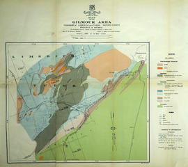
Mineral Map of the Gilmour Area

An original map of the Gilmour area, indicating specific geological areas and signs. Includes the Townships of Limerick and Tudor in the County of Hastings, Ontario. Dated 1913. Published by the Ontario Department of Lands, Forests and Mines, with a compilation of information completed by W. R. Rogers.

Donated by David Pershik.

Ontario. Department of Lands and Forests

Murray Township Map # 442773W

  • CA ON00156 M/M470-2591 - 2616/2592
  • Item
  • c. 1950
  • Part of Map collection

A reproduction of an air survey photograph produced by the Ontario Ministry of Natural Resources. Map # 442773W of Murray Township in Hastings County, Ontario. Circa 1950.

The photograph shows Concession 3 to 10 and Hickory Island of Murray Township, and Lots # 5 to 22, east part of Brighton Township.

Donated by Walter I. Watson, P. L. S.

Ontario. Ministry of Natural Resources and Forestry

National Topographic System Index Maps

  • CA ON00156 M/M470-1580 - 1584
  • Series
  • 31 Oct 1969 - Jan 1981
  • Part of Map collection

5 maps from the Canada Maps of the National Topographic System series - of various indexes.

Canada. Department of Energy, Mines and Resources

New Railway and Commerical Map of Ontario

"New Railway and Commercial Map of Ontario:" a map showing the upper right corner of Ontario, 1887. It features information and reference to railways at the time. Published and donated by S.R.G. Penson.
Received from the Archives of Canada's map collection - 27 Jul. 1966.

Penson, S. R. G.

Ontario Transportation Map series

A series of Southern Ontario maps made by the Ontario Ministry of Transportation.

Ontario. Ministry of Transportation

Ontario travel pictures

Black and white photographs of varying size. Photos taken throughout Ontario, Canada. Place names are written on the photos. Napanee, Gananoque, St. Ann, North Bay, Welland Canal, Massey, Point Traverse, Sault Ste. Marie

Ottawa

Black and white photographs of varying size. Photos taken in Ottawa, Ontario. Place names are written on the photos.

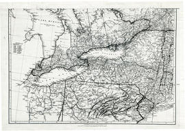
Parts of Ontario and USA in 1834

A map showing settlements of Ontario and part of the United States in February 1834 by J. Arrowsmith. The total area extends from Lake Huron East to Montreal and south Ohio to Long Island.
Received from the Archives of Canada's map collection - 11 May 1977.

Arrowsmith, John

Peace River Valley / by Harry M. Moore

File contains three newspaper articles by Harry M. Moore which appeared in the December 12th and December 19th, 1959 and January 2nd, 1960 editions of the Ontario Intelligencer. The articles chronicle Moore's travels along the Alaska Highway and into the Peace River Valley as well as areas in Northern Alberta.

Plan of block in east end of Belleville

  • CA ON00156 M/M440-1301
  • Item
  • 1 Mar 1951-14 Apr. 1960
  • Part of Map collection

A map showing a plan of survey for lots 4, 5, 6, 7, 8, 9 and lots 37, 38, 39, 40 on the south side of Bridge Street East between Dufferin and Macdonald Avenues in Belleville, Ontario. Surveyed by John T. Ransom on March 1, 1951 and amended April 14, 1960. Scale: 1'':50'.

Ransom, John Thomas, P.L.S.

Plan of Gatling Co.'s Gold Mining Property and adjoining lots in Marmora

"Plan of Gatling Co.'s Gold Mining Property and adjoining lots, Marmora, County of Hastings, Ontario." Scale: 1:3000. Published by The Desbarats Lith. and Comp. Montreal.

Donated by the Col. W. N. Ponton Estate. Col. Ponton or a relation presumably made the additional pen-written notes on the map.

Gatling Company owned the Gatling and Tuttle shafts at the Delora Mine, which were first opened by the Gatling Gold and Silver Mining company in 1873.
Read more: http://www.marmorahistory.ca/1866-founding-of-deloro

Desbarats Lithography and Company

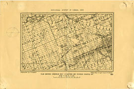
Plan showing Corundum Deposits in Hastings County

A plan showing corundum deposits in the townships of Hastings and Renfrew Counties. Published by the Geological Survey of Canada, Counties, Ontario. Dated 1898. Scale: 5 miles to an inch. Autographed "C. O. Senecal."

Received 19 Jul 1911 from Canada Iron Mines, Trenton Office.

Geological Survey of Canada

Quebec

Black and white photographs of varying size. Photos taken at different locations throughout Quebec. Montreal, Gaspe and Quebec City. Place names are written on each photograph.

Results 101 to 120 of 201