Hungerford, Township of

Taxonomy

Code

Scope note(s)

Source note(s)

Display note(s)

Hierarchical terms

Hungerford, Township of

Hungerford, Township of

Equivalent terms

Hungerford, Township of

Associated terms

Hungerford, Township of

6 Archival description results for Hungerford, Township of

6 results directly related Exclude narrower terms

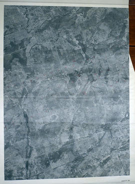
Hungerford Township Map # 444771W

  • CA ON00156 M/M470-2591 - 2616/2600
  • Item
  • c. 1950
  • Part of Map collection

A reproduction of an air survey photograph produced by the Ontario Ministry of Natural Resources. Map # 444771W of Hungerford Township in Hastings County, Ontario. Circa 1950.

The photograph shows Hungerford Township from Tyedinaga Township north to Bogart and Claire River.

Donated by Walter I. Watson, P.L.S.

Ontario. Ministry of Natural Resources and Forestry

Hungerford Township Map # 444772E

  • CA ON00156 M/M470-2591 - 2616/2601
  • Item
  • c. 1950
  • Part of Map collection

A reproduction of an air survey photograph produced by the Ontario Ministry of Natural Resources. Map #444772E of Hungerford Township in Hastings County, Ontario. Circa 1950.

The photograph shows Hungerford Township, Concession 3 to Tweed Village, Stoco Lake and Bogart Village.

Donated by Walter I. Watson, P.L.S.

Ontario. Ministry of Natural Resources and Forestry

Hungerford Township Map # 445772W

  • CA ON00156 M/M470-2591 - 2616/2606
  • Item
  • c. 1950
  • Part of Map collection

A reproduction of an air survey photograph produced by the Ontario Ministry of Natural Resources. Map #445772W of Hungerford Township in Hastings County, Ontario. Circa 1950.

The photograph shows the east part of Hungerford, southeast corner of Elzevir, west part of Sheffield and southwest part of Kaladar Townships in Lennox and Addington County.

Donated by Walter I. Watson, P.L.S.

Ontario. Ministry of Natural Resources and Forestry

Hungerford Township Map # 445772E

  • CA ON00156 M/M470-2591 - 2616/2607
  • Item
  • c. 1950
  • Part of Map collection

A reproduction of an air survey photograph produced by the Ontario Ministry of Natural Resources. Map #445772E of Hungerford Township in Hastings County, Ontario. Circa 1950.

The photograph shows the northeast part of Hungerford Township, south of Elzevir Township, Hwy 7 and Skootamata River.

Donated by Walter I. Watson, P.L.S.

Ontario. Ministry of Natural Resources and Forestry

Map of Hastings and Prince Edward Counties

A map showing the roads, forts and inns of Hastings and Prince Edward Counties in 1850, by Major Baron DeRottenburg. The map extends from Brighton to Gananoque, Prince Edward County. and North to include Rawdon, Huntingdon, Hungerford Townships of Hastings County. Scale: 2 miles = 1". Dimensions 63cm x 44cm.

DeRottenburg, Major Baron