Ontario

Taxonomía

Código

Nota(s) sobre el alcance

Nota(s) sobre el origen

Mostrar nota(s)

Términos jerárquicos

Ontario

Término General Canada

Ontario

Términos equivalentes

Ontario

Términos asociados

Ontario

652 Descripción archivística resultados para Ontario

7 resultados directamente relacionados Excluir términos relacionados

Map of the Province of Ontario

  • CA ON00156 M/M400-3075
  • Unidad documental simple
  • 1898
  • Parte deMap collection

An original "Map of the Province of Ontario showing counties, townships, railways and post offices." Published by COPP Clark Ltd. in 1898.

Sin título

Plan of village of Hastings in 1850

  • CA ON00156 M/M403-1802
  • Unidad documental simple
  • May 1850
  • Parte deMap collection

A certified reproduction of the "Plan of Village of Hastings on west half of Lot # 1 in 6th Concession of Township of Madoc for Uriah Seymour." Surveyed in May of 1850 by P. Elmore, P. L. S. A Furnace building and other buildings are depicted on a Common between the bridge and dam.

This copy was made in 1976 of plan #13, as registered in the Hastings Land Registry Office.

Donated by Walter I. Watson, O.L.S.

Sin título

Reproduction of Murray Canal Plan

  • CA ON00156 M/M410-1044
  • Unidad documental simple
  • 10 Apr 1883
  • Parte deMap collection

"Murray Canal Plan Showing Portions of the Old Canal Reserve Which It is Proposed to Grant to the Province of Ontario."
A reproduction from an original at the Archives of Canada's map collection.

Map of the County of Hastings and Adjoining Townships

  • CA ON00156 M/M420-1108
  • Unidad documental simple
  • c.1857
  • Parte deMap collection

"Map of the County of Hastings and Adjoining Townships. Compiled from Actual Surveys & The Latest Authorities by W. R. Elmore, C.E. Scale 100 chains to an inch. [Published by] Snyder, Black & Sturn, New York."

The townships within Hastings include Lake, Marmora, Madoc, Elzevir, Rawdon, Huntingdon, Hungerford, Sidney, Thurlow and Tyendinaga. The adjoining townships of other counties include Murray, Seymour, Belmont, Kaladar and Richmond. At the the top corners are drawings of the Courthouse and Jail, and the Episcopal Methodist Seminary, both in the town of Belleville.

Featured on the map: settlements, lots, concessions, road allowances, boundaries, mills, schools, post offices, other roads and railroads.

Sin título

Land Settlement Map of the Moira Valley

  • CA ON00156 M/M430-1187
  • Unidad documental simple
  • c. 1951
  • Parte deMap collection

A map of the land settlement, including roads and mills, located in the Moira Valley. This information has been superimposed on Publius V. Elmore's 1836 map of the Midland District.

The mills featured: Bleecker's Saw Mill, Mire's Grist Mill, Saw and Grist Mil, Colman's Mill, Jonas Canniff's Saw Mill, Joseph Canniff's Saw & Grist Mills, Daniel Canniff's Saw & Grist Mills, Reed's Saw Mill, Eowerman's Saw Mill, Thorn's Saw Mill, Thomson's Mill, Latta's Saw & Grist Mill, Carter's Saw Mill, Trumpour's Saw Mill, Munro's Saw & Grist Mill, McKenzie's Saw and Grist Mill, and Reed's Grist Mill.

Sin título

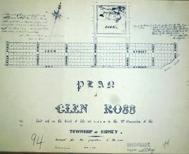
Plan of Glen Ross in the Township of Sidney

  • CA ON00156 M/M430-1701
  • Unidad documental simple
  • Jul 1859
  • Parte deMap collection

A certified reproduction of the Plan of Glen Ross, front of Lots # 8, 9, and 10 in 9th Concession of Sidney Township, for J. Stevenson. Signed by Joseph F. Way (agent of J. Stevenson) in July of 1859. Depicts “Public Park” and the names of streets.

This copy was made in 1972 of plan #94, as registered in the Hastings Land Registry Office.

Donated by Walter I. Watson, O.L.S.

Plan of subdivision of part Lots 5-6 in the Township of Thurlow

  • CA ON00156 M/M430-1702
  • Unidad documental simple
  • 20 Oct 1864
  • Parte deMap collection

A certified reproduction of the Plan of subdivision of part of Lots # 5 & 6 in the 3rd Concession of Thurlow, belonging to Jonas Canniff. Surveyed by Samuel M. Benson, P.L.S. and signed on October 20, 1864.

This copy was made in 1972 of plan #103, as registered in the Hastings Land Registry Office.

Donated by Walter I. Watson, O.L.S.

Sin título

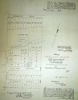
Plan of Terrace Block in the Township of Thurlow

  • CA ON00156 M/M430-1704
  • Unidad documental simple
  • May 1857
  • Parte deMap collection

A certified reproduction of the Plan of Terrace Block, the east half of Lot # 7, 1st Concession of Thurlow, for Messrs Jackson, Peto, Brassey and Betts. Outline of Grand Trunk Railway engine house is north of Belleville Road. Surveyed by Horsey and Nash, P.L.S. in May 1857.

This copy was made in 1972 of plan #91, as registered in the Hastings Land Registry Office.

Donated by Walter I. Watson, O.L.S.

Sin título

Plan of village of Milltown in the Township of Tyendinaga

  • CA ON00156 M/M430-1705
  • Unidad documental simple
  • 1860
  • Parte deMap collection

A certified reproduction of the Plan of part of Lot # 10 in 1st Concession of "Tyandinaga" Township, south of Road and the vilalge of Milltown. Depicted: homes, foundry, grist mill, saw mill, forge wells, lkiln and bounded by the Grand Trunk Railway. Surveyed by J. J. Haslett, P.L.S. in 1860.

This copy was made in 1972 of plan #97, as registered in the Hastings Land Registry Office.

Donated by Walter I. Watson, O.L.S.

Sin título

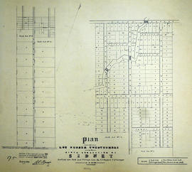
Plan of Lot 23 in the Township of Sidney (Stirling)

  • CA ON00156 M/M430-1706
  • Unidad documental simple
  • 1859
  • Parte deMap collection

A certified reproduction of the Plan of Lot # 23 in 9th Concession of Sidney Township, including Park & Village Lots (in Stirling). Surveyed by J. J. Haslett, P.L.S. in 1859.

This copy was made in 1972 of plan #95, as registered in the Hastings Land Registry Office.

Donated by Walter I. Watson, O.L.S.

Sin título

Plan of Town Lots on Lot 1 in the Township of Thurlow

  • CA ON00156 M/M430-1711
  • Unidad documental simple
  • Oct 1857
  • Parte deMap collection

A certified reproduction of the Plan of (Town Lots) on part of Lot # 1 in 1st Concession of Thurlow, surveyed for the proprietor Asa Yeomans Esq. Plot is bounded by Sidney/Thurlow line, second concession Road, Frank Street., Mill Street with Grand Trunk Rail Road of Canada bisecting. Surveyed by John Emerson, P.L.S. in October 1857.

This copy was made in 1972 of plan #92B, as registered in the Hastings Land Registry Office.

Donated by Walter I. Watson, O.L.S.

Sin título

Plan of part of the Hawley Estate in the town of Trenton

  • CA ON00156 M/M430-1712
  • Unidad documental simple
  • Aug 1865
  • Parte deMap collection

A certified reproduction of the Plan of part of “Hawley Estate” in the town of Trenton, along side of the River Trent as described in Deed from John Rowe to Sheldon Hawley. Depicts buildings and Gilmours Wharf. Surveyed by Innes and MacLeod, P.L.S. in August 1865.

This copy was made in 1972 of plan #107, as registered in the Hastings Land Registry Office.

Donated by Walter I. Watson, O.L.S.

Sin título

Plan of Moodie Property in the town of Belleville

  • CA ON00156 M/M430-1716
  • Unidad documental simple
  • 24 Mar 1861
  • Parte deMap collection

A certified reproduction of the Plan of part of town of Belleville, part of Lot # 2 in 1st Concession of Thurlow, property of J. W. Moodie. The Moodie stone home is depicted before Sinclair St. had been extended to Bridge St. West. Surveyed by Innes and MacLeod, P.L.S. and signed March 24, 1861.

This copy was made in 1972 of plan #102, as registered in the Hastings Land Registry Office.

Donated by Walter I. Watson, O.L.S.

Sin título

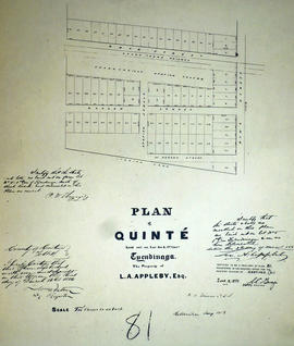
Plan of Quinte in the Township of Tyendinaga

  • CA ON00156 M/M430-1718
  • Unidad documental simple
  • 3 Mar 1856
  • Parte deMap collection

A certified reproduction of the Plan of Quinte, laid out on Lot # 5, 1st Concession of Tyendinaga Township, property of L. A. Appleby. Map shows - Shannonville Station ground and also Grand Trunk Railway. Surveyed by Publius V. Elmore, P.L.S. and signed March 3, 1856.

This copy was made in 1972 of plan #81, as registered in the Hastings Land Registry Office.

Donated by Walter I. Watson, O.L.S.

Sin título

Plan of south Lonsdale in the Township of Tyendinaga

  • CA ON00156 M/M430-1722
  • Unidad documental simple
  • Apr 1855
  • Parte deMap collection

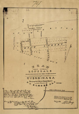
A certified reproduction of the Plan of south Lonsdale, south part of Lot # 32 in 3rd Concession of Tyendinaga Township, property of James Lazier. Surveyed by Publius V. Elmore, P.L.S. and signed April 1855.

This copy was made in 1972 of plan #74, as registered in the Hastings Land Registry Office.

Donated by Walter I. Watson, O.L.S.

Sin título

Plan of Lot 38 in the village of Millpoint (Deseronto)

  • CA ON00156 M/M430-1723
  • Unidad documental simple
  • 7 May 1857
  • Parte deMap collection

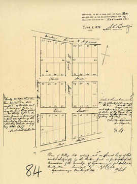
A certified reproduction of the Plan of Village lots as laid out on the east half of Lot 38 in the Broken Front of the 1st Concessionof the Township of Tyendinaga for Archibald Culbertson. Surveyed by Publius V. Elmore, P.L.S. and signed May 7, 1857.

This copy was made in 1972 of plan 84, as registered in the Hastings Land Registry Office.

Donated by Walter I. Watson, O.L.S.

Sin título

Plan of north Shannonville in the Township of Tyendinaga

  • CA ON00156 M/M430-1727
  • Unidad documental simple
  • 13 Sep 1856
  • Parte deMap collection

A certified reproduction of the Plan of north Shannonville - on the south part of Lot # 6, 1st Concession in the Township of 'Tyendenaga', property of Robert Clarke. Surveyed by Publius V. Elmore, P.L.S. and signed September 13, 1856.

This copy was made in 1972 of plan #79, as registered in the Hastings Land Registry Office.

Donated by Walter I. Watson, O.L.S.

Sin título

Plan of Village lots on Lot 1 in the town of Trenton

  • CA ON00156 M/M430-1728
  • Unidad documental simple
  • Aug 1855
  • Parte deMap collection

A certified reproduction of the Plan of Village lots on Lot # 1, Broken Front in Township Sidney, adjoining the village of Annwood in Trenton. Property of J. F. Flindall. Depicted is a cattle stable, distillery, Malt House and also a house on Lot 28. Surveyed by J. S. Peterson, P.L.S. in August 1855.

This copy was made in 1972 of plan #82, as registered in the Hastings Land Registry Office.

Donated by Walter I. Watson, O.L.S.

Sin título

Plan of a tier of lots in Thurlow for E.H. Coleman

  • CA ON00156 M/M430-1730
  • Unidad documental simple
  • 1854
  • Parte deMap collection

A certified reproduction of a Plan of a tier of lots embracing the whole Lot # 10 in the Coleman Block and being part of Lot # 3 in first Concession of Thurlow, for Everitt Hastings Coleman. Surveyed by William Wallbridge, P.L.S. in 1854.

This copy was made in 1972 of plan #72, as registered in the Hastings Land Registry Office.

Donated by Walter I. Watson, O.L.S.

Sin título

Plan of park lots on Lot 6 in Frankford

  • CA ON00156 M/M430-1731
  • Unidad documental simple
  • 23 Dec 1852
  • Parte deMap collection

A certified reproduction of the Plan of survey of Park lots on Lot # 6 in 5th Concession of Sidney Township (Frankford). Lot # 2 is reserved for Church of England Parsonage at south west corner. Surveyed by J. S. Peterson, P.L.S. and signed December 23, 1852.

This copy was made in 1972 of plan #73, as registered in the Hastings Land Registry Office.

Donated by Walter I. Watson, O.L.S.

Sin título

Resultados 121 a 140 de 652