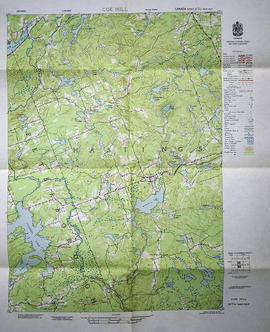
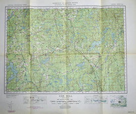
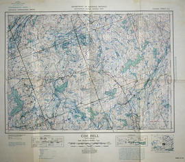
A topographical map of Coe Hill- Canada sheet #31 C/13, west half. Published by the Army Survey Establishment, Department of National Defence in 1956. Scale 1:50,000.
A topographical map of Coe Hill- Canada sheet #31 C/13. Published by the Army Survey Establishment, Department of National Defence in 1950. Scale one inch to one mile = 1/63,360.
A topographical map of Coe Hill- Canada sheet #31 C/13. Published by the Army Survey Establishment, Department of National Defence in 1949. Scale one inch to one mile = 1/63,360.
A topographical map of Clyde - Canada sheet #31 F/2, west half. Published by the Army Survey Establishment, Department of National Defence in 1951. Scale 1:50,000.
A topographical map of Campbellford - Canada sheet #31 C/5, west half. Published by the Army Survey Establishment, Department of National Defence in 1950. Scale 1:50,000.
A topographical map of Campbellford - Canada sheet #31 C/5, east half. Published by the Army Survey Establishment, Department of National Defence in 1950. Scale 1:50,000.
A topographical map of Campbellford - Canada sheet #31 C/5. Published by the Army Survey Establishment, Department of National Defence in 1956. Scale 1:50,000.
A topographical map of Brockville - Canada sheet #31 B/12. Published by the Army Survey Establishment, Department of National Defence in 1951. Scale 1:50,000.
A topographical map of Belleville - Canada sheet #31 C/3, east half. Published by the Army Survey Establishment, Department of National Defence in 1956. Scale 1:50,000.
A topographical map of Belleville - Canada sheet #31 C/3, west half. Published by the Army Survey Establishment, Department of National Defence in 1956. Scale 1:50,000.
A topographical map of Bath - Canada sheet #31 C/2. Published by the Army Survey Establishment, Department of National Defence in 1948. Scale 1 inch to 1 mile = 1/63, 360.
A topographical map of Barry's Bay - Canada sheet #31 F/5. Published by the Army Survey Establishment, Department of National Defence in 1948. Scale 1 inch to 1 mile = 1/63, 360.
A topographical map of Bannockburn - Canada sheet #31 C/12. Published by the Army Survey Establishment, Department of National Defence in 1950. Scale one inch to one mile - 1/63,360.
A topographical map of Bancroft - Canada sheet #31 F/4, east half. Published by the Army Survey Establishment, Department of National Defence in 1956. Scale 1:50,000.
A topographical map of Bancroft - Canada sheet #31 F/4, west half. Published by the Army Survey Establishment, Department of National Defence in 1956. Scale 1:50,000.
A topographical map of Bancroft - Canada sheet #31 F/4, west half. Published by the Army Survey Establishment, Department of National Defence in 1950. Scale 1:50,000.
A topographical map of Bancroft - Canada sheet #31 F/4, east half. Published by the Army Survey Establishment, Department of National Defence in 1950. Scale 1:50,000.
A series of topographical maps of Hastings County and the surrounding area, published by the Army Survey Establishment - National Department of Defence from the 1930s - 1950s.
A map featuring the streets in the City of Belleville, as well as important buildings (e.g. schools, churches etc.). Sponsored by and featuring advertisements from local businesses. Their contact information is listed. Published by OSM Networks Inc.