Showing 1294 results

Archival description
Map collection
Print preview Hierarchy View:

897 results with digital objects Show results with digital objects

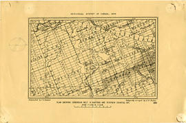
Map of Paleozoic Geology of Kaladar and Tweed

A map of the Paleozoic geology featured in the Tweed-Kaladar area during 1981. Scale 1:50,000. Published by the Ontario Ministry of Natural Resources.

Funded by the Federal Department of Regional and Economic Expansion and the Ontario Ministry of Natural Resources under the Minerals Program of Eastern Ontario Subsidiary Agreement.

Ontario. Ministry of Natural Resources and Forestry

Map of Land Ownership and Fish Species in Bancroft-Mazinaw

A map describing areas of land ownership and fish species in Bancroft/Mazinaw. The map covers the following townships:
Hastings County: Lake, Tudor & Grimsthorpe
Lennox and Addington County: Ashby, Denbigh, Effingham, Abinger & Anglesea
Frontenac County: Barrie, Clarendon, Miller, North Canonto, South Canonto, & Palmerston

Scale 1cm:1km. Published by the Ontario Ministry of Natural Resources in 1993.

Ontario. Ministry of Natural Resources and Forestry

Road Map of Hastings County 1932

A road map of Hastings County in 1932. Portions of adjoining counties are also pictured. Boundaries are yellow, while roads are blue and red. Published by the Ontario Department of Highways. Scale: 1 inch = 4 miles. Dimensions: 40.7cm x 66cm.

Ontario. Department of Highways

Map of Middle Hastings County 1963

Middle Hastings County in 1963. Map features boundaries, roads and railways. Scale: 1 inch : 1 mile. Published by the Department of Highways, Ontario. Made by Hunting Survey Corp. Ltd.

Features: road jurisdictions, Kings Highways, secondary highways, county roads, township roads, roads legally open but not necessarily passable, urban corporate limits, railways and stations, township boundaries, county boundaries, populated areas.

Ontario. Department of Highways

Map of City Streets in Belleville 1932

An original map showing the streets of the City of Belleville, as of January 6, 1932. By Charles A. Mott, City Engineer. Scale: 1" : 400 feet.

Mott, Charles Allan

Map of City Streets in Belleville 1940

An original map showing the streets of the City of Belleville, in March 1940. By Charles A. Mott, City Engineer. Scale: 1" : 400 feet.

Mott, Charles Allan

Map of City Streets in Belleville 1919

An original map showing the streets and businesses of the City of Belleville, in 1919. By John G. Mill, City Engineer. Scale: 1" : 400 feet.

Mill, John G.

Map of Middle Hastings County 1971

Middle Hastings County as of February 1971. Map features boundaries, roads and railways. Scale: 1 inch : 1 mile. Published by the Department of Highways, Ontario. Composed by Hon. Gordon Carton (Minister) and A.T.C. McNab (Deputy Minister).

Features: road jurisdictions, Kings Highways, secondary highways, county roads, township roads, roads legally open but not necessarily passable, urban corporate limits, railways and stations, township boundaries, county boundaries, populated areas.

Ontario. Ministry of Transportation

Map of Northern Hastings County 1974

Northern Hastings County as of August 1974. Scale: 1 cm : 1 km. Published by the Department of Highways, Ontario. Composed by the Cartography Section, Surveys and Plan Office.

Features: road jurisdictions, Kings Highways, secondary highways, county roads, township roads, roads legally open but not necessarily passable, urban corporate limits, railways and stations, township boundaries, county boundaries, populated areas.

Ontario. Ministry of Transportation

Map of Middle Hastings County 1975

Middle Hastings County as of February 1975. Scale: 1 cm : 1 km. Published by the Department of Highways, Ontario. Composed by Hon. James Snow (Minister) and Harold Gilbert (Deputy Minister).

Features: road jurisdictions, Kings Highways, secondary highways, county roads, township roads, roads legally open but not necessarily passable, urban corporate limits, railways and stations, township boundaries, county boundaries, populated areas.

Ontario. Department of Highways

Map of Hastings County and surrounding area 1978

Hastings County and surrounding area as of February 1978. Scale: 1:250,000. Published by Surveyors and Plans Office, Cartography section, Ministry of Transportation and Communication.

Ontario. Ministry of Transportation

Road Map of Hastings County 1969

A road map of Hastings County in 1969. Portions of adjoining counties are also pictured. Boundaries are yellow, while roads are blue and red. Published by the Ontario Department of Highways. Scale: 1 inch = 4 miles.

Ontario. Department of Highways

Map of Townships by waterfront and Mohawk Territory

Map showing townships by the waterfront of the Bay of Quinte and the Mohawk Territory. This area encompasses townships in both Prince Edward and Hastings Counties. Text on map says "District of Nassau." Dated 1790. Map copied from the Archives of Ontario.

Map of Hastings, Frontenac, Lennox and Addington 1850 reprint

Map showing Counties of Hastings, Frontenac, Lennox and Addington and the townships within. Legend shows boundaries of counties and townships, plank and graveled roads, other roads and canals. Surveyed by W. H. Smith. Published by MacLear. Scale 5 miles : 2 cm. Reprinted map from “Canada”: Past, Present, and Future. Original map dated 1850.

Smith, W. H.

Plan of Hastings for Hastings Directory

A map of Hastings County outlining townships:
Marmora, Lake, Madoc, Tudor, Grimsthorpe, Elzevir; Rawdon, Huntingdon, Hungerford, Sidney, Thurlow, Tyendinaga - as well as the northern townships.
Inset is "the Village of Marmora." Surveyed by H. A. F. Macleod, C.E. and P.L.S. Published by W. A. Little Lith., Montreal in the 1864-1865 copy of the Hastings Directory . Scale: 1:190,000.

MacLeod, Henry Augustine Fitzgerald, P.L.S.

Plan showing Corundum Deposits in Hastings County

A plan showing corundum deposits in the townships of Hastings and Renfrew Counties. Published by the Geological Survey of Canada, Counties, Ontario. Dated 1898. Scale: 5 miles to an inch. Autographed "C. O. Senecal."

Received 19 Jul 1911 from Canada Iron Mines, Trenton Office.

Geological Survey of Canada

Map of Northern Hastings County 1963

Northern Hastings County in 1963. Scale: 1" : 1 mile. Published by the Department of Highways, Ontario. Composed by the Hunting Survey Corp. Ltd.
Features: road jurisdictions, Kings Highways, secondary highways, township roads, roads legally open but not necessarily passable, urban corporate limits, railways and stations, township boundaries, county boundaries, populated areas.

Donated by Tom Ransom.

Ontario. Department of Highways

Tourist Map of Hastings County

A tourist road map of Hastings County showing major highways, waterways, towns, cities and villages. Map is undated and from an unnamed tourist guide book. Circa 1940.

Note the absence of any 400 highways.

Map of Belleville to North of Bancroft

A map containing focused maps of: Trenton, Belleville, Prince Edward County, Frankford, Picton, Bancroft, Deseronto, Stirling, Tweed, Marmora and Madoc. Insets refer to roads, streets and highways. Published by Millhouse Maps in 2001.

MIllhouse Maps

Map of Mineral Exploration in the Wicklow Area

A map of mineral exploration in the Wicklow area, Hastings County during 1983. Scale 1:15840. Published by the Ontario Ministry of Natural Resources. Charted by the Ontario Geological Survey.

Insets: legend, symbols, mineral assemblage subcodings, properties and occurrences and marginal notes.

Ontario. Ministry of Natural Resources and Forestry

Results 61 to 80 of 1294