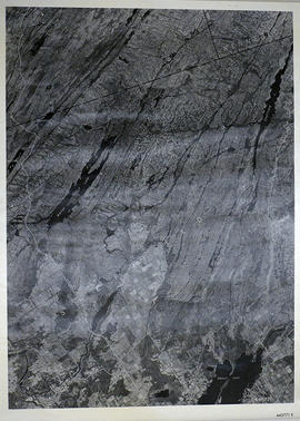
A reproduction of an air survey photograph produced by the Ontario Ministry of Natural Resources. Map # 444773E of Rawdon Township in Hastings County, Ontario. Circa 1950.
The photograph shows Rawdon Township from the eastern border to Hwy 14, Harold and Springbrook Villages, western Huntingdon Township, southern Marmora and Madoc Townships, Banker Lake.
A reproduction of an air survey photograph produced by the Ontario Ministry of Natural Resources. Map # 444773W of Rawdon Township in Hastings County, Ontario. Circa 1950.
The photograph shows Rawdon Township, Concession 8 to 14, west of Hwy 14, small sections of Marmora Township including Marmora Village and Crow Lake and a small part of Seymour Township in Northumberland County
A reproduction of an air survey photograph produced by the Ontario Ministry of Natural Resources. Map #445771E of Sheffield Township in Lennox and Addington County, Ontario. Circa 1950.
The photograph shows Sheffield Township, Concession 3 to 9, Beaver Lake and north to Kaladar Township, Concession VIII to XI, Lingham Lakes in Grimthorpe Township in Hastings County.
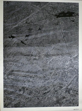
A reproduction of an air survey photograph produced by the Ontario Ministry of Natural Resources. Map #446772E of Elzevir Township in Hastings County, Ontario. Circa 1950.
The photograph shows the North East part of Elzevir Township, Elzevir Creek and the Skootamata River.
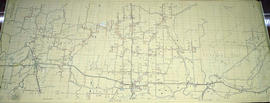
An original map produced for the Hydro-Electric Power Commission of Ontario, concerning hydro power lines, stations and transformers. However, the map also features railways, roads and land boundaries.
This map is the West Centre Section - Tweed ROA. The total area includes parts of Rawdon, Marmora, Huntingdon, Madoc, Hungerford, and Elzevir Townships. Dated October 16, 1951. Scale: 1.2 inches = 1 m.
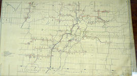
An original map produced for the Hydro-Electric Power Commission of Ontario, concerning hydro power lines, stations and transformers. However, the map also features railways, roads and land boundaries.
This map is of the North Section - Frankford Rural Power District. The total area includes parts of Thurlow, Huntingdon, Sidney, Rawdon, Campbellford, Seymour, Brighton, and Percy Townships. Circa 1950. Donated by David Pershik.
An original map produced for the Hydro-Electric Power Commission of Ontario, concerning hydro power lines, stations and transformers. However, the map also features railways, roads and land boundaries.
This map is of the Southwest Section - Tweed Rural Power District. The total area includes parts of Hungerford, Huntingdon, and Thurlow Townships. Dated October 16, 1951. Scale: 2 inches = 1 mile.
An original map produced for the Seymour Power & Electric Co. Limited, concerning proposed transmission lines within the Township of Murray. However, the map also features railways, roads, mills and land boundaries. Circa 1910. Scale: 50 chains = 1 inch. Map composed by Smith, Kerry and Chace Engineers located in Toronto, Winnipeg, Calgary and Vancouver.
An original map produced for the Trenton Electric & Water Co. Limited, concerning proposed transmission lines within the Township of Sidney. However, the map also features railways, roads and land boundaries. Circa 1910. Scale: 50 chains = 1 inch. Map composed by Smith, Kerry and Chace Engineers located in Toronto, Winnipeg, Calgary and Vancouver.
A blueprint reproduction of a map of Grimsthorpe Township in Hastings County, Ontario. The map features the names of neighboring townships, lot and concession numbers, rivers, and lakes. The total area is 69, 028 acres and without lakes 68, 711 acres. Surveyed by William Murdock, P.L.S., and signed February 22, 1867. Scale 40 chains to an inch.
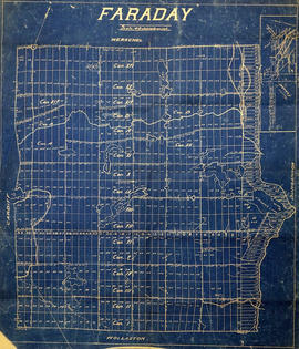
A blueprint reproduction of a map of Faraday Township in Hastings County, Ontario. The map features the names of neighboring townships, lot and concession numbers, rivers, lakes, and creeks. Surveyed by Frank R. Wilkins, O.L.S., circa 1913. Scale 40 chains to an inch.
A map of the Moira Region Watershed. Polychrome colours symbolize the varieties of soils and land use surveys, see Legend. Not dated, circa 1950. Published by the Ontario Department of Planning and Development, Conservation Branch. Dimensions 58.5cmx 69cm.
"Cummins Rural Directory Map:" A map of South and Central Hastings, in 1923, featuring post offices, hamlets and lot owners. Map is surrounded by advertisements. Published by Cummins Map Co., Toronto. Dimensions 71cm x 50.5cm.
A map of Hastings County in 1914. Roads to be removed are highlighted in red colour. Published by the Office of Public Roads and Highways. Scale: 2 miles = 1". Dimensions: 54cm x 87cm.
A Geological Map of the Madoc Gold Region, 1866. Geological data on map was taken principally from the reports of the Geological Survey of Canada. Secondly, by information and facts obtained on the spot by gentlemen engaged in the gold fields. What follows is a description of the general geological character of the area.
Author: Henry White, P.L.S. Published by G. B. Ware, 16 Toronto Street, Toronto, Ontario.
A regional planning map for the Village of Salem in Thurlow Township, February 1st, 1859. Area extends from concession #8 in lot 12. By Wm Wallbridge, P.L.S. Dimensions 71cm x 32cm. Scale: 1" = 2 chains.
Written in blue ink on the back of flowery wallpaper.
A map showing concessions and lots of Huntingdon - Madoc Township, Hastings County. Circa 1869. 30 advertisements for companies surround the map. Published by Macleod and Carre, Engineers and Surveyors. Scale: 1:63,000. Dimensions: 34.0cm x 37.0cm. Map was created from Government plan.
Donated from the Col. W. N. Ponton Estate. Penciled notes on map show Ponton family's interest in mining, especially after the Eldorado Gold Rush in 1866.
A map of Sidney Township, the Plan of Lots on Gladstone Avenue/Trent Road, 1912. Published by Lucien & Allen C.E. on January 2nd, 1912. Created by A.W. Ponton, P.L.S. Scale: 100 feet : 1 inch.
Copy of plan 204 registered in the Hastings County Land Registry Office, showing the Brown Block between Sidney Street (Townline Street) and Wilkins Street in Belleville, Ontario. The plan was drawn up by Evans and Bolger for James W. Brown, a tailor.
A copy of a map planning streets and some buildings in Belleville, Ontario, 1864-65. Composed by R. L. Innes, ESQ. C.E. Produced for the Hastings Directory.