Identity area
Reference code
CA ON00156 M/M470-2591 - 2616/2604
Title
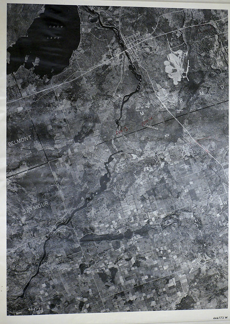
Rawdon Township Map # 444773W
Date(s)
- c. 1950 (Creation)
Level of description
Item
Extent and medium
1 photograph, 68 cm (w) x 93 cm (h)
Context area
Name of creator
Archival history
Immediate source of acquisition or transfer
Donated by Walter I. Watson, P.L.S.
Content and structure area
Scope and content
A reproduction of an air survey photograph produced by the Ontario Ministry of Natural Resources. Map # 444773W of Rawdon Township in Hastings County, Ontario. Circa 1950.
The photograph shows Rawdon Township, Concession 8 to 14, west of Hwy 14, small sections of Marmora Township including Marmora Village and Crow Lake and a small part of Seymour Township in Northumberland County
Donated by Walter I. Watson, P.L.S.
Appraisal, destruction and scheduling
Accruals
System of arrangement
Conditions of access and use area
Conditions governing access
Conditions governing reproduction
Language of material
Script of material
Language and script notes
Physical characteristics and technical requirements
Finding aids
Allied materials area
Existence and location of originals
Existence and location of copies
Photographed and available online at: https://www.flickr.com/photos/cabhc/48093712798/