Hungerford, Township of

Référentiel

Code

Note(s) sur la portée et contenu

Note(s) sur la source

Note(s) d'affichage

Termes hiérarchiques

Hungerford, Township of

Terme générique Hastings, County of

Hungerford, Township of

Termes équivalents

Hungerford, Township of

Termes associés

Hungerford, Township of

62 Description archivistique résultats pour Hungerford, Township of

62 résultats directement liés Exclure les termes spécifiques

Napanee, Tamworth & Quebec Railway reference book for Hungerford Township

  • CA ON00156 2017-81
  • Pièce
  • 1888

List of 81 landowners in Hungerford Township and the village of Tweed who gave up land for the Napanee, Tamworth and Quebec Railway's extension to Tweed in Hastings County. The book lists names of occupiers, concession and lot and acreage of the land taken by the railway company. A note on the front of the volume certifies that the reference book was lodged with the Registrar of Hastings County on October 29th, 1888.

Sans titre

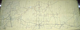
Hydro-Electric Power Commission of Ontario, Tweed-Section

  • CA ON00156 M/M430-2995 - 2996, 3018 - 3021, 3031/3018
  • Pièce
  • 16 Oct 1951
  • Fait partie de Map collection

An original map produced for the Hydro-Electric Power Commission of Ontario, concerning hydro power lines, stations and transformers. However, the map also features railways, roads and land boundaries.

This map is the West Centre Section - Tweed ROA. The total area includes parts of Rawdon, Marmora, Huntingdon, Madoc, Hungerford, and Elzevir Townships. Dated October 16, 1951. Scale: 1.2 inches = 1 m.

Donated by David Pershik.

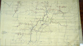
Hydro-Electric Power Commission of Ontario, Tweed Section

  • CA ON00156 M/M430-2995 - 2996, 3018 - 3021, 3031/3021
  • Pièce
  • 16 Oct 1951
  • Fait partie de Map collection

An original map produced for the Hydro-Electric Power Commission of Ontario, concerning hydro power lines, stations and transformers. However, the map also features railways, roads and land boundaries.

This map is of the Southwest Section - Tweed Rural Power District. The total area includes parts of Hungerford, Huntingdon, and Thurlow Townships. Dated October 16, 1951. Scale: 2 inches = 1 mile.

Donated by David Pershik.

Part of a deed for land in Hungerford Township

  • CA ON00156 2019-117
  • Pièce
  • 11 December 1829

Lower half of a memorial recording the sale of Lot 17 in Concession 1 of Hungerford Township from David Gardiner of to Thomas Goldsmith Gardiner, all of Whitby, for £50. The deed is instrument 1488 in Book L of the Hastings County Land Registry Office.

Sans titre

Rebellion Losses Claim #53 : Charles McGuire, Hungerford Township

File contains a manuscript claim submitted by Charles McGuire, Hungerford Township, for the loss of a horse while in service of the militia. Also contains a manuscript affidavit by Charles McGuire detailing the circumstances of the loss, submitted to the Commissioner of the District of Victoria...to investigate...claims for losses sustained during the Rebellion.

Willson, John Metcalfe - Papers

File contains original documents, presented to the Hastings County Historical Society in 1960; Biographical sketch written on 22-September-1869 covers the years 1862 to 1869 when Willson was teaching school in the southern part of Hastings County; educational papers; legal papers; correspondence and a poem entitled "To The Mohawks".

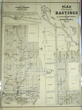
Plan of Hastings for Hastings Directory

  • CA ON00156 M/M420-1080
  • Pièce
  • 1864-1865
  • Fait partie de Map collection

A map of Hastings County outlining townships:
Marmora, Lake, Madoc, Tudor, Grimsthorpe, Elzevir; Rawdon, Huntingdon, Hungerford, Sidney, Thurlow, Tyendinaga - as well as the northern townships.
Inset is "the Village of Marmora." Surveyed by H. A. F. Macleod, C.E. and P.L.S. Published by W. A. Little Lith., Montreal in the 1864-1865 copy of the Hastings Directory . Scale: 1:190,000.

Sans titre

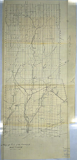
Map of Hastings County in 4 sections

A map of Hastings County outlining townships from the Bay of Quinte in the south, to Wallaston, Limerick and Cashel in the north.
Map is in four sections. Scale: 3 miles : 1 inch. Original map is dated 1894. Photocopy from the Archives of Ontario.

Map of the Counties of Hastings and Prince Edward

A "Map of the Counties of Hastings and Prince Edward." In 1898, the lots, concessions, churches, schools and mines are shown of the townships in Hastings and Prince Edward. Scale: 1.5 miles to an inch. Published by the Canadian Map Publishing Company in Hamilton, Ontario, for the Belleville Sun. Revised by Henry Carre, C.E. Inset is the map of North Hastings, scale 400 chains to an inch.

Sans titre

Plan of Re-subdivision of Lots 10-11 in the Village of Tweed

  • CA ON00156 M/M430-1983
  • Pièce
  • 16 Aug 1890
  • Fait partie de Map collection

A certified reproduction of the "Plan of Resubdivision of Part of Lots # 10, 11, Concession 10, Hungerford Township, Adjoining Village of Tweed, for Dr. Timotheus E. Pomeroy.” Surveyed by C. Fraser Aylsworth Jr., P.L.S., and signed August 6, 1890.

This copy was made in 1972 of plan #294, as registered in the Hastings Land Registry Office.

Donated by Walter I. Watson, P. L. S.

Sans titre

Résultats 1 à 20 sur 62