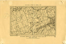
Map of the Moira Region Watershed
- CA ON00156 M/M410-1053
- Pièce
- c.1950
Fait partie de Map collection
A map of the Moira Region Watershed. Polychrome colours symbolize the varieties of soils and land use surveys, see Legend. Not dated, circa 1950. Published by the Ontario Department of Planning and Development, Conservation Branch. Dimensions 58.5cmx 69cm.
Sans titre