
- CA ON00156 M/M410-1047
- Pièce
- 1 Sept 1918
Fait partie de Map collection
A map of the Trent Canal in Ontario, September 1st, 1918. Published by the Department of Railways and Canals, Canada. Scale: 1" = 400 feet.
Sans titre
897 résultats avec objets numériques Afficher les résultats avec des objets numériques
Fait partie de Map collection
A map of the Trent Canal in Ontario, September 1st, 1918. Published by the Department of Railways and Canals, Canada. Scale: 1" = 400 feet.
Sans titre

Map of Watersheds of the Moira and Napanee Rivers
Fait partie de Map collection
A map of the Watersheds of the Moira and Napanee Rivers, 1950. From the Department of Planning and Development by A. H. Richardson, Chief Conservation Officer. Dimensions: 48cm x 35.5cm.
Sans titre

Plan showing extent of the city of Belleville, Ontario
Fait partie de Map collection
Coloured plan showing the extent of the city of Belleville, Ontario, from 1816 to 2003.
Sans titre

Map of Facilities within the Moira River Watershed
Fait partie de Map collection
A map for recreation purposes, showing existing and proposed facilities in the Moira River watershed area. Not dated, circa 1950. Dimensions 47.5cm x 35cm.

Map Hastings, Prince Edward, Northumberland and Peterborough Counties
Fait partie de Map collection
A map of Hastings, Prince Edward, Northumberland and Peterborough counties in 1916 from the Department of Interior Canada. Published by J.E. Chalifour, Chief Geographer. Scale: 3" to 95 miles. Dimensions 63.5cm x 96.5cm.
The legend includes additional information about counties, towns, villages, boundaries, railways, canals, lots, concessions, portages, rapids and First Nations Territories.
Sans titre

Map of Kingston to False Ducks Island
Fait partie de Map collection
A map of Eastern Lake Ontario (Kingston) to False Ducks Island and Prince Edward County. A corrected reprint was published on December 2nd, 1966 by Department of Energy, Mines & Resources, Canadian Hydrographic Service Marine Sciences Branch. Authors: Canadian Hydrographic Service & the Untied States Lake Survey.
Dimensions 103cm x 72cm.
Donated by K.M. Brown.
Sans titre

South and Central Hastings Map
Fait partie de Map collection
"Cummins Rural Directory Map:" A map of South and Central Hastings, in 1923, featuring post offices, hamlets and lot owners. Map is surrounded by advertisements. Published by Cummins Map Co., Toronto. Dimensions 71cm x 50.5cm.
Sans titre

Fait partie de Map collection
A map of Prince Edward County featuring information about local historical traditions, agriculture, community life and geography. Published in 1937 through Picton Times by Conger Allison. Dimensions: 72cm x 53cm.
Sans titre

Road Map of Hastings and Prince Edward Counties
Fait partie de Map collection
A map of Hastings and Prince Edward Counties from 1958. Titled "All roads lead to the City of Belleville and the Highlands of Hastings." Dimensions 19cm x 36cm.

Map of Southern Hastings County
Fait partie de Map collection
Southern Hastings County in 1963. Map features boundaries, roads and railways. Scale: 1:63,360. Published by the Department of Highways, Ontario. Made by Hunting Survey Corp. Ltd. Dimensions 107.5cm x 92.5cm.
A unique "one-inch" map because all one-inch series maps were converted to 1:50,000 after 1950. However, this map was converted to 1:63,360.
Sans titre

School Section Boundaries in Thurlow Township
Fait partie de Map collection
A map of the boundaries of school sections in Thurlow Township, December 1859. The sections are colourized polychrome. Concessions and main bodies of water are marked. By John Emerson, P.L.S. Dimensions 22.0cm x 35.0cm.
Donated by Albert Stapley in Belleville, July 1962.
Sans titre
Thurlow Township Land Ownership Map
Fait partie de Map collection
A map of Thurlow Township and its land ownership, 1862. Dimensions 48cm x 32cm.
Fait partie de Map collection
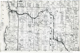
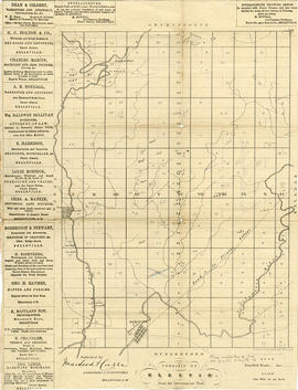
A map showing concessions and lots of Elzevir Township, Hastings County. Circa 1869. 16 advertisements are present on the left-hand side. Published by Macleod and Carre, Engineers and Surveyors. Scale: 1:63,000. Dimensions: 29.0cm x 37.5cm.
Sans titre

Fait partie de Map collection
A map showing concessions and lots of Huntingdon - Madoc Township, Hastings County. Circa 1869. 30 advertisements for companies surround the map. Published by Macleod and Carre, Engineers and Surveyors. Scale: 1:63,000. Dimensions: 34.0cm x 37.0cm. Map was created from Government plan.
Donated from the Col. W. N. Ponton Estate. Penciled notes on map show Ponton family's interest in mining, especially after the Eldorado Gold Rush in 1866.
Sans titre

Fait partie de Map collection
A map showing concessions and lots of Cashel Township, Hastings County. Circa 1869. 13 advertisements for companies are present on the left-hand side. Published by Macleod and Carre, Engineers and Surveyors. Scale: 1:63,000. Dimensions: 29.0cm x 33cm. Map was created from Government plan.
Donated from the Col. W. N. Ponton Estate. Penciled notes on map show Ponton family's interest in mining, especially after the Eldorado Gold Rush in 1866.
Sans titre

Map of Fredericksburg Township
Fait partie de Map collection
A survey plan map of the Township of Fredericksburg, 1784. Contains names of local property owners and bodies of water. Composed by James Peachy, Lewis Kotte, Henry Holland and Samuel Jaffe. Scale: 40 chains in an inch. Dimensions: 53cm x 39cm.
Sans titre

Fait partie de Map collection
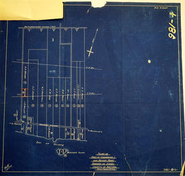
A map of Sidney Township, the Plan of Lots on Gladstone Avenue/Trent Road, 1912. Published by Lucien & Allen C.E. on January 2nd, 1912. Created by A.W. Ponton, P.L.S. Scale: 100 feet : 1 inch.
Sans titre
Map of Expropriated Land for Trenton Air Base
Fait partie de Map collection
A map of Sidney Township, part of Concession #1 and Broken Front, October 18th, 1912. The map details a tract of land expropriated for Trenton Air Base. Scale: 12.5 chains : 1 inch.
Attached is a letter dated May 1st, 1931, The King versus Maitland Hutton and Leda Hutton.

Lot Division Map of Sidney Township
Fait partie de Map collection
A lot division map of Sidney Township in Hastings County, Ontario. Published by the Department of Land Surveys on August 18th, 1944. Scale: 1=4,000.
Bottom right corner reads "Dominion of Canada, War Assets Corporation" and discusses a storage yard location on Lot 3, Concession 1.
Sans titre

Hastings with Town of Belleville and principal villages
Fait partie de Map collection
A map of Hastings County including the Town of Belleville and other principal villages:
Trenton, Madoc, Marmora, Tweed, Bridgewater, Stirling, Wicklow, Bangor, Herschel, Monteagle, Carl, Dungannon, Wollaston, Limerick, Cashel, Tudor, Grimsthorpe, Elzevir; Rawdon, Huntingdon, Hungerford, Sidney, Thurlow, Tyendinaga.
Scale: 3 miles =1 inch. Published by John P. Evans, P.L.S. in 1869.
Sans titre