Previsualizar a impressão Fechar

Mostrar 1530 resultados

Descrição arquivística
Land, settlement and immigration
Previsualizar a impressão Hierarchy Ver:

888 resultados com objetos digitais Mostrar resultados com objetos digitais

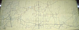
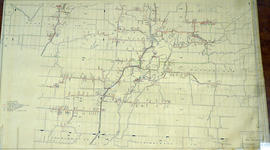
Ontario Hydro Aerial Plan of Lots 23-26 in Cramahe

  • CA ON00156 M/M470-2754 - 2780/2778
  • Item
  • Sep 1973 - Nov 1976
  • Parte de Map collection

Plan showing Cramahe Township, Northumberland County, Concession 8, Lots # 23 to 26 part of road allowance between Lots # 22 & 23, Concession 8 (Map # TD24778Z). For Ontario Hydro Transmission & Distribution projects, Division Orthophoto Title Study. Scale: 1 inch= 200 feet.

Sem título

Ontario Hydro Aerial Plan of Lots 27-31 in Cramahe

  • CA ON00156 M/M470-2754 - 2780/2779
  • Item
  • Sep 1973 - Nov 1976
  • Parte de Map collection

Plan showing Cramahe Township, Northumberland County, Concession 8, part Lots # 27 to 31. Aerial View of Ontario Hydro Project. (Map # TD24779Z). For Ontario Hydro Transmission & Distribution projects, Division Orthophoto Title Study. Scale: 1 inch= 200 feet.

Sem título

Ontario Hydro Aerial Plan of Lots 32-35 in Cramahe

  • CA ON00156 M/M470-2754 - 2780/2780
  • Item
  • Sep 1973 - Nov 1976
  • Parte de Map collection

Plan showing Cramahe Township, Northumberland County, Concession 8, Part Lots # 32 to 35 (Map # TD24780Z). For Ontario Hydro Transmission & Distribution projects, Division Orthophoto Title Study. Scale: 1 inch= 200 feet.

Sem título

Aerial Photograph of Belleville

  • CA ON00156 M/M470-2781 - 2794/2783
  • Item
  • c. 1970
  • Parte de Map collection

Belleville, Map # 78-4413-24 showing areas of; North East Belleville, Alemite Park on South West corner of map, Moira Secondary School near South East corner of map and Leeming Farm on 3rd Concession Road at North side of map. Published by the Ministry of Natural Resources. Surveyed by Walter I. Watson, P.L.S. Circa 1970.

Sem título

Aerial Photograph of Tudor Township

  • CA ON00156 M/M470-2781 - 2794/2784
  • Item
  • c. 1977
  • Parte de Map collection

Tudor Township, Map # 69.4432,6.275 showing areas of; Tudor Township- near Glamire Village on the Hastings Road, including the Beaver Creek and part of Glamire Lake and the road going North Easterly off Hastings Road at Glanmire. Published by the Department of Mines and Technical Surveys. Surveyed by EHR. Circa 1977.

Sem título

Aerial Photograph of Hamilton and Hope Townships

  • CA ON00156 M/M470-2781 - 2794/2789
  • Item
  • 27 Aug 1973
  • Parte de Map collection

Hamilton & Hope Townships, Map (order) 841-5711 showing areas of; Hamilton & Hope Townships-including Cobourg & Port Hope showing Hydro lines and gas & oil pipelines. Dated August 27, 1973. Scale: 1 inch = 2000 feet.

Aerial Photograph of Sophiasburgh Township

  • CA ON00156 M/M470-2781 - 2794/2792
  • Item
  • 1971
  • Parte de Map collection

An aerial photograph of Sophiasburgh Township, Map # 1.71-4402- 2-144 (enlarged section). The total area covered includes, Consecon Creek and Marsh, Hwy 62, County Road 2 and west Concession 7 in centre of map. A “Little Swamp”, Provincial Government Aerial Photo. Scale 1:10,000. Dated 1971.

Aerial Photograph of Tyendinaga Township

  • CA ON00156 M/M470-2781 - 2794/2794
  • Item
  • 10 Sep 1973 - 25 Aug 1976
  • Parte de Map collection

An aerial photograph of Tyendinaga Township, Map # TD19684Z01. The total area covered includes, Lots # 22-40, Concession 2, Lot # 22-31, Concession 3 - showing orthophoto right of way Selection Plan. For Ontario Hydro - Route & Site Selection Division. Aerial photo taken on September 10, 1973 and published August 25, 1976. Scale: 1 inch = 200 feet.

Hydro-Electric Power Commission of Ontario, Tweed-Section

  • CA ON00156 M/M430-2995 - 2996, 3018 - 3021, 3031/3018
  • Item
  • 16 Oct 1951
  • Parte de Map collection

An original map produced for the Hydro-Electric Power Commission of Ontario, concerning hydro power lines, stations and transformers. However, the map also features railways, roads and land boundaries.

This map is the West Centre Section - Tweed ROA. The total area includes parts of Rawdon, Marmora, Huntingdon, Madoc, Hungerford, and Elzevir Townships. Dated October 16, 1951. Scale: 1.2 inches = 1 m.

Donated by David Pershik.

Hydro-Electric Power Commission of Ontario, Frankford Section

  • CA ON00156 M/M430-2995 - 2996, 3018 - 3021, 3031/3020
  • Item
  • c. 1950
  • Parte de Map collection

An original map produced for the Hydro-Electric Power Commission of Ontario, concerning hydro power lines, stations and transformers. However, the map also features railways, roads and land boundaries.

This map is of the North Section - Frankford Rural Power District. The total area includes parts of Thurlow, Huntingdon, Sidney, Rawdon, Campbellford, Seymour, Brighton, and Percy Townships. Circa 1950.
Donated by David Pershik.

Hydro-Electric Power Commission of Ontario, Tweed Section

  • CA ON00156 M/M430-2995 - 2996, 3018 - 3021, 3031/3021
  • Item
  • 16 Oct 1951
  • Parte de Map collection

An original map produced for the Hydro-Electric Power Commission of Ontario, concerning hydro power lines, stations and transformers. However, the map also features railways, roads and land boundaries.

This map is of the Southwest Section - Tweed Rural Power District. The total area includes parts of Hungerford, Huntingdon, and Thurlow Townships. Dated October 16, 1951. Scale: 2 inches = 1 mile.

Donated by David Pershik.

A Close Up of Southern Ontario, Ontario, and Canada

  • CA ON00156 M/M400-3036, 3038 - 3041, 3044/M400-3036
  • Item
  • Dec 1978
  • Parte de Map collection

A map entitled "A Close Up of Southern Ontario, Ontario, and Canada" by the National Geographic Society's Cartography Section. Scale: 1 centimeter = 30 kilometers or 1 inch = 47.3 miles. Dated December 1978.

Sem título

A Map of Canada, 1985

  • CA ON00156 M/M400-3036, 3038 - 3041, 3044/M400-3038
  • Item
  • Nov 1985
  • Parte de Map collection

A map showing all of Canada by the National Geographic Society's Cartography Section. Scale: 1 centimeter = 69 kilometers or 1 inch = 109 miles. Dated November 1985.

Sem título

Map of Grimsthorpe Township

  • CA ON00156 M/M420-2169 - 2183/M420-2174
  • Item
  • 22 Feb 1867
  • Parte de Map collection

A blueprint reproduction of a map of Grimsthorpe Township in Hastings County, Ontario. The map features the names of neighboring townships, lot and concession numbers, rivers, and lakes. The total area is 69, 028 acres and without lakes 68, 711 acres. Surveyed by William Murdock, P.L.S., and signed February 22, 1867. Scale 40 chains to an inch.

Sem título

Map of Faraday Township

  • CA ON00156 M/M420-2169 - 2183/M420-2177
  • Item
  • 1913
  • Parte de Map collection

A blueprint reproduction of a map of Faraday Township in Hastings County, Ontario. The map features the names of neighboring townships, lot and concession numbers, rivers, lakes, and creeks. Surveyed by Frank R. Wilkins, O.L.S., circa 1913. Scale 40 chains to an inch.

Sem título

An Immigrant Story

  • CA ON00156 2011-29
  • Item
  • 2010

Family history of John McIntosh (1865 – 1925) and Henrietta Calder (1867 – 1950), immigrants from Scotland to Canada who settled in Belleville, Ontario.

Sem título

Part of a deed for land in Hungerford Township

  • CA ON00156 2019-117
  • Item
  • 11 December 1829

Lower half of a memorial recording the sale of Lot 17 in Concession 1 of Hungerford Township from David Gardiner of to Thomas Goldsmith Gardiner, all of Whitby, for £50. The deed is instrument 1488 in Book L of the Hastings County Land Registry Office.

Sem título

Photograph of Mike Stanko and Clare Homan

  • CA ON00156 2020-014
  • Item
  • c.1953

Photograph taken at John and Leatha Homan's farm on Harmony Road in Corbyville, Hastings County, Ontario. It shows Mike Stanko, a displaced person from Poland who came to Canada after the Second World War, and the Homan's son, Clare, next to a car.

Resultados 21 a 40 de 1530