Browse
Browse
Archival descriptions
People and organizations
Subjects
Places
Digital objects
Search
Advanced search »
Admin login
Have an account?
Email
*
Password
*
Admin login
Quick links
Quick links
Home
CABHC website
Privacy Policy
Language
Language
English
Français
Español
Nederlands
Português
Clipboard
Clipboard
Clear all selections
Go to clipboard
Load clipboard
Save clipboard
Discover the materials held by the Community Archives of Belleville and Hastings County
Map collection
Inventory list
Return to archival description »
Identifier
Title
Level of description
Date
Digital object
M420-2101
150th Anniversary Map of Stirling
Item
1 May 2008
Add
M440-1307
37 Polling Subdivisions of Belleville
Item
1958
View
Add
M400-3036
A Close Up of Southern Ontario, Ontario, and Canada
Item
Dec 1978
Add
M400-3051
A Compendium of Southern Ontario Rail Lines 1850-1984
Item
1987
Add
M400-3044
A Map of Canada, 1972
Item
Mar 1972
Add
M400-3038
A Map of Canada, 1985
Item
Nov 1985
Add
M400-3041
A Map of the Atlantic Gateways
Item
Mar 1983
Add
M400-3037
A map of the Boreal Forest of Canada
Item
1996
Add
M400-3040
A Map of the Great Lakes
Item
Jul 1987
Add
M400-2198
A New and Accurate Map of Part of North America
Item
7 Mar 1771
View
Add
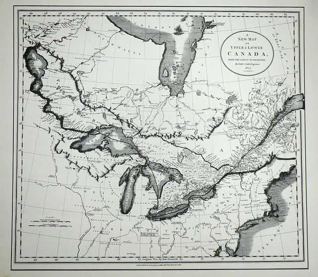
M1100-1654
A New Map of Upper & Lower Canada
Item
1 Dec 1807
View
Add
M430-1851
Additions to Taylor's Plan of George Street in Belleville
Item
25 Aug 1874
View
Add
2783
Aerial Photograph of Belleville
Item
c. 1970
Add
M440-1336
Aerial Photograph of Belleville and Sidney Township
Item
20 Jul 1978
Add
2695-2696
Aerial Photograph of Belleville East
Item
c. 1970
Add
2694
Aerial Photograph of Belleville West
Item
c. 1970
Add
2787
Aerial Photograph of Bowmanville
Item
1972
Add
2785
Aerial Photograph of Clarke Township
Item
1972
Add
2790
Aerial Photograph of Haldimand, Percy & Cramahe Townships
Item
c. 1975
Add
2789
Aerial Photograph of Hamilton and Hope Townships
Item
27 Aug 1973
Add
Results 1 to 20 of 1292
Next »
1
2
3
4
5
6
7
...
65
Next »
