Showing 4676 results

Archival description
With digital objects
Print preview Hierarchy View:
Plan of Wallbridge Estate in the town of Belleville
Plan of Subdivision of Lots 21-22 in the town of Belleville
Plan of Subdivision of Lot 2 in the town of Belleville
Plan of subdivision of Broken Lots 35-36 in the town of Belleville
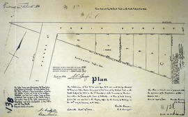
Plan of subdivision of Lot 13 and Gore 2 in the town of Belleville
Scrap map of Trenton to the Hill home
Topographical map of east Trenton - Canada sheet
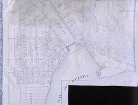
Map of Town Plot at mouth of Trent River
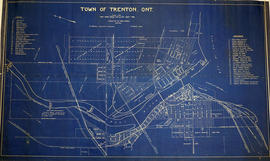
Map of the Town of Trenton 1926
Map of Lot L on the Trent River
Plan of the town plots of Trenton East
Diagram of Town plot called Trent Port
Map of Tyendinaga Mohawk Territory
Diagram of the proposed outlines for incorporation as the Village of Mill Point
Plan of the village of St. Albans 1854
Map of Murray Township showing several lots
Plan of Gatling Co.'s Gold Mining Property and adjoining lots in Marmora
Map of Deseronto city lots and ownership
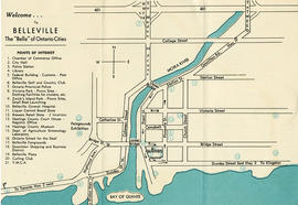
Information Guide Map of Belleville
Map of the City of Belleville, Ontario
Results 1841 to 1860 of 4676