Showing 133 results

Archival description
Madoc, Township of
Print preview Hierarchy View:

49 results with digital objects Show results with digital objects

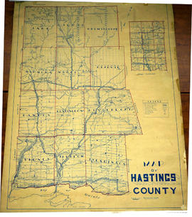
Lloyd's Map of Hastings County

A map of Hastings County outlining the twelve townships:
Marmora and Lake, Madoc, Tudor, Grimsthorpe, Elzevir; Rawdon, Huntingdon, Hungerford, Sidney, Thurlow, Tyendinaga. The northern townships are pictured on the right side.
As well as, the lots and concessions. Circa 1922. Scale: 1.5 miles: 1 inch. Published by Lloyd's Maps, Map Publisher.

Lloyd's Map, Map Publisher

Map of Hastings with townships

A map of Hastings County outlining the twelve townships:
Marmora and Lake, Madoc, Tudor, Grimsthorpe, Elzevir; Rawdon, Huntingdon, Hungerford, Sidney, Thurlow, Tyendinaga.
As well as, the lots and concessions. Circa 1916.Scale: 4 miles: 1 inch.

Donated by K.G.M. Ross.

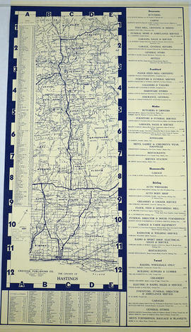
Townships of Hastings County with advertisements

A map of Hastings County, in 1932, showing lakes, rivers, cities, towns and townships. A list of businesses within the county are on the right. Drawn exclusively for and published by Croydon Publishing Company.

Croydon Publishing Co.

Minerals in northern Hastings County

A map of northern Hastings County detailing different types of mineral occurrences, see Legend. Published in 1943 by the Ontario Department of Mines. Scale: 1:120,000. The map includes parts of Quebec and USA, in relation to the region. It was produced to "accompany report by Jas E. Thomson in Vol. LII Ontario Department of Mines, Annual Report, 1943."

Donated by the Ontario Department of Mines, April 1, 1965.

Ontario. Department of Mines

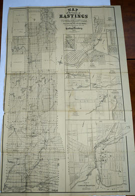
Hastings with Town of Belleville and principal villages

A map of Hastings County including the Town of Belleville and other principal villages:

Trenton, Madoc, Marmora, Tweed, Bridgewater, Stirling, Wicklow, Bangor, Herschel, Monteagle, Carl, Dungannon, Wollaston, Limerick, Cashel, Tudor, Grimsthorpe, Elzevir; Rawdon, Huntingdon, Hungerford, Sidney, Thurlow, Tyendinaga.

Scale: 3 miles =1 inch. Published by John P. Evans, P.L.S. in 1869.

Evans, John Dunlop, P.L.S.

Map of Madoc Township

A map showing concessions and lots of Huntingdon - Madoc Township, Hastings County. Circa 1869. 30 advertisements for companies surround the map. Published by Macleod and Carre, Engineers and Surveyors. Scale: 1:63,000. Dimensions: 34.0cm x 37.0cm. Map was created from Government plan.

Donated from the Col. W. N. Ponton Estate. Penciled notes on map show Ponton family's interest in mining, especially after the Eldorado Gold Rush in 1866.

MacLeod and Carre, P.L.S.

South and Central Hastings Map

"Cummins Rural Directory Map:" A map of South and Central Hastings, in 1923, featuring post offices, hamlets and lot owners. Map is surrounded by advertisements. Published by Cummins Map Co., Toronto. Dimensions 71cm x 50.5cm.

Cummins Map Company

Tudor Township, 1859 : petition for separation from Madoc

File contains a manuscript signed petition from landholders in the Township of Tudor to the County Council of the County of Hastings seeking administrative separation from the Township of Madoc, whose council had responsibility for Tudor. Also present is a by-law issued by the County of Hastings Council in 1859 enacting the separation of Tudor Township from the Township of Madoc.

Results 61 to 80 of 133