Water Communication between the Bay of Quinte and Lake Huron
Water Communication between the Bay of Quinte and Lake Huron

Topographical Map of Ontario - Belleville Sheet

Topographical map of Belleville - west half

Topographical map of Belleville - east half

Topographical Map of Belleville - Canada sheet - east half

Topographic Map of Ontario - Belleville Sheet
Teacher's Guide to Quinte in 1785
Teacher's Guide to Quinte in 1785

South and Central Hastings Map
Registered Plan Map of Belleville
Registered Plan Map of Belleville
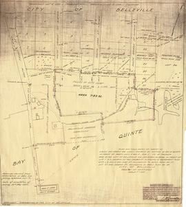
Plan of block in east end of Belleville
Plan of block in east end of Belleville

Meyers' Cave
Maps of Belleville on the Bay of Quinte
Maps of Belleville on the Bay of Quinte
Map of Water Lots in Moira River and Bay of Quinte
Map of Water Lots in Moira River and Bay of Quinte

Map of Railway Station, Harbour and Wharf Facilities
Map of planned Belleville Harbour

Map of Parcel of Area #1 - Land Settlement

Map of Hastings and Prince Edward Counties

Map of Dredging in Belleville Harbour

Map of City of Belleville and Principal Buildings
Map of Belleville to North of Bancroft
Map of Belleville to North of Bancroft