Mostrando 279 resultados

Descripción archivística
Belleville Con objetos digitales
Imprimir vista previa Hierarchy Ver :
South and Central Hastings Map
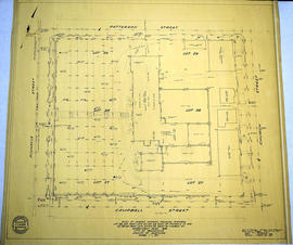
Plan 204 - Brown Block, Belleville, Ontario
Plan of the town of Belleville 1864-65
Haslett's 1868 Plan of Belleville
Map of Railway Station, Harbour and Wharf Facilities
Belleville and Bay of Quinte depth chart
Depth of the Moira River for Channel Plan
Map of Belleville's Growth from 1816-1965
Survey Plan and Physical Features of Belleville
Map of Sampson Ward
Map of Sampson Ward
Map of the City of Belleville, Ontario
Land Use Plan for the City of Belleville
Map of Ketcheson Ward
Carre's Plan of the city of Belleville 1892
Pathfinder's Map of Belleville 1963
Plan of Vair's Block
Aerial View of Quinte Cruising Waters
37 Polling Subdivisions of Belleville
Topographical Map of the Belleville to Kingston
Topographical Map of east Belleville - Canada sheet
Resultados 1 a 20 de 279