Mostrar 27 resultados

Descrição arquivística
Lennox and Addington, County of Com objeto digital Inglês
Previsualizar a impressão Hierarchy Ver:

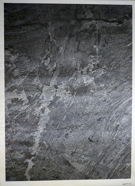
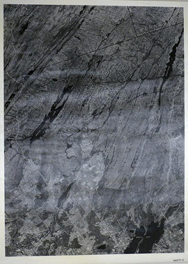
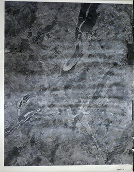
Sheffield Township Map # 444771E

  • CA ON00156 M/M470-2591 - 2616/2599
  • Item
  • c. 1950
  • Parte de Map collection

A reproduction of an air survey photograph produced by the Ontario Ministry of Natural Resources. Map #444771E of Sheffield Township in Lennox and Addington County, Ontario. Circa 1950.

The photograph shows the southwest part of Sheffield Township, Concession 1 to 6, Hwy 49, northwest corner of Camden East, northeast corner of Richmond Township and southeast corner of Hungerford with Village of Marlbank and Lime Lake.

Donated by Walter I. Watson, P.L.S.

Sem título

Hydro-Electric Power Commission of Ontario, Napanee Section

  • CA ON00156 M/M430-2995 - 2996, 3018 - 3021, 3031/2996
  • Item
  • 2 Mar 1931
  • Parte de Map collection

A reproduction of an original map produced for the Hydro-Electric Power Commission of Ontario, concerning the boundaries of the Napanee Rural Power District, center section. However, the map also features railways, roads and land boundaries. Dated March 2, 1931. Scale: 2 inches = 1 mile.

The map includes the townships of Tyendinaga, Richmond and Camden (East).

Donated by David Pershick.

Map of Fredericksburg Township

A survey plan map of the Township of Fredericksburg, 1784. Contains names of local property owners and bodies of water. Composed by James Peachy, Lewis Kotte, Henry Holland and Samuel Jaffe. Scale: 40 chains in an inch. Dimensions: 53cm x 39cm.

Sem título

Topographical Map of Ontario - Belleville Sheet

A map of Hastings, Prince Edward, Northumberland and Peterborough counties in 1929 from the Department of Interior Canada. By J.E. Chalifour, Chief Geographer. Scale: 1" to 3.95 miles.

The legend includes additional information about counties, towns, villages, boundaries, railways, canals, lots, concessions, portages, rapids and First Nations Territories.

Sem título

Bird's Eye View Map of Napanee

Reproduction of an 1874 Bird's Eye View of Napanee, Ontario, showing buildings that existed at that time. The original map was drawn by Herman Brosius and printed by Charles Sober & Co. of Chicago.

Donated by the Belleville Public Library in 2014.

Road Map of the County of Lennox & Addington

A road map of Lennox & Addington County in 1939. Portions of adjoining counties are also pictured. Boundaries are yellow, while roads are blue and red. Published by the Ontario Department of Highways. Scale: 1 inch = 4 miles.

Donated by the Township of Stirling-Rawdon in 2017.

Sem título

Kaladar Township Map # 446771W

  • CA ON00156 M/M470-2591 - 2616/2612
  • Item
  • c. 1950
  • Parte de Map collection

A reproduction of an air survey photograph produced by the Ontario Ministry of Natural Resources. Map #446771W of Kaladar Township in Lennox and Addington County, Ontario. Circa 1950.

The photograph shows Kaladar Township, Concession 1 to 7, Hwy 41, Northbrook and west to Flinton, the Skootamata River and the border of Anglesea Township.

Donated by Walter I. Watson, P.L.S.

Sem título

Map of Watersheds of the Moira and Napanee Rivers

A map of the Watersheds of the Moira and Napanee Rivers, 1950. From the Department of Planning and Development by A. H. Richardson, Chief Conservation Officer. Dimensions: 48cm x 35.5cm.

Sem título

Map of Indian Bands with Linguistic Affiliations

A map entitled "Canada Showing Location of Indian Bands with Linguistic Affiliations." Published by Indian Affairs Branch, Department of Indian Affairs and Northern Development in 1968.

Scale: 100 miles : 1 inch.

Sem título

Map of Hastings, Frontenac, Lennox and Addington 1850 reprint

Map showing Counties of Hastings, Frontenac, Lennox and Addington and the townships within. Legend shows boundaries of counties and townships, plank and graveled roads, other roads and canals. Surveyed by W. H. Smith. Published by MacLear. Scale 5 miles : 2 cm. Reprinted map from “Canada”: Past, Present, and Future. Original map dated 1850.

Sem título

Map of United Countries of Frontenac, Lennox and Addington

A reproduction by Canada Heritage Publications of the "Map of United Counties of Frontenac Lennox Addington, Canada West." Originally published by H. F. Walling of Putnam & Walling in Kingston - 1860. Includes the townships of Adolphustown, North/South Fredericksburgh, Richmond, Ernestown, Camden, Portland and Amherst Island. The names of proprietors are written in lots.

Sem título

Topographical map of Mazinaw Lake

  • CA ON00156 M/M470-1559 - 1573, 1576 - 1579, and 1585 - 1621/1599
  • Item
  • 1947
  • Parte de Map collection

A topographical map of Mazinaw Lake - Canada sheet #31 C/14. Published by the Army Survey Establishment, Department of National Defence in 1947. Scale 1 inch to 1 mile = 1/63.360.

Sem título

Sheffield Township Map # 445771E

  • CA ON00156 M/M470-2591 - 2616/2605
  • Item
  • c. 1950
  • Parte de Map collection

A reproduction of an air survey photograph produced by the Ontario Ministry of Natural Resources. Map #445771E of Sheffield Township in Lennox and Addington County, Ontario. Circa 1950.

The photograph shows Sheffield Township, Concession 3 to 9, Beaver Lake and north to Kaladar Township, Concession VIII to XI, Lingham Lakes in Grimthorpe Township in Hastings County.

Donated by Walter I. Watson, P.L.S.

Sem título

Thelma Joyce photographs from Deseronto and Napanee

  • CA ON00156 2019-072
  • Coleção
  • 1927-1931

Three photographs, formerly in the possession of Thelma Joyce:
1) Students and staff of Deseronto High School, 1927-1928, taken by E. J. Powell of Hamilton [photograph has names on reverse]
2) Members of the United Empire Loyalist Pageant in Deseronto, 1929, taken by Marrison of Kingston
3) Students and staff of Napanee Collegiate Institute and Vocational School, 1930-1931, taken by E. J. Powell of Hamilton

Sem título

Resultados 1 a 20 de 27