Mostrando 66 resultados

Descripción archivística
Rawdon, Township of
Imprimir vista previa Hierarchy Ver :

29 resultados con objetos digitales Muestra los resultados con objetos digitales

Hubel, Sarah, 1880

File contains a typescript transcript concerning the life of Sarah Ruth Hubel[sic], b. 1792, daughter of Loyalist Nehemiah Hubel[sic]. Includes references to Rawdon Township in the period of the the War of 1812.

News clipping on King's Mill, Rawdon Township

  • CA ON00156 2018-093
  • Unidad documental simple
  • 1997

Clipping from the Community Press newspaper of 19 July 1997 by Steven Tubb concerning the desire to find a new use for the King's Mill building in Rawdon Township, Ontario.

Globe and Mail obituary for Jim Pollock

  • CA ON00156 2022-013
  • Unidad documental simple
  • 2 Februrary 2022

Newspaper obituary for Rawdon Township dairy farmer and former Hastings-Peterborough MPP, Jim Pollock (1930-2021), written by his daughter, Virginia Warren.

Sin título

Deeds relating to properties in Stirling and Rawdon

  • CA ON00156 2022-028
  • Unidad documental compuesta
  • 1842-1896

Deeds, abstracts of title, and correspondence relating to two properties:

  1. Lot 22 in Concession 7; Lots 23 and 24 in Concession 6 of of Rawdon Township, Ontario
    This property was originally granted to Captain John Deserontyon and was later purchased by William Totten and Robert Matthews
  2. Lots between Church, Front, Annis and Allen Streets in Stirling, Ontario

Scrapbooks

  • CA ON00156 2024-077
  • Serie
  • 1919-1951

Scrapbooks of local newspaper articles and cards compiled by Lorena Marjorie Haight (later Ashley). They cover the following dates:

  1. 1919-1941 (predominately 1938-1941)
  2. 1941-1944 (includes a program for a Field Day at R.C.A.F. Trenton on 4 September 1944)
  3. 1945-1948
  4. Weddings, 1945-1951
  5. 1949-1950
  6. 1950-1951

Sin título

Rawdon Township Map # 443772W

  • CA ON00156 M/M470-2591 - 2616/2596
  • Unidad documental simple
  • c. 1950
  • Parte deMap collection

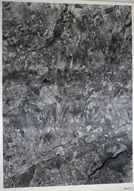
A reproduction of an air survey photograph produced by the Ontario Ministry of Natural Resources. Map # 443772W of Rawdon Township in Hastings County, Ontario. Circa 1950.

The photograph shows the west part of Rawdon Township and the east part of Huntingdon Township.

Donated by Walter I. Watson, P. L. S.

Sin título

Rawdon Township Map # 443773E

  • CA ON00156 M/M470-2591 - 2616/2597
  • Unidad documental simple
  • c. 1950
  • Parte deMap collection

A reproduction of an air survey photograph produced by the Ontario Ministry of Natural Resources. Map # 443773E of Rawdon Township in Hastings County, Ontario. Circa 1950.

The photograph shows Glen Ross, Oak Lake, Stirling and north to Concession 7.

Donated by Walter I. Watson, P.L.S.

Sin título

Rawdon Township Map # 444773E

  • CA ON00156 M/M470-2591 - 2616/2603
  • Unidad documental simple
  • c. 1950
  • Parte deMap collection

A reproduction of an air survey photograph produced by the Ontario Ministry of Natural Resources. Map # 444773E of Rawdon Township in Hastings County, Ontario. Circa 1950.

The photograph shows Rawdon Township from the eastern border to Hwy 14, Harold and Springbrook Villages, western Huntingdon Township, southern Marmora and Madoc Townships, Banker Lake.

Donated by Walter I. Watson, P.L.S.

Sin título

Rawdon Township Map # 444773W

  • CA ON00156 M/M470-2591 - 2616/2604
  • Unidad documental simple
  • c. 1950
  • Parte deMap collection

A reproduction of an air survey photograph produced by the Ontario Ministry of Natural Resources. Map # 444773W of Rawdon Township in Hastings County, Ontario. Circa 1950.

The photograph shows Rawdon Township, Concession 8 to 14, west of Hwy 14, small sections of Marmora Township including Marmora Village and Crow Lake and a small part of Seymour Township in Northumberland County

Donated by Walter I. Watson, P.L.S.

Sin título

Resultados 1 a 20 de 66