2 maps showing geological areas in Madoc (Map No. 2053) and Gananoque (Map No. 2053). Scale 1 in to 2 miles. Booklet by D. F. Hewitt, Senior Geologist, Ontario Department of Mines, Toronto.
Ontario. Ministry of Natural Resources and Forestry
A map of the Napanee Administrative District including Northumberland, Hasting County, Prince Edward County, Lennox Addington counties. Published by the Ministry of Natural Resources in 1980.
Donated by the Belleville Public Library in 2014.
Ontario. Ministry of Natural Resources and Forestry
A map of the Universal Transverse Mercator Grid System covering area in Zone 06 from Havelock to Brockville. Scale 1:250,000. Published by the Ministry of Natural Resources April 1st, 1989.
Ontario. Ministry of Natural Resources and Forestry
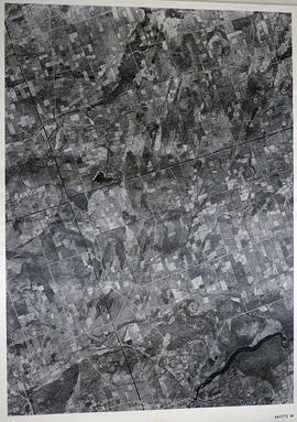
A reproduction of an air survey photograph produced by the Ontario Ministry of Natural Resources. Map # 442773E of Sidney Township in Hastings County, Ontario. Circa 1950.
The photograph shows Sidney Township, Concession 1 to 8, Lots # 1 to 25, Hwy 33 and the Trent Canal and Frankford Village, southeast part of Murray Township.
Donated by Walter I. Watson, P. L. S.
Ontario. Ministry of Natural Resources and Forestry
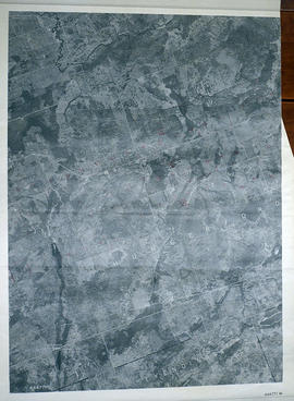
A reproduction of an air survey photograph produced by the Ontario Ministry of Natural Resources. Map # 442773W of Murray Township in Hastings County, Ontario. Circa 1950.
The photograph shows Concession 3 to 10 and Hickory Island of Murray Township, and Lots # 5 to 22, east part of Brighton Township.
Donated by Walter I. Watson, P. L. S.
Ontario. Ministry of Natural Resources and Forestry
A reproduction of an air survey photograph produced by the Ontario Ministry of Natural Resources. Map # 443771W of Tyendinaga Township in Hastings County, Ontario. Circa 1950.
The photograph shows Lonsdale, Melrose and north to Concession 8, Township of Tyendinaga.
Donated by Walter I. Watson, P. L. S.
Ontario. Ministry of Natural Resources and Forestry
A reproduction of an air survey photograph produced by the Ontario Ministry of Natural Resources. Map # 443772E of Thurlow Township in Hastings County, Ontario. Circa 1950.
The photograph shows the east part of Thurlow Township and west part of Tyendinaga Township from Concession 5 to Concession 8.
Donated by Walter I. Watson, P. L. S.
Ontario. Ministry of Natural Resources and Forestry
A reproduction of an air survey photograph produced by the Ontario Ministry of Natural Resources. Map # 443772W of Rawdon Township in Hastings County, Ontario. Circa 1950.
The photograph shows the west part of Rawdon Township and the east part of Huntingdon Township.
Donated by Walter I. Watson, P. L. S.
Ontario. Ministry of Natural Resources and Forestry
A reproduction of an air survey photograph produced by the Ontario Ministry of Natural Resources. Map # 443773E of Rawdon Township in Hastings County, Ontario. Circa 1950.
The photograph shows Glen Ross, Oak Lake, Stirling and north to Concession 7.
Donated by Walter I. Watson, P.L.S.
Ontario. Ministry of Natural Resources and Forestry
A reproduction of an air survey photograph produced by the Ontario Ministry of Natural Resources. Map # 444771W of Hungerford Township in Hastings County, Ontario. Circa 1950.
The photograph shows Hungerford Township from Tyedinaga Township north to Bogart and Claire River.
Donated by Walter I. Watson, P.L.S.
Ontario. Ministry of Natural Resources and Forestry
A reproduction of an air survey photograph produced by the Ontario Ministry of Natural Resources. Map #444772E of Hungerford Township in Hastings County, Ontario. Circa 1950.
The photograph shows Hungerford Township, Concession 3 to Tweed Village, Stoco Lake and Bogart Village.
Donated by Walter I. Watson, P.L.S.
Ontario. Ministry of Natural Resources and Forestry
A reproduction of an air survey photograph produced by the Ontario Ministry of Natural Resources. Map # 444772W of Huntingdon Township in Hastings County, Ontario. Circa 1950.
The photograph shows Huntingdon Township, Fuller Village north to Concession 13 and Moira Lake.
Donated by Walter I. Watson, P.L.S.
Ontario. Ministry of Natural Resources and Forestry
A reproduction of an air survey photograph produced by the Ontario Ministry of Natural Resources. Map # 444773E of Rawdon Township in Hastings County, Ontario. Circa 1950.
The photograph shows Rawdon Township from the eastern border to Hwy 14, Harold and Springbrook Villages, western Huntingdon Township, southern Marmora and Madoc Townships, Banker Lake.
Donated by Walter I. Watson, P.L.S.
Ontario. Ministry of Natural Resources and Forestry
A reproduction of an air survey photograph produced by the Ontario Ministry of Natural Resources. Map # 444773W of Rawdon Township in Hastings County, Ontario. Circa 1950.
The photograph shows Rawdon Township, Concession 8 to 14, west of Hwy 14, small sections of Marmora Township including Marmora Village and Crow Lake and a small part of Seymour Township in Northumberland County
Donated by Walter I. Watson, P.L.S.
Ontario. Ministry of Natural Resources and Forestry
A reproduction of an air survey photograph produced by the Ontario Ministry of Natural Resources. Map #445772W of Hungerford Township in Hastings County, Ontario. Circa 1950.
The photograph shows the east part of Hungerford, southeast corner of Elzevir, west part of Sheffield and southwest part of Kaladar Townships in Lennox and Addington County.
Donated by Walter I. Watson, P.L.S.
Ontario. Ministry of Natural Resources and Forestry
A reproduction of an air survey photograph produced by the Ontario Ministry of Natural Resources. Map #445772E of Hungerford Township in Hastings County, Ontario. Circa 1950.
The photograph shows the northeast part of Hungerford Township, south of Elzevir Township, Hwy 7 and Skootamata River.
Donated by Walter I. Watson, P.L.S.
Ontario. Ministry of Natural Resources and Forestry
A reproduction of an air survey photograph produced by the Ontario Ministry of Natural Resources. Map #445772W of Madoc Township in Hastings County, Ontario. Circa 1950.
The photograph shows Madoc Township, Concession 5 to 9, Huntingdon Township Concession 14, northwest Elzevir Township, Queenboro and Black River.
Donated by Walter I. Watson, P.L.S.
Ontario. Ministry of Natural Resources and Forestry
A reproduction of an air survey photograph produced by the Ontario Ministry of Natural Resources. Map #445773E of Madoc Township in Hastings County, Ontario. Circa 1950.
The photograph shows Madoc Township, Concession 1 to 7, Hwy 62, and Moira River Watershed, Eldorado, Lake Township, Concession 3 to 10.
Donated by Walter I. Watson, P.L.S.
Ontario. Ministry of Natural Resources and Forestry
A reproduction of an air survey photograph produced by the Ontario Ministry of Natural Resources. Map #445773W of Marmora Township in Hastings County, Ontario. Circa 1950.
The photograph shows Marmora Township, Crow Lake, and north to Thompson Lake.
Donated by Walter I. Watson, P.L.S.
Ontario. Ministry of Natural Resources and Forestry