Showing 1164 results

Archival description
Ontario Image With digital objects English
Print preview Hierarchy View:

Belleville Senators: notes for City Council and Staff

  • CA ON00156 2016-72
  • Item
  • September 2016

One-page information sheet on the Belleville Senators, the American Hockey League and the planned renovation and expansion of the Yardmen Arena at the Quinte Sports and Wellness Centre.

City of Belleville

Postcards

Photogelatine Engraving Co. Ltd., Ottawa postcards showing aerial views of Belleville, Ontario and a notecard of the Tabernacle United Church on Church Street, printed by Alex Wilson Publications of Dryden, Ontario.

Dorothy Bowes collection

  • CA ON00156 2016-81
  • Collection
  • 1936

Typewritten list of names residents of Tweed, Ontario,1902-1920, with their professions, four photographs of the Belleville, Ontario, flood of 1936 and two newsclippings from April 1999 about the Belleville Choral Society.

Bowes, Dorothy

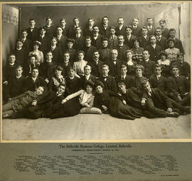
Photograph of Commercial Department, Belleville Business College

  • CA ON00156 2016-91
  • Item
  • 1903

Photograph of the Commercial Department of Belleville Business College, Belleville, Ontario, 10 March 1903. Names on photograph:

  • Fred Wannamaker, Hartsmere, Ont.
  • H. A. Millar, Cardinal, Ont.
  • George Cook, Belleville
  • Frank Pillsworth, Belleville
  • Blake Milligan, Melrose, Ont.
  • A. D. McDonell, Greenfield, Ont.
  • J. A. Toner, Port Ashford, Que.
  • J. D. Johnson, Sydney, C.B.
  • Alex. Hosie, Belleville
  • Fred Ketcheson, Belleville
  • Raymond Zufelt, Belleville
  • J. A. Wilson, Belleville
  • Thomas Fenlon, Stoco, Ont.
  • Harold Sanders, Belleville
  • E. Bourassa, St. Barthelemi, Que.
  • Fred Denyes, Plainfield, Que.
  • J. D. Hutchison, Lemesurier, Que.
  • Aylmer Frederick, Campbellford, Ont.
  • Ryerson Vandervoort, Trenton, Ont.
  • J. F. Treverton, Belleville
  • J. Mackewen, Foxboro, Ont.
  • Laura Mouck, Tweed, Ont.
  • Walter Goswell, Foxboro, Ont.
  • Daisy McDonald, Belleville
  • Harry Mackie, Belleville
  • Dora McPherson, Bouck's Hills, Ont.
  • Anson Lowry, Picton, Ont.
  • May McDonald, Tyndal, Man.
  • J. W. Sprague, Demorestville, Ont.
  • Florence Ellis, Lindsay, Ont.
  • J. D. Burnet, St. Timothee, Que.
  • Blanche Banford, Hainesville, Ont.
  • Angus F. Pringle, Belleville
  • Harry Denton, Assistant
  • A. M. McInnes, Teacher
  • J. A. Tousaw, Teacher
  • J. Frith Jeffers, M.A., Principal
  • S. T. Thompson, Teacher
  • Douglas Kirby, Assistant
  • Maggie Troy, Belleville
  • Carl Sills, Foxboro, Ont.
  • Robert Bunnett, Plainfield, Ont.
  • George A. Mathison, Havelock, Ont.
  • Helen E. Moore, Belleville
  • Bidwell Sharp, Belleville
  • Fred Clark, Belleville
  • Harry Richards, Wooler, Ont.
  • John Dale, Madoc, Ont.
  • Lizzie Farrell, Belleville
  • George Denyes, Plainfield, Ont.
  • J. M. Dodd, Elmside, Que.
  • W. A. Grills, Chapman, Ont.
  • Benson Wannamaker, Hartsmere, Que.
  • Pearl Montague, Gananoque, Que.
  • M. I. Corrigan, Winchester, Ont.
  • James E. Palmer, Corbyville, Ont.
  • Wakefield Ward, Foxboro, Ont.

Clarke, W. S.

Map of Mayo Township

  • CA ON00156 M/M420-2169 - 2183/M420-2170
  • Item
  • c. 1890
  • Part of Map collection

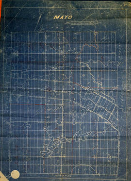
An original waxed linen map of Mayo Township in Hastings County, Ontario. The map features the names of neighboring townships, lot and concession numbers, and lakes. Signed by a “J. E. Appleby” of Toronto. Circa 1890.

Map of Mayo Township

  • CA ON00156 M/M420-2169 - 2183/M420-2171
  • Item
  • c. 1865
  • Part of Map collection

A blueprint reproduction of a map of Mayo Township in Hastings County, Ontario. The map features the names of neighboring townships, lot and concession numbers, rivers, lakes and school sections in red. Circa 1865. Scale 40 chains to an inch.

Map of Wollaston Township

  • CA ON00156 M/M420-2169 - 2183/M420-2175
  • Item
  • c. 1880
  • Part of Map collection

A blueprint reproduction of a map of Wollaston Township in Hastings County, Ontario. The map features the names of neighboring townships, lot and concession numbers, rivers, lakes, and the Central Ontario Railway. Original map circa 1880. Scale 40 chains to an inch.

Map of Limerick Township

  • CA ON00156 M/M420-2169 - 2183/M420-2180
  • Item
  • c. 1880
  • Part of Map collection

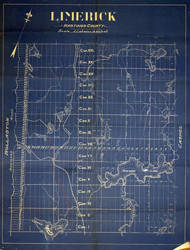
A blueprint reproduction of a map of Limerick Township in Hastings County, Ontario. The map features the names of neighboring townships, lot and concession numbers, creeks, lakes (Salmon, Bass, Mud, etc.), and the Central Ontario Railway. The Hastings Road borders the west side of the township. Original map circa 1880. Scale 40 chains to an inch.

Map of Wicklow Township

  • CA ON00156 M/M420-2169 - 2183/M420-2181
  • Item
  • c. 1880
  • Part of Map collection

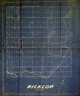
A blueprint reproduction of a map of Wicklow Township in Hastings County, Ontario. The map features the names of neighboring townships, lot and concession numbers, creeks, lakes (Papineau, Gull, Hawk, etc.), and the Central Ontario Railway. The Hastings Road borders the west side of the township. Original map circa 1880. Scale 40 chains to an inch.

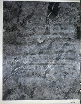
Rawdon Township Map # 443773E

  • CA ON00156 M/M470-2591 - 2616/2597
  • Item
  • c. 1950
  • Part of Map collection

A reproduction of an air survey photograph produced by the Ontario Ministry of Natural Resources. Map # 443773E of Rawdon Township in Hastings County, Ontario. Circa 1950.

The photograph shows Glen Ross, Oak Lake, Stirling and north to Concession 7.

Donated by Walter I. Watson, P.L.S.

Ontario. Ministry of Natural Resources and Forestry

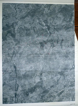
Sheffield Township Map # 444771E

  • CA ON00156 M/M470-2591 - 2616/2599
  • Item
  • c. 1950
  • Part of Map collection

A reproduction of an air survey photograph produced by the Ontario Ministry of Natural Resources. Map #444771E of Sheffield Township in Lennox and Addington County, Ontario. Circa 1950.

The photograph shows the southwest part of Sheffield Township, Concession 1 to 6, Hwy 49, northwest corner of Camden East, northeast corner of Richmond Township and southeast corner of Hungerford with Village of Marlbank and Lime Lake.

Donated by Walter I. Watson, P.L.S.

Ontario. Ministry of Natural Resources and Forestry

Hungerford Township Map # 444771W

  • CA ON00156 M/M470-2591 - 2616/2600
  • Item
  • c. 1950
  • Part of Map collection

A reproduction of an air survey photograph produced by the Ontario Ministry of Natural Resources. Map # 444771W of Hungerford Township in Hastings County, Ontario. Circa 1950.

The photograph shows Hungerford Township from Tyedinaga Township north to Bogart and Claire River.

Donated by Walter I. Watson, P.L.S.

Ontario. Ministry of Natural Resources and Forestry

Huntingdon Township Map # 444772W

  • CA ON00156 M/M470-2591 - 2616/2602
  • Item
  • c. 1950
  • Part of Map collection

A reproduction of an air survey photograph produced by the Ontario Ministry of Natural Resources. Map # 444772W of Huntingdon Township in Hastings County, Ontario. Circa 1950.

The photograph shows Huntingdon Township, Fuller Village north to Concession 13 and Moira Lake.

Donated by Walter I. Watson, P.L.S.

Ontario. Ministry of Natural Resources and Forestry

Hungerford Township Map # 445772E

  • CA ON00156 M/M470-2591 - 2616/2607
  • Item
  • c. 1950
  • Part of Map collection

A reproduction of an air survey photograph produced by the Ontario Ministry of Natural Resources. Map #445772E of Hungerford Township in Hastings County, Ontario. Circa 1950.

The photograph shows the northeast part of Hungerford Township, south of Elzevir Township, Hwy 7 and Skootamata River.

Donated by Walter I. Watson, P.L.S.

Ontario. Ministry of Natural Resources and Forestry

Madoc Township Map # 445772W

  • CA ON00156 M/M470-2591 - 2616/2609
  • Item
  • c. 1950
  • Part of Map collection

A reproduction of an air survey photograph produced by the Ontario Ministry of Natural Resources. Map #445772W of Madoc Township in Hastings County, Ontario. Circa 1950.

The photograph shows Madoc Township, Concession 5 to 9, Huntingdon Township Concession 14, northwest Elzevir Township, Queenboro and Black River.

Donated by Walter I. Watson, P.L.S.

Ontario. Ministry of Natural Resources and Forestry

Marmora Township Map # 445773W

  • CA ON00156 M/M470-2591 - 2616/2610
  • Item
  • c. 1950
  • Part of Map collection

A reproduction of an air survey photograph produced by the Ontario Ministry of Natural Resources. Map #445773W of Marmora Township in Hastings County, Ontario. Circa 1950.

The photograph shows Marmora Township, Crow Lake, and north to Thompson Lake.

Donated by Walter I. Watson, P.L.S.

Ontario. Ministry of Natural Resources and Forestry

Kennebec Township Map # 446771E

  • CA ON00156 M/M470-2591 - 2616/2611
  • Item
  • c. 1950
  • Part of Map collection

A reproduction of an air survey photograph produced by the Ontario Ministry of Natural Resources. Map #446771E of Kennebec Township in Frontenac County, Ontario. Circa 1950.

The photograph shows Kennebec Township, Concession 1 to 5 and south to Cranberry Lake.

Donated by Walter I. Watson, P.L.S.

Ontario. Ministry of Natural Resources and Forestry

Elzevir Township Map # 446772W

  • CA ON00156 M/M470-2591 - 2616/2614
  • Item
  • c. 1950
  • Part of Map collection

A reproduction of an air survey photograph produced by the Ontario Ministry of Natural Resources. Map #446772W of Elzevir Township in Hastings County, Ontario. Circa 1950.

The photograph shows the Black River Watershed, North West Elzevir Township, North East Madoc Township, South West Grimsthorpe Township, South East corner of Tudor Township.

Donated by Walter I. Watson, P.L.S.

Ontario. Ministry of Natural Resources and Forestry

Lake Township Map # 446773W

  • CA ON00156 M/M470-2591 - 2616/2616
  • Item
  • c. 1950
  • Part of Map collection

A reproduction of an air survey photograph produced by the Ontario Ministry of Natural Resources. Map #446773W of Lake Township in Hastings County, Ontario. Circa 1950.

The photograph shows Concession 6 to 9 from the border with Marmora Township, north to Little Burnt Lake and Big Burnt Lake and Carson Lake.

Donated by Walter I. Watson, P.L.S.

Ontario. Ministry of Natural Resources and Forestry

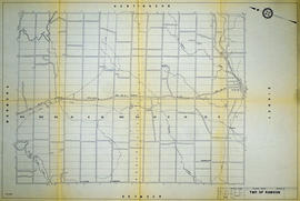
Hydro-Electric Power Commission of Ontario, Rawdon Section

  • CA ON00156 M/M430-2995 - 2996, 3018 - 3021, 3031/2995
  • Item
  • 16 Dec 1964
  • Part of Map collection

A reproduction of an original map produced for the Hydro-Electric Power Commission of Ontario, concerning the boundaries of their eastern region in the Township of Rawdon. However, the map also features railways, roads and land boundaries. Dated December 16, 1964. Scale: 2 inches = 1 mile.

Donated by David Pershick.

Results 1 to 20 of 1164