Showing 3 results

Archival description
Tyendinaga, Township of Transportation and utilities With digital objects
Print preview Hierarchy View:

Hydro-Electric Power Commission of Ontario, Napanee Section

  • CA ON00156 M/M430-2995 - 2996, 3018 - 3021, 3031/3019
  • Item
  • 23 Jan 1942
  • Part of Map collection

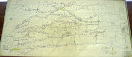
An original map produced for the Hydro-Electric Power Commission of Ontario, concerning hydro power lines, stations and transformers. However, the map also features railways, roads and land boundaries.

This map is of the South Section - Napanee Rural Power District. The total area includes parts of Ernestown, Frederickburgh South, Frederickburgh, Richmond, Tyendinaga, and Adolphustown Townships. Dated January 23, 1942. Scale: 2 inches = 1 mile.

Donated by David Pershik.

Hydro-Electric Power Commission of Ontario, Napanee Section

  • CA ON00156 M/M430-2995 - 2996, 3018 - 3021, 3031/2996
  • Item
  • 2 Mar 1931
  • Part of Map collection

A reproduction of an original map produced for the Hydro-Electric Power Commission of Ontario, concerning the boundaries of the Napanee Rural Power District, center section. However, the map also features railways, roads and land boundaries. Dated March 2, 1931. Scale: 2 inches = 1 mile.

The map includes the townships of Tyendinaga, Richmond and Camden (East).

Donated by David Pershick.

Townships of Hastings County with advertisements

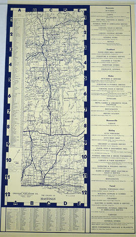
A map of Hastings County, in 1932, showing lakes, rivers, cities, towns and townships. A list of businesses within the county are on the right. Drawn exclusively for and published by Croydon Publishing Company.

Croydon Publishing Co.