Mostrando 5997 resultados

Descripción archivística
Ontario
Imprimir vista previa Hierarchy Ver :

1573 resultados con objetos digitales Muestra los resultados con objetos digitales

Subdivision of Lot 6 in the Township of Thurlow

  • CA ON00156 M/M440-2112
  • Unidad documental simple
  • 25 Aug 1948
  • Parte deMap collection

A certified reproduction of the "Subdivision of Lot # 6, east of North Park Street, Government Plan,Township of Thurlow.” The area includes; east of North Park Street and both sides of North Park Gardens. Surveyed by John Thomas Ransom, O. L. S. and signed August 25, 1948.

Donated by Walter I. Watson, P. L. S.

Sin título

Re-subdivision of Lots 5-16 in the City of Belleville

  • CA ON00156 M/M430-2110
  • Unidad documental simple
  • 8 Jul 1948
  • Parte deMap collection

A certified reproduction of the "Plan of resubdivision: part Lots # 5 & 6 and all of Lots # 7 to 16 inclusive as shown on Reg'd Plan No. 22.” The area includes; Sidney Street, College Street West, Lemoine Street and on north side: Lot # 1, Concession 1, Township Thurlow. Surveyed by Campbell T. Smith, O. L. S. and signed July 8, 1948.

Donated by Walter I. Watson, P. L. S.

Sin título

Subdivision of part of Lot 35 in the Township of Sidney

  • CA ON00156 M/M430-2082
  • Unidad documental simple
  • 17 Sep 1948
  • Parte deMap collection

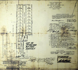
A certified reproduction of the "Subdivision of part of Lot # 35, broken front and first Concession in Sidney Township, owners Harold A. Wright and Cynthia J. Wright.” The area includes; Lot # 35 from Highway 2 north and on both sides of Wright Avenue. Surveyed by John Thomas Ransom, O. L. S. and signed September 17, 1948.

Donated by Walter I. Watson, P. L. S.

Sin título

Subdivision of Lots 1-6 in the City of Belleville

  • CA ON00156 M/M440-2069
  • Unidad documental simple
  • 18 Dec 1945
  • Parte deMap collection

A certified reproduction of the "Subdivision of Lots # 1, 2, 3, 4 and parts of Lots # 5 and 6 as shown on Reg. Plan No. 22, for owner G. Murcheson, Director of [the] Veterans Land Act.” The area includes; Lots # 1 to 18 from College Street north to Auburn Street between Sidney Street and Lemoine Street. Surveyed by Campbell T. Smith, O. L. S. and signed December 18, 1945.

Donated by Walter I. Watson, P. L. S.

Sin título

Survey of Hydro Pole Line crossing over the Trent Canal

  • CA ON00156 M/M430-2060
  • Unidad documental simple
  • 1 Nov 1929
  • Parte deMap collection

A certified reproduction of the "Hydro-Electric Power Commission, 8000/4600 Volt Wood Pole Line crossing over [the] Trent Canal from Lot # 2, Concession 4 to west side of Traveled Road.” Surveyed by Fred W. Wilkins, O. L. S. of J. Walter Evans & Company, Engineers & Surveyors. Signed November 1, 1929.

This copy was made in 1972 of plan #561, as registered in the Hastings Land Registry Office.

Donated by Walter I. Watson, P. L. S.

Sin título

Subdivision of part of Block 23 in the village of Frankford

  • CA ON00156 M/M430-2058
  • Unidad documental simple
  • 29 Sep 1925
  • Parte deMap collection

A certified reproduction of the "Village of Frankford, subdivision of parts of Block 23 and Lots # 2-3 on [the] west side of Scott Street.” The area surveyed includes; both sides of Finnegan Drive between the Canadian National Railway and Scott Street. Surveyed by Fraser Aylsworth Jr., O. L. S. and signed September 29, 1925.

This copy was made in 1972 of plan #552, as registered in the Hastings Land Registry Office.

Donated by Walter I. Watson, P. L. S.

Sin título

Part of Block L in the town of Deseronto

  • CA ON00156 M/M430-2049
  • Unidad documental simple
  • 24 Sep 1921
  • Parte deMap collection

A certified reproduction of "Part of Block L [in] Deseronto...” The area surveyed includes the part which lies between Dundas and Cross Streets and College and Brant Streets. Surveyed by Evans and Evans, Civil Engineers and Ontario Land Surveyors and signed September 24, 1921.

This copy was made in 1972 of plan #514, as registered in the Hastings Land Registry Office.

Donated by Walter I. Watson, P. L. S.

Sin título

Subdivision of Park Lots 61-62 in the town of Trenton

  • CA ON00156 M/M430-2047
  • Unidad documental simple
  • 1 Oct 1918
  • Parte deMap collection

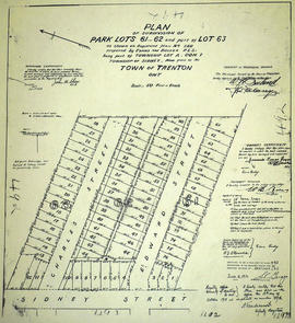
A certified reproduction of the "Subdivision of Park Lots # 61-62, part of Lot # 63, Reg. Plan 240 by Evans & Bolger P. L. S. being part of Township Lot A, Concession 1, Sidney Township (now Trenton).” The area surveyed includes; east of Sidney Street, including both sides of Edward Street, both sides of Charles Street, and east to the boundary of Park Lots # 61, 62, and 63. Surveyed by John H. Shaw, O. L. S. and signed October 1, 1918.

This copy was made in 1972 of plan #492, as registered in the Hastings Land Registry Office.

Donated by Walter I. Watson, P. L. S.

Sin título

Plan of subdivision of part Lot # 28 in the Township of Thurlow

  • CA ON00156 M/M440-2223
  • Unidad documental simple
  • 22 Jun 1955
  • Parte deMap collection

A certified reproduction of the "Plan of subdivision of part Lot # 28, Reg. Plan No. 65, Township of Thurlow.” The area surveyed includes; east of Herchimer Avenue, being 15 Lots on both sides of Symington Drive. Surveyed by John T. Ransom, O. L. S. and signed June 22, 1955.

This copy was made in 1972 of plan #991, as registered in the Hastings Land Registry Office.

Donated by Walter I. Watson, P. L. S.

Sin título

Subdivision of Part of Lot # 13 in the Township of Sidney

  • CA ON00156 M/M430-2218
  • Unidad documental simple
  • 26 Apr 1955
  • Parte deMap collection

A certified reproduction of the "Plan of Subdivision of Part of Lot # 13, Concession 1, Township of Sidney.” The area surveyed includes; Concession 1, Lot # 13, east of Road Allowance between Lots # 12 & 13- and 22 Lots on both sides of Quinte Street. Surveyed by W. J. Pattison, O. L. S. and signed April 26, 1955.

This copy was made in 1972 of plan #988, as registered in the Hastings Land Registry Office.

Donated by Walter I. Watson, P. L. S.

Sin título

Subdivision of Park Lots 1-2 in the Township of Rawdon

  • CA ON00156 M/M430-2126
  • Unidad documental simple
  • 28 Dec 1951
  • Parte deMap collection

A certified reproduction of the "Subdivision of Easterly parcel of Park Lot # 1 and part of Easterly parcel of Park Lot # 2 according to Reg'd Plan No. 38, being part of Lot XI, Concession 1, Township Rawdon.” The area includes; Park Lots # 1 and part Lot # 2, both bounded by Marmora Road, Wellington Street and Nancy Street. Surveyed by George H. Richards, O. L. S. and signed December 28, 1951.

This copy was made in 1972 of plan #875, as registered in the Hastings Land Registry Office.

Donated by Walter I. Watson, P. L. S.

Sin título

Subdivision of Lots 13-21 in the village of Stirling

  • CA ON00156 M/M430-2125
  • Unidad documental simple
  • 27 Jan 1951
  • Parte deMap collection

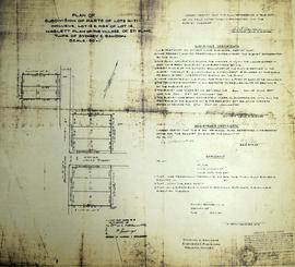
A certified reproduction of the "Subdivision of Parts of Lots # 16 to 21, Lot # 13 and North 34 feet of Lot # 14. Haslett Plan of Village of Stirling, Township of Sidney and Rawdon.” The area includes; Lots # 16 to 21 inclusive on the east side of Henry Street and Lots # 13 and north 34 feet of Lot # 4 on the west side of Henry Street. Surveyed by Donevan & Richards, O. L. S. and signed January 27, 1951.

This copy was made in 1972 of plan #859, as registered in the Hastings Land Registry Office.

Donated by Walter I. Watson, P. L. S.

Sin título

Plan of Resurvey of part of Township of Lake

  • CA ON00156 M/M430-2121
  • Unidad documental simple
  • 18 Nov 1949
  • Parte deMap collection

A certified reproduction of the "Plan of Resurvey of part of Township of Lake.” The area includes; Township of Marmora as the south boundary, Township Methuen as the west boundary, and the Township of Wollaston as the north boundary. Surveyed by John T. Ransom, O. L. S. and signed November 18, 1949.

This copy was made in 1972 of plan #840, as registered in the Hastings Land Registry Office.

Donated by Walter I. Watson, P. L. S.

Sin título

Subdivision of Roman Catholic Cemetery in the city of Belleville

  • CA ON00156 M/M440-2117
  • Unidad documental simple
  • 30 Aug 1949
  • Parte deMap collection

A certified reproduction of the "Subdivision [of] part of Roman Catholic Cemetery Lot. Registered Plan 178, City of Belleville - owner: Mabel J. Bunnett.” The total area surveyed includes; both sides of Emily Street, west of Cemetery Street on Cemetery Lot. Surveyed by John T. Ransom, O. L. S. and signed August 30, 1949.

This copy was made in 1972 of plan #817, as registered in the Hastings Land Registry Office.

Donated by Walter I. Watson, P. L. S.

Sin título

Plan of Lot 6 in the Township of Marmora

  • CA ON00156 M/M430-1904
  • Unidad documental simple
  • 9 Oct 1871
  • Parte deMap collection

A certified reproduction of the "Plan of Lot # 6 in the 4th Concession of Township of Marmora for Malcolm Cameron." Surveyed by John J. Haslett, P. L. S. and signed October 9, 1871.

This copy was made in 1972 of plan #150, as registered in the Hastings Land Registry Office.

Donated by Walter I. Watson, O.L.S.

Sin título

Plan of the village of Marmora

  • CA ON00156 M/M430-1912
  • Unidad documental simple
  • 22 Dec 1868
  • Parte deMap collection

A certified reproduction of the "Plan of Village of Marmora laid out on farm Lots # 6-9, Concession 4 of Marmora Township. Requested by John Beatty, secretary of the Cobourg, Peterboro & Marmora Railway & Mining Co., proprietors of Lots # 6, 7, 8 & 9 of the 4th Concession of Marmora Township." Surveyed by E.C. Caddy, P.L.S., and signed December 2, 1868.

This copy was made in 1972 of plan #129, as registered in the Hastings Land Registry Office.

Donated by Walter I. Watson, O.L.S.

Sin título

Plan of the village of Bancroft

  • CA ON00156 M/M430-1967
  • Unidad documental simple
  • 5 Jul 1911
  • Parte deMap collection

A certified reproduction of the "Plan of Village of Bancroft, being part of Lots # 1 & 2, Concession A & B, Lots # 59, 60, 61, 62, 63, 64, 65 66 & 67, west of Hastings Road and Lot # 1, Concession 15, Township of Faraday." Surveyed by W. J. Moore, O.L.S., and signed July 5, 1911.

This copy was made in 1972 of plan #411, as registered in the Hastings Land Registry Office.

Donated by Walter I. Watson, O.L.S.

Sin título

Plan of survey of part of Dundas Street, Town of Trenton

  • CA ON00156 M/M430-2810
  • Unidad documental simple
  • 15 Apr 1967 - 16 May 1969
  • Parte deMap collection

Registered Plans 258, 82, 64 - "Plan of survey of part of Dundas Street, Town of Trenton, showing property frontages and owners." Survey includes; Town of Trenton, part of Dundas Street on 2 sheets, including cross streets Flindal, Herman, Scott, and Campbell.

Sin título

Plan of Hamilton Place Subdivision in the Township of Sidney

  • CA ON00156 M/M430-1889
  • Unidad documental simple
  • 28 Aug 1875
  • Parte deMap collection

A certified reproduction of the "Hamilton Place subdivision of part of the [the] west half of Lot # 37 in 1st Concession, Sidney Township belonging to William H. Ponton.” The block is on bounded by Palmer Street in the west, Hanwell Street in the north, Selena Street on east and in the south by the road from Trenton to Belleville. Surveyed by Samuel M. Benson, P. L. S. & D.P.S., and signed August 28, 1875.

This copy was made in 1972 of plan #191, as registered in the Hastings Land Registry Office.

Donated by Walter I. Watson, P. L. S.

Sin título

Resultados 5341 a 5360 de 5997