Aerial Photograph of Belleville
- CA ON00156 M/M470-2781 - 2794/2783
- Item
- c. 1970
Part of Map collection
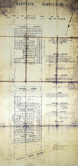
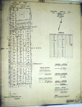
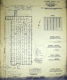
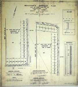
Belleville, Map # 78-4413-24 showing areas of; North East Belleville, Alemite Park on South West corner of map, Moira Secondary School near South East corner of map and Leeming Farm on 3rd Concession Road at North side of map. Published by the Ministry of Natural Resources. Surveyed by Walter I. Watson, P.L.S. Circa 1970.
Watson, Walter Irvine, O.L.S.