Mostrando 81 resultados

Descripción archivística
Sidney, Township of Imagen
Imprimir vista previa Hierarchy Ver :

81 resultados con objetos digitales Muestra los resultados con objetos digitales

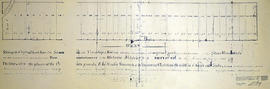
Hydro-Electric Power Commission of Ontario, Frankford Section

  • CA ON00156 M/M430-2995 - 2996, 3018 - 3021, 3031/3020
  • Unidad documental simple
  • c. 1950
  • Parte deMap collection

An original map produced for the Hydro-Electric Power Commission of Ontario, concerning hydro power lines, stations and transformers. However, the map also features railways, roads and land boundaries.

This map is of the North Section - Frankford Rural Power District. The total area includes parts of Thurlow, Huntingdon, Sidney, Rawdon, Campbellford, Seymour, Brighton, and Percy Townships. Circa 1950.
Donated by David Pershik.

Trenton Electric & Water Co. Limited in Sidney Township

  • CA ON00156 M/M430-2998 - 3001/M430-3001
  • Unidad documental simple
  • c. 1910
  • Parte deMap collection

An original map produced for the Trenton Electric & Water Co. Limited, concerning proposed transmission lines within the Township of Sidney. However, the map also features railways, roads and land boundaries. Circa 1910. Scale: 50 chains = 1 inch. Map composed by Smith, Kerry and Chace Engineers located in Toronto, Winnipeg, Calgary and Vancouver.

Donated by David Pershick.

Sin título

Sidney Township Plan of Lots

  • CA ON00156 M/M430-1169
  • Unidad documental simple
  • 2 Jan. 1912
  • Parte deMap collection

A map of Sidney Township, the Plan of Lots on Gladstone Avenue/Trent Road, 1912. Published by Lucien & Allen C.E. on January 2nd, 1912. Created by A.W. Ponton, P.L.S. Scale: 100 feet : 1 inch.

Sin título

Plan of Hastings for Hastings Directory

  • CA ON00156 M/M420-1080
  • Unidad documental simple
  • 1864-1865
  • Parte deMap collection

A map of Hastings County outlining townships:
Marmora, Lake, Madoc, Tudor, Grimsthorpe, Elzevir; Rawdon, Huntingdon, Hungerford, Sidney, Thurlow, Tyendinaga - as well as the northern townships.
Inset is "the Village of Marmora." Surveyed by H. A. F. Macleod, C.E. and P.L.S. Published by W. A. Little Lith., Montreal in the 1864-1865 copy of the Hastings Directory . Scale: 1:190,000.

Sin título

Map of Hastings County in 4 sections

  • CA ON00156 M/M420-1090
  • Unidad documental simple
  • 1894
  • Parte deMap collection

A map of Hastings County outlining townships from the Bay of Quinte in the south, to Wallaston, Limerick and Cashel in the north.
Map is in four sections. Scale: 3 miles : 1 inch. Original map is dated 1894. Photocopy from the Archives of Ontario.

Boundary Lines Survey of Sidney Township, Con. 2

  • CA ON00156 M/M430-2530
  • Unidad documental simple
  • 4 Sep 1840
  • Parte deMap collection

A certified reproduction of the “Boundary Line Commissioners Survey of the Second Concession of Sidney, for the Victoria District..” The area contained includes; Sidney Township, Concession 2, Lot Block A and Lots # 1 to 38. Originally surveyed by John Emerson, P. L. S. and produced on September 4, 1840. This reproduction was made on June 2, 1972 and approved by the Deputy Registrar.
Donated by Walter I. Watson, P. L. S.

Sin título

Boundary Lines Survey of Sidney Township, Con. 3

  • CA ON00156 M/M430-2531
  • Unidad documental simple
  • c. 1841
  • Parte deMap collection

A certified reproduction of the “Boundary Line Commissioners Survey of the Third Concession of Sidney, for the Victoria District.” The area contained includes; Sidney Township, Concession 3, Lots: Block A and Lots # 1 to 38. Originally surveyed by John Emerson, P. L. S. and produced circa 1841. This reproduction was made on June 5, 1972 and approved by the Deputy Registrar.
Donated by Walter I. Watson, P. L. S.

Sin título

Registrar's Plan of Lot 26 in Sidney Township

  • CA ON00156 M/M430-2408
  • Unidad documental simple
  • 10 Mar 1967
  • Parte deMap collection

A certified reproduction of the "Registrar's compiled plan, part of Lot # 26, in Broken Front Concession Township of Sidney.” The area includes; Lots west ½ and east ½ of Lot 26, Broken Front, being the north of side of Hwy 2. Registered March 9, 1967.

Donated by Walter I. Watson, P. L. S.

Graphic Index of Lot 28, Belleville

  • CA ON00156 M/M440-2415
  • Unidad documental simple
  • 10 May 1968
  • Parte deMap collection

A certified reproduction of the "Registrar's compiled plan, being a graphic index of part of Lot # 28, Concession 1, Township of Sidney now City of Belleville.” The area includes; 14 Lots in Concession 1, west of Sidney Street and south of Moira Street. Surveyed by S. C. Geneja CST, Registry Office of Hastings and signed May 10, 1968.

Donated by Walter I. Watson, P. L. S.

Sin título

Graphic Index of Lot 37, Belleville

  • CA ON00156 M/M440-2416
  • Unidad documental simple
  • 28 May 1968
  • Parte deMap collection

A certified reproduction of the "Registrar's Compiled Plan, being a graphic index of part of Lot # 37, Concession 1, Township of Sidney... now City of Belleville.” The area includes; Lots # 1 to 15 Westerly from Sidney Street to Palmer Road and Northerly from Bridge St. West to Moira Street West.. Surveyed by S. C. Geneja CST, Registry Office of Hastings and signed May 28, 1968.

Donated by Walter I. Watson, P. L. S.

Sin título

Registrar's Plan of Lots 6, 27-28 in the Township of Sidney

  • CA ON00156 M/M430-2456
  • Unidad documental simple
  • 29 Jan 1970
  • Parte deMap collection

A certified reproduction of the "Registrar's Compiled Plan- being a graphic index of Lots # 6, 27, 28 and part of Lot # 21, Plan 1631, Township of Sidney.” The area includes; Lots # 1 to 48 Northerly from Hwy 2 to Canadian Pacific Railway and Easterly of Montrose Drive and County Club Drive. Surveyed by Walter I. Watson, O. L. S. and signed January 29, 1970.

Donated by Walter I. Watson, P. L. S.

Sin título

Subdivision of Block A in the City of Belleville

  • CA ON00156 M/M440-2475
  • Unidad documental simple
  • 10 May 1972
  • Parte deMap collection

A certified reproduction of the "Subdivision of Block A, Reg. Plan No. 1904, Belleville, owner Maurice H. Rollins.” The area includes; Lots # 1 to 14, Blocks A and B and Conger Place North of College Street West ( the third street west of Sidney Street). Surveyed by Walter I. Watson, O. L. S. and signed May 10, 1972.

Donated by Walter I. Watson, P. L. S.

Sin título

Map of the Counties of Hastings and Prince Edward

  • CA ON00156 M/M420-1093
  • Unidad documental simple
  • 1898
  • Parte deMap collection

A "Map of the Counties of Hastings and Prince Edward." In 1898, the lots, concessions, churches, schools and mines are shown of the townships in Hastings and Prince Edward. Scale: 1.5 miles to an inch. Published by the Canadian Map Publishing Company in Hamilton, Ontario, for the Belleville Sun. Revised by Henry Carre, C.E. Inset is the map of North Hastings, scale 400 chains to an inch.

Sin título

Registrar's Plan of Lot 25 in the Township of Sidney

  • CA ON00156 M/M430-2381
  • Unidad documental simple
  • 30 Mar 1965
  • Parte deMap collection

A certified reproduction of the "Registrars' Compiled Plan. Part of Lot # 25, Concession 1 and Broken Front concession Township of Sidney.” The area includes; the Bay of Quinte to the Canadian National Railway, being along the east side of Montrose Road. Surveyed by Thomas S. Ransom, O. L. S. of Ransom & Watson, O. L. S. and signed March 30, 1965.

Donated by Walter I. Watson, P. L. S.

Sin título

Registrar's Plan of Lots 2-3 in the Township of Sidney

  • CA ON00156 M/M430-2393
  • Unidad documental simple
  • 31 Mar 1965
  • Parte deMap collection

A certified reproduction of the "Registrar's Compiled Plan, of part of Lots # 2 and 3, Concession 2, Township of Sidney.” The area includes; part of Lots # 2 & 3, Concession 2, Sidney Township, northeast of Trenton. Surveyed by Ronald Benn, O. L. S. and signed March 31, 1965.

Donated by Walter I. Watson, P. L. S.

Sin título

Plan of addition to Sidney Cemetery

  • CA ON00156 M/M430-2057
  • Unidad documental simple
  • 14 Apr 1928
  • Parte deMap collection

A certified reproduction of the "Plan of addition to Sidney Cemetery, formerly known as “Vanblaricom Burying Ground,”' part of Lot # 10 in the Broken Front Concession of the Township of Sidney.” Surveyed by Charles D. Campbell, O. L. S. and signed April 14, 1928.

This copy was made in 1972 of plan #551, as registered in the Hastings Land Registry Office.

Donated by Walter I. Watson, P. L. S.

Sin título

Subdivision of Lots 37-38 in the Township of Sidney

  • CA ON00156 M/M440-2225
  • Unidad documental simple
  • 24 Mar 1955
  • Parte deMap collection

A certified reproduction of the "Subdivision of part Lots # 37 & 38, Concession 1...and part Lots # 6, 8, 10, 12, 14, 16, 18, 20...Hanwell St. Reg. Plan No. 191, Township of Sidney. Prepared for Wm. Nisbet Ponton Estate.” The area surveyed includes; south of Leland Drive and east of Palmer Road being Lots on both sides of Selena Street, Hutton Drive and Nisbet Avenue. Surveyed by John T. Ransom, O. L. S. and signed March 24, 1955.

This copy was made in 1972 of plan #996, as registered in the Hastings Land Registry Office.

Donated by Walter I. Watson, P. L. S.

Sin título

Subdivision of the Moore Plot in the Township of Sidney

  • CA ON00156 M/M430-1882
  • Unidad documental simple
  • 14 Jan 1876
  • Parte deMap collection

A certified reproduction of the "Moore Plot - resubdivision of Lot # 13 on subdivision called Bogart Plot, being the southhwest part of Lot # 35, Concession 1 of Sidney Township.” The plot is on bounded on the south by the Bay of Quinte and on the west by the line between Lots # 34-35. Surveyed by Evans and Bolger, P. L. S., and signed January 14, 1876.

This copy was made in 1972 of plan #198, as registered in the Hastings Land Registry Office.

Donated by Walter I. Watson, P. L. S.

Sin título

Plan of Lots 25-27 in the Township of Sidney

  • CA ON00156 M/M430-1973
  • Unidad documental simple
  • 20 Sep 1890
  • Parte deMap collection

A certified reproduction of the "Plan of road allowance across Lots # 25, 26, 27 in 1st Concession Sidney, opened in accordance with By-Law No. 316- signed J. M. Farley, Reeve of Sidney.” Surveyed by Henry Carre, O.L.S., and signed September 20, 1890.

This copy was made in 1972 of plan #283, as registered in the Hastings Land Registry Office.

Donated by Walter I. Watson, P. L. S.

Sin título

Resultados 1 a 20 de 81