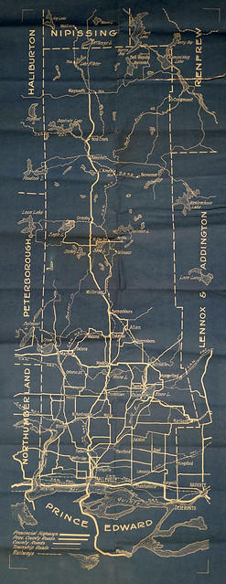
Map of Hastings County with New Road System
- CA ON00156 M/M420-2163
- Item
- 1914 - 1 Jul 1925
Part of Map collection
A map of Hastings County, with its 24 townships, in 1914. Superimposed on top is the New Road System as of July 1, 1925. The map features lots, concessions, locks, settlements, water ways and railroads. Published by the Office of Public Roads & Highways of Ontario.
Donated by Nick January of the Hastings County Planning and Development Department in 2016.
Office of Public Roads and Highways