Affichage de 133 résultats

Description archivistique
Madoc, Township of
Aperçu avant impression Hierarchy Affichage :

49 résultats avec objets numériques Afficher les résultats avec des objets numériques

Tudor Township, 1859 : petition for separation from Madoc

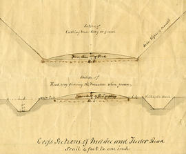
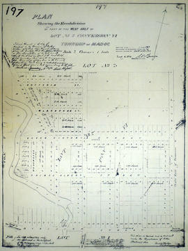
File contains a manuscript signed petition from landholders in the Township of Tudor to the County Council of the County of Hastings seeking administrative separation from the Township of Madoc, whose council had responsibility for Tudor. Also present is a by-law issued by the County of Hastings Council in 1859 enacting the separation of Tudor Township from the Township of Madoc.

McEwen Land Records

The file contains land records as follows:

  1. 19 May 1841 – Thomas Beathy to Thomas Cooper
  2. Quit Claim Deed dated 13 October 1868 – Francis McAnnany to John Meighan
  3. Deed of Land dated 17 January 1879 – Thomas Cross to Samuel McEwan
  4. Deed of Land dated 10 August 1881 – Alexander S. Brown to Emily Elizabeth Brown Gardner
  5. Deed of Land dated 11 May 1887 – James Brown to Samuel McEwan
  6. Deed of Land dated January 1888 – Duncan Coulson to Samuel McEwen
  7. Proceedings under Power of Sale dated 28 October 1890 sold by Samuel Gardner
  8. Deed of Land dated 4 November 1890 - Francis Edmund O’Flynn and Samuel McEwan
  9. Deed of Land dated 2 April 1892 – Elizabeth Mumby and Samuel McEwan
  10. Treasurer’s Deed dated 17 February 1893 – to Samuel McEwen
  11. Deed of Land dated 1 April 1892 – Grace Keith to S. McEwen
  12. Treasurer’s Deed dated 11 August 1900 – to Samuel McEwen
  13. Mining Lease dated 11 January 1902 – Samuel Chambers to Samuel McEwan
  14. Deed of Land dated 28 June 1904 – Samuel McEwen to The Bay of Quinte Railway Company
  15. Treasurer’s Deed dated 11 August 1904 – to Samuel McEwen
  16. Treasurer’s Deed dated 22 August 1906 – to Samuel McEwen
  17. Mortgage dated 25 Mar 1907 between William Brown and Israel McEwan
  18. Deed of Land dated 1916 – Samuel McEwen to Samuel Lindsay McEwen and William John
  19. Deed of Land dated 23 September 1920 – The International Nickel Company of Canada Limited and Israel McEwen-
  20. Deed of Land dated 14 September 1923 – Israel McEwen to William McEwen
  21. Crown Sale dated 17 October 1924 –to William John McEwen
  22. Letter dated 12 February 1949 from Township of Madoc Clerk to Miss Jessie McEwen
  23. Deed of Land dated 6 October 1949 – Jessie McEwen to Walter Brett
  24. Deed of Land dated 27 June 1951 – Jessie McEwen to Alex Andrews

Hastings with Town of Belleville and principal villages

A map of Hastings County including the Town of Belleville and other principal villages:

Trenton, Madoc, Marmora, Tweed, Bridgewater, Stirling, Wicklow, Bangor, Herschel, Monteagle, Carl, Dungannon, Wollaston, Limerick, Cashel, Tudor, Grimsthorpe, Elzevir; Rawdon, Huntingdon, Hungerford, Sidney, Thurlow, Tyendinaga.

Scale: 3 miles =1 inch. Published by John P. Evans, P.L.S. in 1869.

Sans titre

Madoc and Tudor Road Plans

A cross-sectional plan regarding the formation of Madoc and Tudor Roads. Scale: 4 feet : 1 inch.

Plan of the Northern part of the Village of Hastings

  • CA ON00156 M/M430-2537
  • Pièce
  • Dec 1858
  • Fait partie de Map collection

A certified reproduction of the "Plan of the Northern part of the Village of Hastings. ” The area contained includes; Village of Hastings [now Madoc] laid out on the West half of Lot # 2 and a part of Lot # 1 in the 6th Concession of Township of Madoc. The area is property of the Estate of the Late Colin Russell of Montreal. Surveyed for Mrs. Sarah Russell of Montreal. Originally surveyed by Samuel M. Benson, P.L.S. and produced in December 1858.

This reproduction was made on June 5, 1972 and approved by the Deputy Registrar.

Donated by Walter I. Watson, P. L. S.

Sans titre

Plan of Rollins Block in the Township of Madock

  • CA ON00156 M/M430-1887
  • Pièce
  • 3 Oct 1875
  • Fait partie de Map collection

A certified reproduction of the "Rollins Block - Lots on part of Lot # 1 in Concession 5, Township of 'Madock' for proprietor Samuel Rollins.” Rollins Block is between Lot # 2 in 5th Concession of 'Madock', the road between Huntingdon & 'Madock' Township, Francis Street and lastly the road between 5th and 6th Concession of 'Madock.' Surveyed by John Emerson, P.L.S ., and signed October 3, 1875.

This copy was made in 1972 of plan #193, as registered in the Hastings Land Registry Office.

Donated by Walter I. Watson, P. L. S.

Sans titre

Subdivision of west Lot 2 in the village of Madoc

  • CA ON00156 M/M430-1883
  • Pièce
  • 18 Dec 1875
  • Fait partie de Map collection

A certified reproduction of the "Re-subdivision of part of west half of Lot # 2, Concession 6, Township of Madoc for Sarah Russell of Montreal, widow of Colin Russel." The lot is bounded by Lots #2-3 in the north, Mill Pond and Deer Creek on the west, Division Street and Lawrence Street in the south and Wellington Street on the east. Surveyed by Evans and Bolger, P.L.S ., and signed December 18, 1875.

This copy was made in 1972 of plan #197, as registered in the Hastings Land Registry Office.

Donated by Walter I. Watson, P. L. S.

Sans titre

Plan of McBeath Block in the Township of Madoc

  • CA ON00156 M/M430-1861
  • Pièce
  • Sep 1881
  • Fait partie de Map collection

A certified reproduction of the "Plan of McBeath Block, subdivision of part of east half of Lot # 2, Concession 6, Township of Madoc.” Includes land north of St. Lawrence Street. and east of Wellington Street in the Village of Madoc and south of Duncan Street in Block 45. Surveyed by Evans and Bolger, P. L. S. and dated September 16, 1881.

This copy was made in 1972 of plan #221, as registered in the Hastings Land Registry Office.

Donated by Walter I. Watson, P. L. S.

Sans titre

Subdivision of Lots 28 in the Township of Madoc

  • CA ON00156 M/M430-1960
  • Pièce
  • 1 Sep 1887
  • Fait partie de Map collection

A certified reproduction of the "Plan of subdivision of part of Lots # 28 in Concession 5 & 6 in Township of Madoc, being in the Village of Bannockburn.” Surveyed by C. Fraser Aylsworth Jr. P. L. S., and signed September 1, 887.

This copy was made in 1972 of plan #261, as registered in the Hastings Land Registry Office.

Donated by Walter I. Watson, P. L. S.

Sans titre

Plan of Norman Hill Subdivision in the Township of Madoc

  • CA ON00156 M/M440-1685
  • Pièce
  • 4 Apr 1861
  • Fait partie de Map collection

A certified reproduction of Norman Hill subdivision of Park Lots # 1 & 2 of the Russell Estate - half of Lot # 2, 6th Concession of Madoc.
The Property of R. M. Norman Esq. Surveyed by C. F. Aylsworth Sr., P.L.S. and signed April 4, 1861.

This copy was made in 1972 of plan #119, as registered in the Hastings Land Registry Office.

Donated by Walter I. Watson, O.L.S.

Sans titre

Plan of Eldorado Lots in the Township of Madoc

  • CA ON00156 M/M440-1681
  • Pièce
  • 2 Jan 1867
  • Fait partie de Map collection

A certified reproduction of the Plan of Eldorado, Village & Mining Lots, as laid out on the northeast quarter of Lot # 17 in the 5th Concession of Madoc Township for John Moore. Surveyed by C. F. Aylsworth Sr., P.L.S. and signed January 2, 1867.

This copy was made in 1972 of plans #114, 115 and 115B, as registered in the Hastings Land Registry Office.

Donated by Walter I. Watson, O.L.S.

Sans titre

Madoc : history and churches

File contains a newspaper clipping and photocopied manuscript history of Madoc Township from early French exploration in 1615 to ca. 1965, including a discussion of the creation of roads, schools and local churches. The historical research was composed by Mrs. Ken Bateman for Gerry Boyce as background for Historic Hastings.

Madoc Township : talc mines

File contains a newspaper article on the history and development of talc mining in Madoc Township. Also contains photocopied printed notes from the Hastings County Directory, 1860-61 concerning Madoc Township and its resources with a list of landowners by concession and lot.

Résultats 101 à 120 sur 133