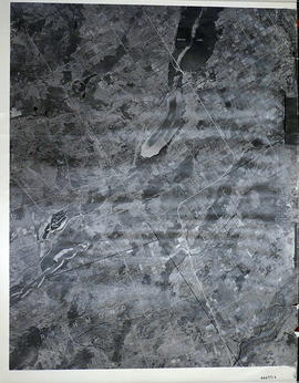
A reproduction of an air survey photograph produced by the Ontario Ministry of Natural Resources. Map #444771E of Sheffield Township in Lennox and Addington County, Ontario. Circa 1950.
The photograph shows the southwest part of Sheffield Township, Concession 1 to 6, Hwy 49, northwest corner of Camden East, northeast corner of Richmond Township and southeast corner of Hungerford with Village of Marlbank and Lime Lake.
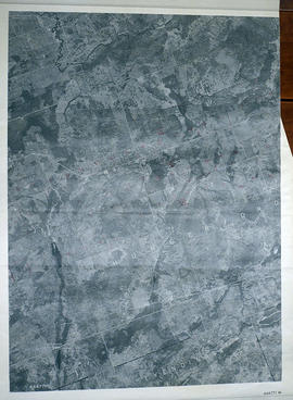
A reproduction of an air survey photograph produced by the Ontario Ministry of Natural Resources. Map # 444771W of Hungerford Township in Hastings County, Ontario. Circa 1950.
The photograph shows Hungerford Township from Tyedinaga Township north to Bogart and Claire River.
A reproduction of an air survey photograph produced by the Ontario Ministry of Natural Resources. Map # 444772W of Huntingdon Township in Hastings County, Ontario. Circa 1950.
The photograph shows Huntingdon Township, Fuller Village north to Concession 13 and Moira Lake.
A reproduction of an air survey photograph produced by the Ontario Ministry of Natural Resources. Map #445772E of Hungerford Township in Hastings County, Ontario. Circa 1950.
The photograph shows the northeast part of Hungerford Township, south of Elzevir Township, Hwy 7 and Skootamata River.
A reproduction of an air survey photograph produced by the Ontario Ministry of Natural Resources. Map #445772W of Madoc Township in Hastings County, Ontario. Circa 1950.
The photograph shows Madoc Township, Concession 5 to 9, Huntingdon Township Concession 14, northwest Elzevir Township, Queenboro and Black River.
A reproduction of an air survey photograph produced by the Ontario Ministry of Natural Resources. Map #445773W of Marmora Township in Hastings County, Ontario. Circa 1950.
The photograph shows Marmora Township, Crow Lake, and north to Thompson Lake.
A reproduction of an air survey photograph produced by the Ontario Ministry of Natural Resources. Map #446771E of Kennebec Township in Frontenac County, Ontario. Circa 1950.
The photograph shows Kennebec Township, Concession 1 to 5 and south to Cranberry Lake.
A reproduction of an air survey photograph produced by the Ontario Ministry of Natural Resources. Map #446772W of Elzevir Township in Hastings County, Ontario. Circa 1950.
The photograph shows the Black River Watershed, North West Elzevir Township, North East Madoc Township, South West Grimsthorpe Township, South East corner of Tudor Township.
A reproduction of an air survey photograph produced by the Ontario Ministry of Natural Resources. Map #446773W of Lake Township in Hastings County, Ontario. Circa 1950.
The photograph shows Concession 6 to 9 from the border with Marmora Township, north to Little Burnt Lake and Big Burnt Lake and Carson Lake.
2 copies of maps detailing electoral districts #40 to 45 (inclusive) within Centre Hastings. The map includes polling divisions, road networks and municipal boundaries. Inset # 2, # 35073.
A reproduced map detailing electoral polling stations within the City of Belleville. The map includes numbered stations, washrooms, parking, roads and parks.
An aerial photograph of east Belleville (Map # 45C4709/70). Map includes: Thurlow Townshjp Lots # 21 to 31, Concession 1 to 9, Huntingdon Township Lots 14 to 20, Concession 1 & 2, Tyendinaga Township All, Hungerford Township Concession 1, 2, 3, Richmond Township, part of Camden East and part of Sheffield. Circa 1970. Scale: 1:2,000.
Map includes Trans-Northern Pipeline and Trans Canada Pipeline and the Hydro Lines. Donated by Walter I. Watson, P. L. S.
An aerial photograph of Thurlow Township, Concession 4 (Map # TD19686Z). The photo includes Lots # 12 to 31, including proposed Hydro right of way and land owner's names and instrument numbers. Photographed on September 10, 1973 and annotations made July 27, 1976. Scale 1 inch = 200 feet. For the Ontario Hydro Route and site Selection Division, Orthophoto R/W Selection Plan Lennox G. S. - Oshawa Area T. S. Aerial View. By J. E. Clements- photogrammetric production officer; D. Crozier- chief draftsman; J. Sedgwal- project engineer; C. E. Bishop- Sr R/W planning engineer.
Plan showing parts of Lot # 29 -38 inclusive, Concession 4, Township Sidney and Part of Lot # 1, Concession 4, Township of Thurlow (Map # TD30197Z). For Ontario Hydro, Design and Construction Branch, Surveys and Mapping. Scale 1 inch = 200 feet. Drawn by R. Sweeney.
Plan showing Tyendinaga Township, Part of Lots # 2 to 10, Concession 3, Ontario Hydro proposed right of way (Map # TD30192Z). For Ontario Hydro, Design and Construction Branch, Surveys and Mapping. Scale 1 inch = 200 feet. Drawn by R. Sweeney, R. A. Schan, O .L. S.
Plan showing Thurlow Township, Parts of Lots # 25 to 31, Concession 4, Ontario Hydro proposed right of way (Map # TD30193Z). For Ontario Hydro, Route and Site Selection Division. Scale: 1 inch = 200 feet. Drawn by R. Sweeney 1977, R. A. Schan, O. L. S.
Plan showing Frederickburgh Township, Lennox and Addington County, Concession 4, Lots # 3 to 7 proposed Ontario Hydro Transmission Line. For Ontario Hydro, Route and Site Selection Division.
Plan showing Township of Fredericksburg, Lots # 1 to 3, Concession 4 Township of Fredericksburg and Lots 1 to 13, Concession 5, Proposed Ontario Hydro Transmission Line. For Ontario Hydro, Route and Site Selection Division. Surveyed by R. A. Schan, O. L. S.
Plan showing Cramahe Township, Northumberland County, Concession 8, Lots # 17 to 22 (Map # TD24777Z). For Ontario Hydro Transmission & Distribution projects, Division Orthophoto Title Study. Scale: 1 inch= 200 feet.
Madoc Township, Map # A18256-148 showing areas of Hwy 62 at Bannockburn and the road east to Cooper. The railway parallel with Hwy 62. The Ontario Hydro easement running west from Cooper. By the Air Photographic Production Division of the Deptartment of Mines & Technical Surveys - Government of Canada.