Showing 174 results

Archival description
Item Buildings and structures With digital objects
Print preview Hierarchy View:
City of Belleville and Advertisements
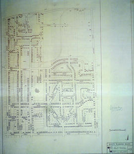
City of Belleville Map with Property Boundaries in 1981
City of Belleville on Acme advertisement
City of Belleville on hardware advertisement
CNR Crossing at Cannifton Road Blueprint
Coloured postcard of the Bay of Quinte Bridge, Belleville, Ont.
Commercial Bank Subdivision of Lots 11-19 in Belleville
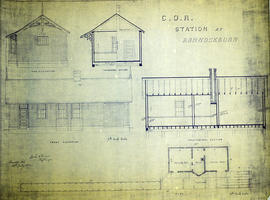
COR Station at Bannockburn Plans
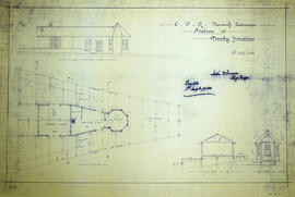
COR Station at Bloomfield Plans
COR Station at Ormsby Plans
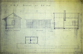
COR Station at St. Ola Plans
Corporation of Thurlow Map of Roads
Corporation of Thurlow Map of Wards
Depth of the Moira River for Channel Plan
Digital aerial photograph of Stream plant in Belleville
Digital photograph of 232 Front Street, Belleville
Digital photograph of former sign at 214 Front Street, Belleville
Digital photograph of property at 217 Pinnacle Street, Belleville
East City of Belleville Map with Property Boundaries in 1976
Elevations of the Belleville City Hall Auditorium
Results 21 to 40 of 174