Showing 279 results

Archival description
Belleville With digital objects
Print preview Hierarchy View:
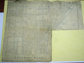
Map of Ketcheson Ward
Map of Coleman Ward Part ll
Map of Hastings with townships
Land Use Plan for the City of Belleville
Map of Sampson Ward
Map of Sampson Ward
Map of Baldwin Ward
Map of Baldwin Ward
City of Belleville and Advertisements
Survey Plan and Physical Features of Belleville
Map of Belleville's Growth from 1816-1965
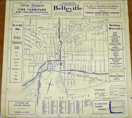
Vernon Mights Clearview Map of Belleville
Map of Dredging in Belleville Harbour
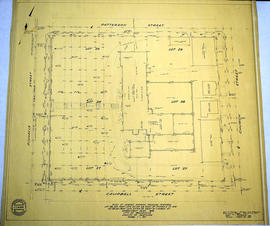
Map of Parcel of Area #1 - Land Settlement
Map of Railway Station, Harbour and Wharf Facilities
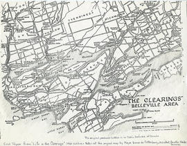
Map of the clearings in Belleville Area
Map of Hastings and Prince Edward Counties
Hastings with Town of Belleville and principal villages
South and Central Hastings Map
Map Hastings, Prince Edward, Northumberland and Peterborough Counties
Plan showing extent of the city of Belleville, Ontario
Results 261 to 279 of 279