A topographical map of the area between Belleville and Kingston. The total area extends from Prince Edward County to Buckshoot Lake North & South and from Havelock to Smith Falls East and West. Dated 1935. Published by the Department of National Defense.
A topographical map of east Belleville - Canada sheet #31 C/3. Area extends from Tyendinaga Mohawk Territory to Lennox & Addington East to West and South to Picton Bay. Map was published by the Department of National Defence in November 1962. Scale 1:50,000.
A topographical map of west Trenton - Canada sheet #31 C/4. Area includes the West Half of Trenton and part of Northumberland County. Map was published by the Department of National Defence in December 1962. Scale 1:50,000.
A military map of Trenton and Belleville published by the Department of National Defence's Mapping and Charting Establishment. Dated 1978. Scale 1:25,000.
A topographical map of Bancroft - Canada sheet #31 F/4, west half. Published by the Army Survey Establishment, Department of National Defence in 1956. Scale 1:50,000.
A topographical map of Belleville - Canada sheet #31 C/3, west half. Published by the Army Survey Establishment, Department of National Defence in 1956. Scale 1:50,000.
A topographical map of Belleville - Canada sheet #31 C/3, east half. Published by the Army Survey Establishment, Department of National Defence in 1956. Scale 1:50,000.
A topographical map of Campbellford - Canada sheet #31 C/5. Published by the Army Survey Establishment, Department of National Defence in 1956. Scale 1:50,000.
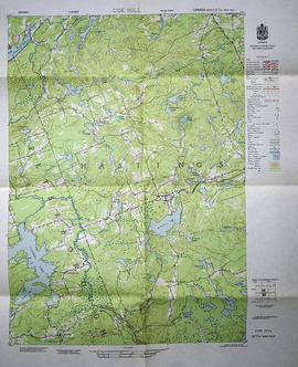
A topographical map of Coe Hill- Canada sheet #31 C/13, west half. Published by the Army Survey Establishment, Department of National Defence in 1956. Scale 1:50,000.
A topographical map of Denbigh - Canada sheet #31 F/3, east half. Published by the Army Survey Establishment, Department of National Defence in 1951. Scale 1:50,000.
A topographical map of Denbigh - Canada sheet #31 F/3. Published by the Army Survey Establishment, Department of National Defence in 1948. Scale 1:50,000.
A topographical map of Kaladar - Canada sheet #31 C/11, east half. Published by the Army Survey Establishment, Department of National Defence in 1950. Scale 1:50,000.
A topographical map of Peterborough - Canada sheet #31 D/18, east half. Published by the Army Survey Establishment, Department of National Defence in 1950. Scale 1:50,000.
A topographical map of Port Hope - Canada sheet #30 M/16. Published by the Army Survey Establishment, Department of National Defence in 1938. Scale 1 inch to 1 mile = 1/63, 360.
A topographical map of Presqu'ile - Canada sheet #30 N/13, east half. Published by the Army Survey Establishment, Department of National Defence in 1951. Scale 1:50,000.
A topographical map of Tweed - Canada sheet #31 C/6, east half. Published by the Army Survey Establishment, Department of National Defence in 1958. Scale 1:50,000.
A topographical map of Tweed - Canada sheet #31 C/6, west half. Published by the Army Survey Establishment, Department of National Defence in 1958. Scale 1:50,000.
A topographical map of Wellington - Canada sheet #30 N/14, both east and west half sheets. Published by the Army Survey Establishment, Department of National Defence in 1951. Scale 1:50,000.
A topographical map of Zone 18 - Hastings & Prince Edward Counties. Depicted current as of 1974. Printed 1977. Scale: 1:50,000. Published by the Mapping & Charting Establishment, Department of National Defence Canada. Belleville MCE 139, Edition 2. Transverse Mercator Projection, Contour Interval 25 ft. Elevations in Feet above sea level.
A topographical map of Ontario - Campbellford sheet #31 C/5. Map was published by the Department of National Defence and reprinted in 1941. Scale 1:63,360.