Transportation and utilities

Taxonomy

Code

Scope note(s)

Source note(s)

Display note(s)

Hierarchical terms

Transportation and utilities

Equivalent terms

Transportation and utilities

Associated terms

Transportation and utilities

529 Archival description results for Transportation and utilities

529 results directly related Exclude narrower terms

Map of Southern Hastings County 1975

A map of the County of Hastings, South Portion, County Seat - Belleville. Published by the Ministry of Transportation and Communications, Ontario. Revised September 1975.

Features: road jurisdictions, Kings Highways, secondary highways, township roads, roads legally open but not necessarily passable, urban corporate limits, railways and stations, township boundaries, county boundaries, populated areas.

Donated by the Belleville Public Library in 2014.

Ontario. Ministry of Transportation

Road Map of Hastings County 1972

A road map of Hastings County in 1972. Portions of adjoining counties are also pictured. Boundaries are yellow, while roads are blue and red. Published by the Ontario Department of Transportation and Communications.

Donated by the Belleville Public Library in 2014.

Ontario. Ministry of Transportation

Map of Northern Hastings County 1980

A map of the County of Hastings, North Portion, County Seat - Belleville. Published by the Ministry of Transportation and Communications, Ontario in 1980.

Features: road jurisdictions, Kings Highways, secondary highways, township roads, roads legally open but not necessarily passable, urban corporate limits, railways and stations, township boundaries, county boundaries, populated areas.

Donated by the Belleville Public Library in 2014.

Ontario. Ministry of Transportation

Map of Northern Hastings County 1971

A map of the County of Hastings, North Portion, County Seat - Belleville. Published by the Ministry of Transportation and Communications, Ontario. Revised in February 1971.

Features: road jurisdictions, Kings Highways, secondary highways, township roads, roads legally open but not necessarily passable, urban corporate limits, railways and stations, township boundaries, county boundaries, populated areas.

Donated by the Belleville Public Library in 2014.

Ontario. Ministry of Transportation

Croydon's Map of the City of Belleville

A map of the City of Belleville, circa 1932, showing railroads, streets, bus roues, city limits and highways. Also featured is a street index. Published by the Croydon Map Company and drawn excursively for the Rural Township Map Company.

Donated by the Belleville Public Library in 2014.

Croydon Publishing Co.

Reproduced plan of Point Ann Railway

A photocopy of the "Plan of the Point Ann Railway in the Township of Thurlow and County of Hastings and Province of Ontario." The area includes from the Grand Trunk Railway, Lots 13-16 Concession 1, Lots 16-19 Broken Front Concession and south to the Bay of Quinte. Originally printed January 17, 1903. Scale 400 feet to an inch. Surveyed by Henry Carre, O. L. S.

Donated by the Belleville Public Library in 2014.

Carre, Henry, O.L.S.

Reproduced plan of Thurlow Railway Company Location

A photocopy of the "Thurlow Railway Company Location Plan Profile & Book of Reference, Province of Ontario." The area included extends from Lehigh Portland Cement Co. in Point Ann, First Concession of Thurlow Township and Lot # 23.

Buiy, Rayman R.

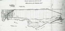
Reproduced plan of Belleville Radial Railway

A photocopy of a "Plan Shewing Location of Belleville Radial R. Y. (Railway)." The area included extends from the town line in Sidney Township (west) to Shannonville (east) and from the Grand Trunk Railway (north) to the Bay of Quinte (south). Originally printed in February 1909. Scale 25 chains to an inch.

Donated by the Belleville Public Library in 2014.

Belleville Public Library

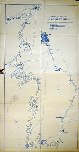
Map of Kingston to Ottawa

A map of Kingston to Ottawa, Ontario published by the National Development Bureau's Department of the Interior, circa 1930. The map features locks, bridges, waterways and settlements. Scale 2 miles to an inch. Written on the back, in ink, is "canoe trip." Presumably a tool of direction for someone's voyage.

Donated by the Belleville Public Library in 2014.

Canada. Department of the Interior

Map of Prince Edward County c.1975

Prince Edward County Map, circa 1975. Published by the Ministry of Transportation and Communications. Composed by Hon. James Snow (Minister) and Harold Gilbert (Deputy Minister).

Features: road jurisdictions, Kings Highways, secondary highways, county roads, township roads, roads legally open but not necessarily passable, urban corporate limits, railways and stations, township boundaries, county boundaries, populated areas.

Donated by the Belleville Public Library in 2014.

Ontario. Ministry of Transportation
Map of Prince Edward County 2001

Prince Edward County with Quinte's Isle in 2001. Published by the Prince Edward County Chamber of Tourism & Commerce.

Features: Map of Picton with West Lake & East Lake. Map Bloomfield & Wellington.

Donated by the Belleville Public Library in 2014.

Prince Edward County Chamber of Tourism and Commerce

Map of Lennox and Addington, Frontenac and Prince Edward Counties.

A map of Lennox and Addington, Frontenac and Prince Edward Counties as of April 1st, 1974. Published by Engineering Plans Office, Cartography section. Produced by the Ministry of Transportation and Communications. Map features information regarding roads, settlements, boundaries, parks and transportation. Scale: 1:250,000. Dimensions: 71cm x 56cm.

Ontario. Ministry of Transportation

Map of Northumberland County 2001

A map of the roads in Northumberland County in 2001, including Hop, Hamilton, Alnwick Haldimand, Cramah, Brighton, Percy, Campbellford and Seymour Townships.

Donated by the Belleville Public Library in 2014.

MIllhouse Maps

Map of Prince Edward County 1972

Prince Edward County as of April 1972. Published by the Ministry of Transportation and Communications.

Features: road jurisdictions, Kings Highways, secondary highways, county roads, township roads, roads legally open but not necessarily passable, urban corporate limits, railways and stations, township boundaries, county boundaries, populated areas.

Donated by the Belleville Public Library in 2014.

Ontario. Ministry of Transportation
Surveying for Settlement Map of Ontario

A map of Ontario to eastern Quebec entitled "Surveyed for Settlement." Produced to commemorate the organization's centennial 1892-1992. Pictures and stories of early surveying surround the map. Scale 1:2,775,000.

Donated by the Belleville Public Library in 2014.

Association of Ontario Land Surveyors

Plan of Ketcheson Block in the Township of Sidney

A certified reproduction of the Plan of subdivision of Ketcheson Block, west half of Lot # 31 in 2nd Concession Sidney Township, into park lots of 5 acres each for Elijah Ketcheson. Surveyed by P.V. Elmore, P.L.S. in January of 1853.

This copy was made in 1972 of plan #49, as registered in the Hastings Land Registry Office.

Donated by Walter I. Watson, O.L.S.

Elmore, Publius Virgillius, D.P.S.

Plan of Lot 38 in the Township of Sidney

A certified reproduction of the Plan of Lot # 38, 1st Concession of Sidney Township, property of William H. Ponton and William Breakenridge. Surveyed by P.V. Elmore, P.L.S. in May of 1854.

This copy was made in 1972 of plan #63, as registered in the Hastings Land Registry Office.

Donated by Walter I. Watson, O.L.S.

Elmore, Publius Virgillius, D.P.S.

Plan of park lots on farm Lot 38 in the Township of Sidney

A certified reproduction of the Plan of Park Lots in the south part of farm Lot # 38 in 5th Concession Sidney Township. Surveyed by P.V. Elmore, P.L.S. in September of 1856.

This copy was made in 1972 of plan #86, as registered in the Hastings Land Registry Office.

Donated by Walter I. Watson, O.L.S.

Elmore, Publius Virgillius, D.P.S.

Plan of village lots on Lot 7 in the Township of Sidney

A certified reproduction of the Plan shewing the survey of village lots on Lot # 7 in 5th Concession of Sidney Township (Frankford). Shows route of Junction Railroad through village. Surveyed by J. S. Peterson, P.L.S. in May of 1855.

This copy was made in 1972 of plan #89, as registered in the Hastings Land Registry Office.

Donated by Walter I. Watson, O.L.S.

Peterson, J.S., P.L.S.

Results 141 to 160 of 529