Prince Edward, County of

Taxonomy

Code

Scope note(s)

Display note(s)

Equivalent terms

Prince Edward, County of

Associated terms

Prince Edward, County of

160 Archival description results for Prince Edward, County of

90 results directly related Exclude narrower terms

Plans for COR Station at Picton

A blueprint of the proposed new COR station at Picton, Prince Edward County, Ontario. Drawn by John Dunlop Evans, Chief Engineer. Published by the Office of Master of Bridges and Buildings G.T.R. in December 1901.

Evans, John Dunlop, P.L.S.

Plans for COR Station at Wellington

A blueprint of the proposed new COR station at Wellington, Prince Edward County, Ontario. Drawn by John Dunlop Evans, Chief Engineer. Published by the Office of Master of Bridges and Buildings G.T.R. on March 23, 1911.

Evans, John Dunlop, P.L.S.

COR Station at Bloomfield Plans

A blueprint planning the COR passenger station at Bloomfield, Hastings County, Ontario. Plan features floor, platform plans, elevation and sections. Drawn by John Dunlop Evans, Chief Surveyor/Engineer - July 24, 1909.

Evans, John Dunlop, P.L.S.

Election Canada Districts in Prince Edward County

  • CA ON00156 M/M480-2646 - 2652 and 2654/2647
  • Item
  • 2003
  • Part of Map collection

A map detailing electoral districts #183 to 189 (inclusive) within Prince Edward County. The map includes polling divisions, road networks and municipal boundaries. Inset # 9, # 35073.

Canada. Department of Natural Resources

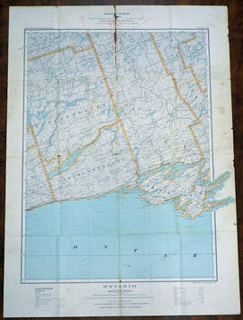
Topographical Map of Ontario - Belleville Sheet

A map of Hastings, Prince Edward, Northumberland and Peterborough counties in 1929 from the Department of Interior Canada. By J.E. Chalifour, Chief Geographer. Scale: 1" to 3.95 miles.

The legend includes additional information about counties, towns, villages, boundaries, railways, canals, lots, concessions, portages, rapids and First Nations Territories.

Canada. Department of the Interior

Map of Napanee Administrative District 1980

A map of the Napanee Administrative District including Northumberland, Hasting County, Prince Edward County, Lennox Addington counties. Published by the Ministry of Natural Resources in 1980.

Donated by the Belleville Public Library in 2014.

Ontario. Ministry of Natural Resources and Forestry

Regional Map of Belleville, Trenton, Sidney Township, Picton

A Regional Map of Belleville, Trenton, Sidney Township and Picton. Including advertisements around map. Composed by the Belleville & District Chamber of Commerce. Published by the Ontario Mapping Company in 1995.

Donated by the Belleville Public Library in 2014.

Belleville Chamber of Commerce

Hastings and Prince Edward Counties Topographical Map

A topographical map of Zone 18 - Hastings & Prince Edward Counties. Depicted current as of 1974. Printed 1977. Scale: 1:50,000. Published by the Mapping & Charting Establishment, Department of National Defence Canada. Belleville MCE 139, Edition 2. Transverse Mercator Projection, Contour Interval 25 ft. Elevations in Feet above sea level.

Canada. Department of National Defence

Map of Prince Edward County c.1975

Prince Edward County Map, circa 1975. Published by the Ministry of Transportation and Communications. Composed by Hon. James Snow (Minister) and Harold Gilbert (Deputy Minister).

Features: road jurisdictions, Kings Highways, secondary highways, county roads, township roads, roads legally open but not necessarily passable, urban corporate limits, railways and stations, township boundaries, county boundaries, populated areas.

Donated by the Belleville Public Library in 2014.

Ontario. Ministry of Transportation

Map of Prince Edward County 2001

Prince Edward County with Quinte's Isle in 2001. Published by the Prince Edward County Chamber of Tourism & Commerce.

Features: Map of Picton with West Lake & East Lake. Map Bloomfield & Wellington.

Donated by the Belleville Public Library in 2014.

Prince Edward County Chamber of Tourism and Commerce

Map of Lennox and Addington, Frontenac and Prince Edward Counties.

A map of Lennox and Addington, Frontenac and Prince Edward Counties as of April 1st, 1974. Published by Engineering Plans Office, Cartography section. Produced by the Ministry of Transportation and Communications. Map features information regarding roads, settlements, boundaries, parks and transportation. Scale: 1:250,000. Dimensions: 71cm x 56cm.

Ontario. Ministry of Transportation

Map of Prince Edward County 1972

Prince Edward County as of April 1972. Published by the Ministry of Transportation and Communications.

Features: road jurisdictions, Kings Highways, secondary highways, county roads, township roads, roads legally open but not necessarily passable, urban corporate limits, railways and stations, township boundaries, county boundaries, populated areas.

Donated by the Belleville Public Library in 2014.

Ontario. Ministry of Transportation

Photographs of Belleville floods and maps of Prince Edward County

  • CA ON00156 2018-058
  • Collection
  • 1936-1981

Collection comprising:
1) 4 black and white photographs of Belleville floods taken by Loreta Fairman (donor's aunt), 1936
2) 5 colour photographs of Belleville floods taken by Leslie Best, 1981
3) 2 Ontario Department of Highways maps of Prince Edward County, 1928 and 1967

Best, Leslie

Materials relating to Mary Eliza Rose of Ameliasburgh

  • CA ON00156 2011-11
  • Collection
  • 2002-2011

Transcript of 1885 diary of Mary Eliza Rose (1863-1941) of Ameliasburgh, Prince Edward County, Ontario, with scanned copies of photographs of members of the Rose family and their hotel on Rednersville Road.

Rector, Anne Elspeth

Aerial Photograph of Sophiasburgh Township

An aerial photograph of Sophiasburgh Township, Map # 1.71-4402- 2-144, (small section). The total area covered includes, Hwy 62 along the east side, Smith Road on west side, and in the centre Concession 7. A Provincial Government Aerial Photo. Dated 1971.

Aerial Photograph of Sophiasburgh Township

An aerial photograph of Sophiasburgh Township, Map # 1.71-4402- 2-144 (enlarged section). The total area covered includes, Consecon Creek and Marsh, Hwy 62, County Road 2 and west Concession 7 in centre of map. A “Little Swamp”, Provincial Government Aerial Photo. Scale 1:10,000. Dated 1971.

Aerial Photograph of Sophiasburgh Township

An aerial photograph of Sophiasburgh Township, Map # 1.71-4402- 2-144. The total area covered includes, Consecon Creek and Marsh, Hwy 62, County Road 2 and west Concession 7 in centre of map. A “Little Swamp”, Provincial Government Aerial Photo. Scale 1:10,000. Dated 1971.

Map of Quinte's Isle in Prince Edward County

A double-sided map of the accommodations and services located in Quinte's Isle and Prince Edward County. Scale 4.5cm : 5km.

Prince Edward County Chamber of Tourism and Commerce

Results 41 to 60 of 160