Ontario

Taxonomia

Código

Nota(s) de âmbito

Nota(s) da fonte

Mostrar nota(s)

Termos equivalentes

Ontario

Termos associados

Ontario

165 Descrição arquivística resultados para Ontario

6 resultados diretamente relacionados Excluir termos específicos

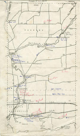
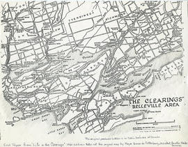
Plan of the village of Bancroft

A certified reproduction of the "Plan of Village of Bancroft, being part of Lots # 1 & 2, Concession A & B, Lots # 59, 60, 61, 62, 63, 64, 65 66 & 67, west of Hastings Road and Lot # 1, Concession 15, Township of Faraday." Surveyed by W. J. Moore, O.L.S., and signed July 5, 1911.

This copy was made in 1972 of plan #411, as registered in the Hastings Land Registry Office.

Donated by Walter I. Watson, O.L.S.

Sem título

Patricia Park Plan in the Town of Trenton

A certified reproduction of the "Patricia Park Plan - part of subdivision of Lot # 1, Concession 2, Murray Township signed by John A. Stevenson; William H. Reid; Hugh Leonard O'Rourke." Surveyed by Evans and Evans Civil Engineers and O.L.S. Plan was signed October 21, 1913.

This copy was made in 1972 of plan #451, as registered in the Hastings Land Registry Office.

Donated by Walter I. Watson, O.L.S.

Sem título

Plan of the incorporated village of Marmora 1901

A certified reproduction of the "Plan of Incorporated Village of Marmora." The plan includes the Road Allowance between Concession 3 & 4 (west), side line between Lots # 8 & 9 (north), road allowance between Concession 4 & 5 plus Loucks Estate on part of Concession 5, Lot # 8 (east), and the Road Allowance between Lots # 5 & 6 (south). Surveyed by William R. Aylsworth, P.L.S., and signed September 31, 1901.

This copy was made in 1972 of plan #307, as registered in the Hastings Land Registry Office.

Donated by Walter I. Watson, O.L.S.

Sem título

Plan of the village of Marlbank

A certified reproduction of the "Marlbank Village - Plan of Lots # 32-55, Concession 2 & 3, Hungerford Township." Surveyed by Frederick W. Wilkins, O.L.S., and signed July 26, 1910.

This copy was made in 1972 of plan #396, as registered in the Hastings Land Registry Office.

Donated by Walter I. Watson, O.L.S.

Sem título

Plan of town of Deseronto

A certified reproduction of the "Plan of town of Deseronto, compiled fromRegistered Plans & Actual Surveys by M. J. Butler, O. L. S." Surveyed by Evans and Evans, Civil Engineers and O.L.S. Plan signed September 24, 1921.

This copy was made in 1972 of plan #517, as registered in the Hastings Land Registry Office.

Donated by Walter I. Watson, O.L.S.

Sem título

Subdivision of part of Lot 2 in the Township of Wicklow

A certified reproduction of the "Wicklow Township, shewing subdivision of part of Lot# 2 in Concession 6 on [the] south side of Papineau Lake." The plan includes the south shore, sand beach, Papineau Lake, along the shore between Lots # 3 and 2, Concession 6. Surveyed by F. T. Webster, O.L.S., and signed February 3, 1927.

This copy was made in 1972 of plan #566, as registered in the Hastings Land Registry Office.

Donated by Walter I. Watson, O.L.S.

Sem título

Plan of survey of part of Dundas Street, Town of Trenton

  • CA ON00156 M/M430-2810
  • Item
  • 15 Apr 1967 - 16 May 1969
  • Parte de Map collection

Registered Plans 258, 82, 64 - "Plan of survey of part of Dundas Street, Town of Trenton, showing property frontages and owners." Survey includes; Town of Trenton, part of Dundas Street on 2 sheets, including cross streets Flindal, Herman, Scott, and Campbell.

Sem título

Corporation of Thurlow Map of Roads

A map from the Corporation of the Township of Thurlow showing Ontario Hydro lines, concessions and additional country roads. Circa 1970.
Donated by the City of Belleville.

Corporation of Thurlow Map of Wards

A map from the Corporation of the Township of Thurlow showing the ten ward boundaries. Circa 1970.
Donated by the City of Belleville.

Town of Trenton with advertising businesses

A photocopy of a map of the Town of Trenton, circa 1915. The map features advertisements for local businesses, important sites, industries and many railways and stations.

Donated by Bruce Polmanter.

Map of Thurlow Township with annotations

A map of Thurlow Township featuring the addition of handwritten annotations. Concessions, railways, proprietors, businesses and locations are featured. The map extends from the Bay of Quinte in the southwest to Roslin the northeast. Circa 1950 (Bakelite plant opened c. 1948 and the Foxboro Cheese Factory closed in 1961).

Specific annotations are as follows: Halloway Grist Mill, Latta Bridge, Plainfield Grist, Saw Mill, O'Brien's Bridge, Grist Mill, Canning Factory Foxboro, Footbridge, Cheese Factory, Fairfields Bridge, Dam Corbyville, Distillery, Cannifton Dam, Grist & Saw Mill, Quarry & Substation, Round House, Brickyard, Graham's Dried Foods, Bell Telephone Lines, Hydro Power Lines, and Cement Works.

Map of the clearings in Belleville Area

A map of clearings in the Belleville Area, 1850. The area of the map stretches from the Belleville Area and Prince Edward County, to Tyendinaga and over to Amherst Island. Published by Baren de Rottenburg, Assistant Quarter Master General C.

This map is featured as the end of "Life in the Clearings" - 1950 edition. It is not a true copy of the original by Major Baron de Rottenburg. The original can be found in the Library and Archives of Canada.

Sem título

Plan of west side of Front Street

A map of the planned west side of Front Street in Belleville, Ontario, 1854. By John J. Haslett, P.L.S.

Sem título

Plan of the streets of Belleville

A map of the planned streets for the town of Belleville, Ontario, in 1860-61. The map also features some buildings. Composed by R. L. Innes, ESQ. C.E. Published by M. Bowell (W.A. Little Lith. Montreal). Produced for the Hastings Directory.

Scale: 10 chains to an inch or 1:7,000.

Sem título

Photocopy of plan of the streets of Belleville

Note: contains the upper right corner of map that is missing from the original

A map of the planned streets for the town of Belleville, Ontario, in 1860-61. The map also features some buildings. Composed by R. L. Innes, ESQ. C.E. Published by M. Bowell (W.A. Little Lith. Montreal). Produced for the Hastings Directory.

Scale: 10 chains to an inch or 1:7,000.

Sem título

Map of Park and Building Lots Plan in Thurlow

An original map showing a plan for park and building lots on Bleecker Avenue between Concession 2 (College Street) and Bridge Street in Thurlow Township, Ontario. Along with the creation of subdivisions, Meyers Street was also being planned. Drawn by Philip Short for P. V. Elmore, P.L.S. Created on February 9, 1863 and registered 18 days later on February 27. Scale 3.5 chains to an inch.

Property of Tobias Blecker.

Sem título

Plan of the town of Belleville 1864-65

A copy of a map planning streets and some buildings in Belleville, Ontario, 1864-65. Composed by R. L. Innes, ESQ. C.E. Produced for the Hastings Directory.

Scale: 10 chains to an inch.

Plan of the town of Belleville 1869

A copy of a map planning streets and some buildings in Belleville, Ontario, 1869. Produced for the Hastings Directory. Map shows location of schools, court house, churches, banks, post office, town hall, police station, important industries.

Scale: 10 chains to an inch.

Depth of the Moira River for Channel Plan

A map showing, primarily, the depth of the Moira River within Belleville, Ontario. Together with a written report, it proposed a channel to the New Ferry Slip. Major streets and some lots are also labelled. By John D. Evans, P.L.S. on April 28, 1881 or 1887. Scale: 66 feet : 1". Note the interesting colouring at dimmed edges.

Donated by the Col W. N. Ponton Estate.

Sem título

Carre's Plan of the city of Belleville 1892

A copy of a map planning streets and buildings in Belleville, Ontario, 1892. The total area extends from Belleville to Bay of Quinte to Bridge Street (sheet 2) and from Bridge Street to Concession Road Allowance - now College Street - (sheet 1). Surveyed by Henry Carre, Ontario Land Surveyor.

Scale: 10 chains to an inch.

Sem título

Resultados 41 a 60 de 165