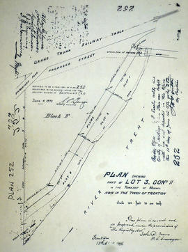
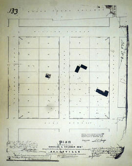
Plan of part of Lot 3 in the Township of Murray
- CA ON00156 M/M430-1924
- Item
- Oct 1873
Part of Map collection
A certified reproduction of the "Plan of part of the west half of Lot # 3, Concession 1, Murray Township, the property of W. H. Austin.” Surveyed by John Dunlop Evans, P.L.S., and signed October 1873.
This copy was made in 1972 of plan #233, as registered in the Hastings Land Registry Office.
Donated by Walter I. Watson, P. L. S.
Evans, John Dunlop, P.L.S.