Ontario

Taxonomía

Código

Nota(s) sobre el alcance

Nota(s) sobre el origen

Mostrar nota(s)

Términos jerárquicos

Ontario

Término General Canada

Ontario

Términos equivalentes

Ontario

Términos asociados

Ontario

1249 Descripción archivística resultados para Ontario

355 resultados directamente relacionados Excluir términos relacionados

Topographical maps and Callaghan family scrapbook

  • CA ON00156 2020-011
  • Colección
  • 1970-1994

Collection of Canada Department of Mines and Technical Surveys maps of the Quinte region (1:25,000):
1) Topographical map 30N/15f of False Duck Islands (Prince Edward County), 1965
2) Topographical map 30N/14a of Gull Bar (Prince Edward County), 1965
3) Topographical map 31C/3d of Ameliasburgh (Prince Edward County), 1966
4) Topographical map 30N/15g,h of Main Duck Island (Prince Edward County), 1966
5) Topographical map 30N/14b of Point Petre (Prince Edward County), 1966
6) Topographical map 31C/3a of Glenora (Prince Edward County), 1966
7) Topographical map 31C/4g of Wooler, 1970
8) Topographical map 31C/3e of west Belleville, 1971
9) Topographical map 31C/3f of east Belleville, 1971
10) Topographical map 31C/3h of Deseronto, 1971
11) Topographical map 31C/2e of Napanee, 1971

12) Canadian Hydrographic Service nautical chart (1:30,000), of Belleville to Telegraph Narrows, with Belleville harbour inset, 1982

13) Scrapbook of newspaper clippings relating to members of the Callaghan and Kellaway family, including Chris Simboli, Thomas Callaghan, Kay Callaghan, Don Kellaway, Ellen Kellaway, Frank Maloney, Michael Callaghan, Theresa Kellaway and Jack Bradford, 1983-1994

Sin título

Plan of subdivision in Plainfield

  • CA ON00156 2021-088
  • Unidad documental simple
  • 1877

Plan of subdivision creating Bay and Cross Streets in Plainfield, Thurlow Township, Ontario. Text reads: "Plan of Town lots laid out on the front of the East Half of lot number twenty three in the Seventh concession of the Township of Thurlow in the County of Hastings, Surveyed for the proprietor Josephy Fletcher Mackencie [Mackenzie] , By John Emerson P.L.S. October 1877. Scale one chain to an Inch. This plan is correct and is prepared under the provisions of the Registrations of Titles (Ontario) Act. John Emerson P.L.S. Duplicate Plan registered the first day of June A. D. 1878." The lot at the southeast corner is identified as "Halls Tavern Lot".

Sin título

Map of Hastings County, Ontario

  • CA ON00156 DA 2011.03
  • Unidad documental simple
  • c.1947

Map of Hastings County, Ontario, with business directory information for Belleville, Deseronto, Frankford, Madoc, Shannonville, Stirling and Tweed in the right and left-hand panels.

Sin título

Photocopy of plan of Rathbun farms near Deseronto, Ontario

  • CA ON00156 DA 2020.06
  • Unidad documental simple
  • c.1900

Photocopy of a plan of the Rathbun Farms (later Fingland and Kimmett farms) on Boundary Road to the northeast of Deseronto, showing crop rotations and land use.

A New Map of Upper & Lower Canada

  • CA ON00156 M/M1100-1654
  • Unidad documental simple
  • 1 Dec 1807
  • Parte deMap collection

A "New Map of Upper & Lower Canada" published December 1, 1807. Scale: British statute 69.5 miles to a degree. Created by John Cary, engraver and map-seller, No. 181 strand, London.

Sin título

Map of the Dominion of Canada

  • CA ON00156 M/M1100-3048
  • Unidad documental simple
  • 1927
  • Parte deMap collection

A map of the Dominion of Canada. Map dated 1927. Published by the Department of the Interior (Canada). Scale: 100 miles to 1 inch.

Sin título

Map of Canada indicating Natural Resources

  • CA ON00156 M/M1100-3049
  • Unidad documental simple
  • 1936
  • Parte deMap collection

A "Map of Canada - Exclusive of Northern Regions - Indicating Main Natural Resources." Map revised in 1936. Published by the Department of Mines & Resources (Canada). Scale: 100 miles to 1 inch.

Sin título

Reproduction of a map of Upper Canada

  • CA ON00156 M/M400-1000
  • Unidad documental simple
  • Mar. 1792 - Sept. 1795
  • Parte deMap collection

Reproduction of a map showing "the Routes Lt. Gov. J. G. Simcoe took on trips" throughout Upper Canada from March 1792 to September 1795. The map was charted by Lt. Gov. Simcoe. A good depiction of the area now referred to as Southern Ontario and his plans for a capital there - "London." This map was published as part of "Charting Our Past" from the Archives of Ontario by Stonehouse Publications.

Scale: about 20 miles to an inch.

Proposed Towns and Military Roads of Upper Canada

  • CA ON00156 M/M400-1001
  • Unidad documental simple
  • c. 1796
  • Parte deMap collection

Poor reproduction of a sketch of Upper Canada to show places designated by Lt. Gov. Simcoe for towns and proposed military roads, circa 1796. The map was published by B. M. Kings.

Reproduction of a map of the province of Upper Canada

  • CA ON00156 M/M400-1002
  • Unidad documental simple
  • 12 April 1800
  • Parte deMap collection

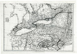
Reproduction of a map showing new settlements, townships, counties etc.in the province of Upper Canada as of April 12, 1800. The total area spans from Quebec to Lake Huron and from Lake Michigan to New Hampshire then south to Pennsylvania in the U.S.A. This was the first printed map of Upper Canada, showing all settlements since 1784. Charted by D. W. Smith, Esq., Surveyor General London and published by W. Faden.

This map was published by Stonehouse Productions as part of "Charting Our Past" from the Archives of Ontario.

Sin título

Map of the principal settlements of Upper Canada (Part 1)

  • CA ON00156 M/M400-1003
  • Unidad documental simple
  • 1817
  • Parte deMap collection

Reproduction of Part 1 of a map showing a plan of the Principal Settlements of Upper Canada in 1817. The area covers from Eastern to Midland to Home District.
This map can be found the Archives of Canada.

Map of the principal settlements of Upper Canada (Part 2)

  • CA ON00156 M/M400-1004
  • Unidad documental simple
  • 1817
  • Parte deMap collection

Reproduction of Part 2 of a map showing a plan of the Principal Settlements of Upper Canada in 1817. The area covers from Northumberland to Essex counties.
This map can be found the Archives of Canada.

Map of Lower Canada, Quebec and Ontario

  • CA ON00156 M/M400-1005
  • Unidad documental simple
  • 1825
  • Parte deMap collection

A reproduction of part of a map showing Lower Canada, Quebec and Ontario in 1825. Map shows bodies of water and names of settlements. The boundary of Lower Canada is according to a treaty with the United States. From the Archives of Canada on July 27, 1966. Donated by Chewett.

Map of Upper Canada and United States

  • CA ON00156 M/M400-1006
  • Unidad documental simple
  • 1834
  • Parte deMap collection

A map showing settlements of Upper Canada and part of the United States in 1834 by J. Arrowsmith.
Received from the Archives of Canada's map collection - July 9, 1971.

Sin título

Parts of Ontario and USA in 1834

  • CA ON00156 M/M400-1007
  • Unidad documental simple
  • 15 Feb. 1834
  • Parte deMap collection

A map showing settlements of Ontario and part of the United States in February 1834 by J. Arrowsmith. The total area extends from Lake Huron East to Montreal and south Ohio to Long Island.
Received from the Archives of Canada's map collection - 11 May 1977.

Sin título

Resultados 1 a 20 de 1249