Madoc, Township of

Taxonomy

Code

Scope note(s)

Display note(s)

Hierarchical terms

Madoc, Township of

Madoc, Township of

Equivalent terms

Madoc, Township of

Associated terms

Madoc, Township of

133 Archival description results for Madoc, Township of

133 results directly related Exclude narrower terms

Plan of Rectification Survey of Madoc Township

A certified reproduction of a “Plan showing the Rectification Survey... of the Township of Madoc.” The area contained includes; northern lots #30, 31, 32 on concessions 1-11 (inclusive) in Madoc Township. Originally surveyed by Charles Fraser Aylsworth, P. L. S. and produced on March 18, 1891.

This reproduction was made on June 5, 1972 and approved by the Deputy Registrar.

Donated by Walter I. Watson, P. L. S.

Aylsworth, Charles Fraser Sr., P.L.S.

Plan of Lakeview Cemetery in the Township of Madoc

A certified reproduction of the "Plan of Lake View Cemetery, situated on the west half of Lot # 1, Concession 7, Madoc Township.” Surveyed by C. Fraser Aylsworth Jr., P.L.S., and signed October 23, 1891.

This copy was made in 1972 of plan #287, as registered in the Hastings Land Registry Office.

Donated by Walter I. Watson, P. L. S.

Aylsworth, Charles Fraser Jr., O.L.S.

Map of Hastings County in 4 sections

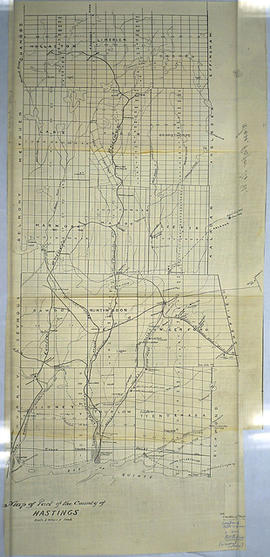
A map of Hastings County outlining townships from the Bay of Quinte in the south, to Wallaston, Limerick and Cashel in the north.
Map is in four sections. Scale: 3 miles : 1 inch. Original map is dated 1894. Photocopy from the Archives of Ontario.

Map of the Counties of Hastings and Prince Edward

A "Map of the Counties of Hastings and Prince Edward." In 1898, the lots, concessions, churches, schools and mines are shown of the townships in Hastings and Prince Edward. Scale: 1.5 miles to an inch. Published by the Canadian Map Publishing Company in Hamilton, Ontario, for the Belleville Sun. Revised by Henry Carre, C.E. Inset is the map of North Hastings, scale 400 chains to an inch.

Carre, Henry, O.L.S.

Blackburn family papers

  • CA ON00156 2011-13
  • Fonds
  • 1901-1930

Collection contains:
1) Twelve letters from Nicholas Wood Blackburn to his future wife, Fannie Elizabeth 'Lizzie' Bateman and one from Lizzie to Nicholas, 1901-1902. Letters from Nicholas were written from Marmora, Blairton, Rat Portage [Kenora], Macdonald (Manitoba), Millbridge, Coe Hill Mines, L'Amable Station, and Turriff.
2) Colour photocopy of certificate of marriage of Nicholas Wood Blackburn and Fannie E. Bateman, 25 March1903
3) Last will and testament of Nicholas Wood Blackburn of Madoc Township, 1918
4) Photocopied diary entries of Lizzie Blackburn at the time of Nicholas's last illness, 1929-1930
5) Photocopy of a letter from the nurse who tended Nicholas Blackburn before his death, 1 January 1930

Blackburn, Nicholas Wood

Map of Hastings with townships

A map of Hastings County outlining the twelve townships:
Marmora and Lake, Madoc, Tudor, Grimsthorpe, Elzevir; Rawdon, Huntingdon, Hungerford, Sidney, Thurlow, Tyendinaga.
As well as, the lots and concessions. Circa 1916.Scale: 4 miles: 1 inch.

Donated by K.G.M. Ross.

Subdivision of part of east half of Lot 1 in the Township of Madoc

A certified reproduction of the "Subdivision of part of the east half of Lot # 1, Concession 6, Township of Madoc & partly in Village of Madoc, property of W. H. McBain.” Surveyed by Henry Carre O. L. S., and signed January 13, 1914.

This copy was made in 1972 of plan #454, as registered in the Hastings Land Registry Office.

Donated by Walter I. Watson, P. L. S.

Carre, Henry, O.L.S.

Lloyd's Map of Hastings County

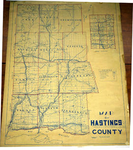
A map of Hastings County outlining the twelve townships:
Marmora and Lake, Madoc, Tudor, Grimsthorpe, Elzevir; Rawdon, Huntingdon, Hungerford, Sidney, Thurlow, Tyendinaga. The northern townships are pictured on the right side.
As well as, the lots and concessions. Circa 1922. Scale: 1.5 miles: 1 inch. Published by Lloyd's Maps, Map Publisher.

Lloyd's Map, Map Publisher

South and Central Hastings Map

"Cummins Rural Directory Map:" A map of South and Central Hastings, in 1923, featuring post offices, hamlets and lot owners. Map is surrounded by advertisements. Published by Cummins Map Co., Toronto. Dimensions 71cm x 50.5cm.

Cummins Map Company

Thomas Henry Thompson

The file contains original copy of The Daily Ontario newspaper with the headline "T.H. Thompson Died Suddenly, Honoured Man". Member for East Hastings. Contained also in file some research notes, photo copies of pictures, copy of Last Will and Testament for Susan Thompson (wife of Thomas)

Townships of Hastings County with advertisements

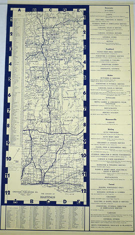
A map of Hastings County, in 1932, showing lakes, rivers, cities, towns and townships. A list of businesses within the county are on the right. Drawn exclusively for and published by Croydon Publishing Company.

Croydon Publishing Co.

Minerals in northern Hastings County

A map of northern Hastings County detailing different types of mineral occurrences, see Legend. Published in 1943 by the Ontario Department of Mines. Scale: 1:120,000. The map includes parts of Quebec and USA, in relation to the region. It was produced to "accompany report by Jas E. Thomson in Vol. LII Ontario Department of Mines, Annual Report, 1943."

Donated by the Ontario Department of Mines, April 1, 1965.

Ontario. Department of Mines

Madoc Township Map # 446773E

  • CA ON00156 M/M470-2591 - 2616/2615
  • Item
  • c. 1950
  • Part of Map collection

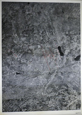
A reproduction of an air survey photograph produced by the Ontario Ministry of Natural Resources. Map #446773E of Madoc Township in Hastings County, Ontario. Circa 1950.

The photograph shows the northern part of Madoc Township, Bannockburn, Tudor Township, Concession 1 to 9, Robinson Lake, Westerly to Millbridge, Moira River, Highway 62, and the Canadian National Railway.

Donated by Walter I. Watson, P.L.S.

Ontario. Ministry of Natural Resources and Forestry

Madoc Township Map # 445772W

  • CA ON00156 M/M470-2591 - 2616/2609
  • Item
  • c. 1950
  • Part of Map collection

A reproduction of an air survey photograph produced by the Ontario Ministry of Natural Resources. Map #445772W of Madoc Township in Hastings County, Ontario. Circa 1950.

The photograph shows Madoc Township, Concession 5 to 9, Huntingdon Township Concession 14, northwest Elzevir Township, Queenboro and Black River.

Donated by Walter I. Watson, P.L.S.

Ontario. Ministry of Natural Resources and Forestry

Madoc Township Map # 445773E

  • CA ON00156 M/M470-2591 - 2616/2609
  • Item
  • c. 1950
  • Part of Map collection

A reproduction of an air survey photograph produced by the Ontario Ministry of Natural Resources. Map #445773E of Madoc Township in Hastings County, Ontario. Circa 1950.

The photograph shows Madoc Township, Concession 1 to 7, Hwy 62, and Moira River Watershed, Eldorado, Lake Township, Concession 3 to 10.

Donated by Walter I. Watson, P.L.S.

Ontario. Ministry of Natural Resources and Forestry

Results 41 to 60 of 133