Madoc, Township of

Taxonomia

Código

Nota(s) de âmbito

Mostrar nota(s)

Termos hierárquicos

Madoc, Township of

Madoc, Township of

Termos equivalentes

Madoc, Township of

Termos associados

Madoc, Township of

133 Descrição arquivística resultados para Madoc, Township of

133 resultados diretamente relacionados Excluir termos específicos

Madoc Township Map # 445773E

  • CA ON00156 M/M470-2591 - 2616/2609
  • Item
  • c. 1950
  • Parte de Map collection

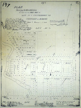
A reproduction of an air survey photograph produced by the Ontario Ministry of Natural Resources. Map #445773E of Madoc Township in Hastings County, Ontario. Circa 1950.

The photograph shows Madoc Township, Concession 1 to 7, Hwy 62, and Moira River Watershed, Eldorado, Lake Township, Concession 3 to 10.

Donated by Walter I. Watson, P.L.S.

Sem título

Aerial Photograph of Madoc Township

  • CA ON00156 M/M470-2781 - 2794/2782
  • Item
  • c. 1977
  • Parte de Map collection

Madoc Township, north part Bannockburn with Hwy 62, the railway, and the Bannockburn Road running east toward Cooper. By the Air Photographic Production Division of the Deptartment of Mines & Technical Surveys - Government of Canada.

Sem título

Plan of McBeath Block in the Township of Madoc

A certified reproduction of the "Plan of McBeath Block, subdivision of part of east half of Lot # 2, Concession 6, Township of Madoc.” Includes land north of St. Lawrence Street. and east of Wellington Street in the Village of Madoc and south of Duncan Street in Block 45. Surveyed by Evans and Bolger, P. L. S. and dated September 16, 1881.

This copy was made in 1972 of plan #221, as registered in the Hastings Land Registry Office.

Donated by Walter I. Watson, P. L. S.

Sem título

Subdivision of west Lot 2 in the village of Madoc

A certified reproduction of the "Re-subdivision of part of west half of Lot # 2, Concession 6, Township of Madoc for Sarah Russell of Montreal, widow of Colin Russel." The lot is bounded by Lots #2-3 in the north, Mill Pond and Deer Creek on the west, Division Street and Lawrence Street in the south and Wellington Street on the east. Surveyed by Evans and Bolger, P.L.S ., and signed December 18, 1875.

This copy was made in 1972 of plan #197, as registered in the Hastings Land Registry Office.

Donated by Walter I. Watson, P. L. S.

Sem título

Plan of Rollins Block in the Township of Madock

A certified reproduction of the "Rollins Block - Lots on part of Lot # 1 in Concession 5, Township of 'Madock' for proprietor Samuel Rollins.” Rollins Block is between Lot # 2 in 5th Concession of 'Madock', the road between Huntingdon & 'Madock' Township, Francis Street and lastly the road between 5th and 6th Concession of 'Madock.' Surveyed by John Emerson, P.L.S ., and signed October 3, 1875.

This copy was made in 1972 of plan #193, as registered in the Hastings Land Registry Office.

Donated by Walter I. Watson, P. L. S.

Sem título

Subdivision of Lots 28 in the Township of Madoc

A certified reproduction of the "Plan of subdivision of part of Lots # 28 in Concession 5 & 6 in Township of Madoc, being in the Village of Bannockburn.” Surveyed by C. Fraser Aylsworth Jr. P. L. S., and signed September 1, 887.

This copy was made in 1972 of plan #261, as registered in the Hastings Land Registry Office.

Donated by Walter I. Watson, P. L. S.

Sem título

Map of Madoc Township

  • CA ON00156 M/M420-2169 - 2183/M420-2169
  • Item
  • c. 1880
  • Parte de Map collection

A blueprint reproduction of a map of Madoc Township in Hastings County, Ontario. The map features the names of neighboring townships, lot and concession numbers, Central Ontario Railway, Moira River, a mill site and springs. Circa 1880. Scale 40 chains to an inch.

Resultados 101 a 120 de 133