Kaladar

Taxonomie

Code

Bereik aantekeningen

ron aantekeningen

Toon aantekening(en)

Hiërarchische termen

Kaladar

Gelijksoortige termen

Kaladar

Verwante termen

Kaladar

6 Archivistische beschrijving results for Kaladar

6 results directly related Exclude narrower terms

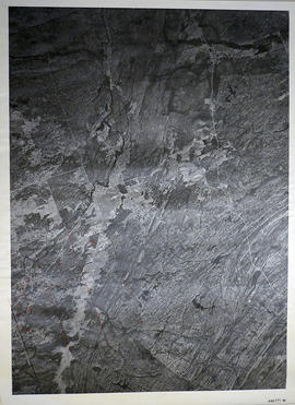
Topographical map of Kaladar - west half

  • CA ON00156 M/M470-1559 - 1573, 1576 - 1579, and 1585 - 1621/1595
  • Stuk
  • 1950
  • Part of Map collection

A topographical map of Kaladar - Canada sheet #31 C/11, west half. Published by the Army Survey Establishment, Department of National Defence in 1950. Scale 1:50,000.

Zonder titel

Topographical map of Kaladar - east half

  • CA ON00156 M/M470-1559 - 1573, 1576 - 1579, and 1585 - 1621/1594
  • Stuk
  • 1950
  • Part of Map collection

A topographical map of Kaladar - Canada sheet #31 C/11, east half. Published by the Army Survey Establishment, Department of National Defence in 1950. Scale 1:50,000.

Zonder titel

Kaladar Township Map # 446771W

  • CA ON00156 M/M470-2591 - 2616/2612
  • Stuk
  • c. 1950
  • Part of Map collection

A reproduction of an air survey photograph produced by the Ontario Ministry of Natural Resources. Map #446771W of Kaladar Township in Lennox and Addington County, Ontario. Circa 1950.

The photograph shows Kaladar Township, Concession 1 to 7, Hwy 41, Northbrook and west to Flinton, the Skootamata River and the border of Anglesea Township.

Donated by Walter I. Watson, P.L.S.

Zonder titel

Map of Paleozoic Geology of Kaladar and Tweed

A map of the Paleozoic geology featured in the Tweed-Kaladar area during 1981. Scale 1:50,000. Published by the Ontario Ministry of Natural Resources.

Funded by the Federal Department of Regional and Economic Expansion and the Ontario Ministry of Natural Resources under the Minerals Program of Eastern Ontario Subsidiary Agreement.

Zonder titel