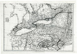
Parts of Ontario and USA in 1834
- CA ON00156 M/M400-1007
- Item
- 15 Feb. 1834
Part of Map collection
A map showing settlements of Ontario and part of the United States in February 1834 by J. Arrowsmith. The total area extends from Lake Huron East to Montreal and south Ohio to Long Island.
Received from the Archives of Canada's map collection - 11 May 1977.
Arrowsmith, John