Mostrando 116 resultados

Descripción archivística
Transportation and utilities Con objetos digitales
Imprimir vista previa Hierarchy Ver :

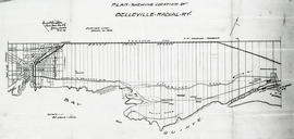
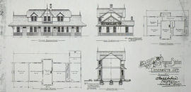
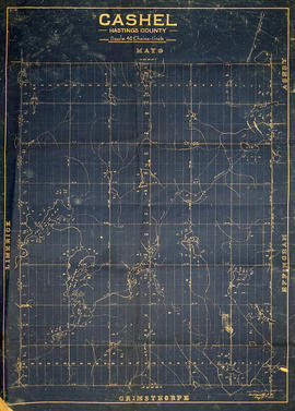
John Fairbairn Anderson negatives

  • CA ON00156 JFA
  • Fondo
  • 1903-1918

Negatives of photographs taken by John Fairbairn Anderson. They include images of dams, electricity generating plants, the Beal family cottage on Stoney Lake and photographs of places Anderson visited, including Orillia, Los Angeles, Peterborough, Young's Point, Sulphide, Port Hope, Muskegon (Michigan), Chicago and Trenton (Ontario).

Many of the negatives are associated with an index card, on which Anderson wrote the number of the negative, the subject of the photograph and the date it was taken. There were also a number of negatives with no associated card.

Sin título

Collection of Deseronto-related materials

  • CA ON00156 2016-67
  • Colección
  • 1900-2000

This collection contains a variety of materials relating to the history of Deseronto and Hastings County. Items include:

  • video of the 1989 Deseronto Centennial and Homecoming celebration, 4-5 August 1989, including performances of the Centennial Song, a Main Street parade, a baby show, karate demonstration and fireworks
  • File on the 1989 Deseronto Centennial celebrations
  • 35mm slides of historic views of Deseronto
  • Morrison family snapshots of unidentified people
  • Photograph of an aircraft from Camp Mohawk on the shore of the Bay of Quinte, August 1917
  • Programme and photograph (https://www.flickr.com/photos/cabhc/29760539332/) of the United Empire Loyalist Celebration, June 1929
  • Plan of Deseronto lots, 1943
  • Series of 120 photographs of Deseronto, taken around 1995. Many are aerial shots, others are of individual houses. A few depict individuals: Don Lindsay, Dennis Vick, Dick Beare, Joe Carter, Ed Gordanier
  • 'A Building Code for Smaller Municipalities' by the National Research Council of Canada, Ottawa, 1947
  • County of Hastings directories for 1983, 1984, 1985
  • County of Hastings receipts and expenditures statement, 1921
  • By-law to Regulate the Running At Large of Animals and for Other Purposes, Township of Tyendinaga, 6 August 1895
  • File of 'Deseronto Firsts' compiled by Ken Brown
  • File of photographs, press clippings and list of entrants in Deseronto's Easter Parade of 2006
  • 16 photographs of empty lots in Deseronto, taken 2004
  • File of partial letters from Joe Goold to his sweetheart, Marnie, written while he was based in Detroit, 11 September to 11 October 1919, with blank postcards of Deseronto scenes and a letter from Elizabeth Goold to Bill Hunt concerning the letters
  • File on James Fairbairn including a newspaper extract and a studio photograph taken by him.
  • Typescript biography of Harry B. Free (Camp Rathbun flight instructor) by Margaret Crothers, 1991
  • File on the Dryden family, including a photograph of the Drydens at the Peterborough Lift Lock (https://flic.kr/p/9dmEYZ)
  • File of clippings about Gwen Lazier Braidwood, 2005
  • File of clippings about Deseronto mayor Glen Belcour, 1995-2002
  • File relating to the Asten family, including a letter from James Asten, Town Scavenger, to the Deseronto Town Council, 1936 (available at https://www.flickr.com/photos/cabhc/albums/72157674226629315)
  • Promotional brochure and news clipping on Bridgeline Ropes of Deseronto, 1999
  • Listing by plot number of owners of plots in the Deseronto cemetery and names of people buried there, with their year of death, 2003
  • File on the Deseronto Theatre Guild's formation, 2004
  • File on a Deseronto Waterfront Study Workshop held February 2005
  • File and photographs on the 'Leander Electra' electric yacht, 1986
  • Bakery token for R. Marrigan, Baker, Deseronto
  • File of materials relating to E. A. Rixen, including three letters from Deseronto teacher Lena Warren, 1908
  • File on Deseronto Arts & Culture Society, 2004-2007
  • File and photographs relating to the Deseronto Yacht Club, 1993-2003
  • 'Dear Hame hid awa' in the Glen' photocopy of sheet music by Archibald Duncan MacIntyre (oversize - stored in box 66)
  • List of members of St. Mark's Anglican Church who volunteered for active service in World War Two (oversize - stored in box 66)
  • Folder of Deseronto Yacht Club materials: photographs and news clippings (part of the Floyd Marlin collection - stored in box 46), 1950-1997

Road Map of the Province of Ontario 1956

  • CA ON00156 M/M400-1019
  • Unidad documental simple
  • 1956
  • Parte deMap collection

A road map of the northern and southern portions of the Province of Ontario. Published by the Ontario Department of Highways in 1956. Various indexes and legends are located on the map.

Sin título

Reproduction of a topographical Map of the New Welland Canal

  • CA ON00156 M/M470-1045
  • Unidad documental simple
  • 1870-1871
  • Parte deMap collection

A reproduction of a topographical map showing the New Welland Canal and the country lying between Allanburgh and Port Dalhousie, by Thomas Monro and John Page (Chief Engineers of Canals). The Welland Canal shows the extent of communities along the canal, government lands along the canal and private owners of lands. The information on the map is from surveys completed in 1870-1871. Scale: 5 feet to an inch.

This map was published by Stonehouse Productions as part of "Charting Our Past" from the Archives of Ontario.

Sin título

Land Settlement Map of the Moira Valley

  • CA ON00156 M/M430-1187
  • Unidad documental simple
  • c. 1951
  • Parte deMap collection

A map of the land settlement, including roads and mills, located in the Moira Valley. This information has been superimposed on Publius V. Elmore's 1836 map of the Midland District.

The mills featured: Bleecker's Saw Mill, Mire's Grist Mill, Saw and Grist Mil, Colman's Mill, Jonas Canniff's Saw Mill, Joseph Canniff's Saw & Grist Mills, Daniel Canniff's Saw & Grist Mills, Reed's Saw Mill, Eowerman's Saw Mill, Thorn's Saw Mill, Thomson's Mill, Latta's Saw & Grist Mill, Carter's Saw Mill, Trumpour's Saw Mill, Munro's Saw & Grist Mill, McKenzie's Saw and Grist Mill, and Reed's Grist Mill.

Sin título

Madoc and Tudor Road Plans

  • CA ON00156 M/M450-1506
  • Unidad documental simple
  • c. 1865
  • Parte deMap collection

A cross-sectional plan regarding the formation of Madoc and Tudor Roads. Scale: 4 feet : 1 inch.

COR Station at Ormsby Plans

  • CA ON00156 M/M450-1508
  • Unidad documental simple
  • 1 Sep 1900
  • Parte deMap collection

A blueprint planning the COR Bancroft extension station at Ormsby junction, Hastings County, Ontario. Plan features floor, elevation and sections. Drawn by John Dunlop Evans, Chief Surveyor/Engineer - September 1, 1900.

Sin título

Plans for COR CPR Union Station at Trenton

  • CA ON00156 M/M450-1510
  • Unidad documental simple
  • 23 Aug 1897
  • Parte deMap collection

A blueprint planning the COR and CPR Union Station at Trenton, Hastings County, Ontario. Plan features floor, elevation and sections. Drawn by John Dunlop Evans, Chief Surveyor/Engineer - August 23, 1897.

Sin título

Plans for COR Station at Gilmour

  • CA ON00156 M/M450-1515
  • Unidad documental simple
  • 17 Sep 1902
  • Parte deMap collection

A blueprint planning the COR station at Gilmour, Hastings County, Ontario. Plan of freight shed, office, waiting room, high platform, ramp, low platform and platform. Drawn by John Dunlop Evans, Chief Surveyor/Engineer - September 17, 1902.

Sin título

Plan of park lots on farm Lot 38 in the Township of Sidney

  • CA ON00156 M/M430-1736
  • Unidad documental simple
  • Sep 1856
  • Parte deMap collection

A certified reproduction of the Plan of Park Lots in the south part of farm Lot # 38 in 5th Concession Sidney Township. Surveyed by P.V. Elmore, P.L.S. in September of 1856.

This copy was made in 1972 of plan #86, as registered in the Hastings Land Registry Office.

Donated by Walter I. Watson, O.L.S.

Sin título

Croydon's Map of the City of Belleville

  • CA ON00156 M/M440-2547
  • Unidad documental simple
  • c. 1932
  • Parte deMap collection

A map of the City of Belleville, circa 1932, showing railroads, streets, bus roues, city limits and highways. Also featured is a street index. Published by the Croydon Map Company and drawn excursively for the Rural Township Map Company.

Donated by the Belleville Public Library in 2014.

Sin título

Reproduced plan of Belleville Radial Railway

  • CA ON00156 M/M440-2573
  • Unidad documental simple
  • Feb 1909
  • Parte deMap collection

A photocopy of a "Plan Shewing Location of Belleville Radial R. Y. (Railway)." The area included extends from the town line in Sidney Township (west) to Shannonville (east) and from the Grand Trunk Railway (north) to the Bay of Quinte (south). Originally printed in February 1909. Scale 25 chains to an inch.

Donated by the Belleville Public Library in 2014.

Sin título

CNR Crossing at Cannifton Road Blueprint

  • CA ON00156 M/M450-2826
  • Unidad documental simple
  • 21 Sep 1929
  • Parte deMap collection

A blueprint planning the CNR crossing and gas mains at Cannifton Road in Belleville, Ontario. Drawn by Charles Mott - September 21, 1929. Scale: 1" : 4'0.
Features: 4/4/59 Canadian National Railways Agreement as to Laying Pipes Under Track.

Sin título

Grand Trunk Station Deseronto Plans

  • CA ON00156 M/M450-2980
  • Unidad documental simple
  • 8 Oct 1897
  • Parte deMap collection

A photocopy of a blueprint planning the Grand Trunk Railway station at Deseronto, Hastings County, Ontario. Plan features floors, elevation and blocks. Drawn by Joseph Hobson, Chief Engineer in Montreal - October 8, 1897.

David Pershick informs us that this building was later moved by rail to Marysville in 1905.

Donated by Bruce Polmanter.

Map of Madoc Township

  • CA ON00156 M/M420-2169 - 2183/M420-2169
  • Unidad documental simple
  • c. 1880
  • Parte deMap collection

A blueprint reproduction of a map of Madoc Township in Hastings County, Ontario. The map features the names of neighboring townships, lot and concession numbers, Central Ontario Railway, Moira River, a mill site and springs. Circa 1880. Scale 40 chains to an inch.

Map of Cashel Township

  • CA ON00156 M/M420-2169 - 2183/M420-2176
  • Unidad documental simple
  • 17 May 1861
  • Parte deMap collection

A blueprint reproduction of a map of Cashel Township in Hastings County, Ontario. The map features the names of neighboring townships, lot and concession numbers, rivers, and lakes. Surveyed by Henry A. F. MacLeod, P.L.S., and signed May 17, 1861 at Belleville. Scale 40 chains to an inch.

Sin título

Resultados 1 a 20 de 116