Affichage de 23 résultats

Description archivistique
Sidney, Township of Transportation and utilities
Aperçu avant impression Hierarchy Affichage :

8 résultats avec objets numériques Afficher les résultats avec des objets numériques

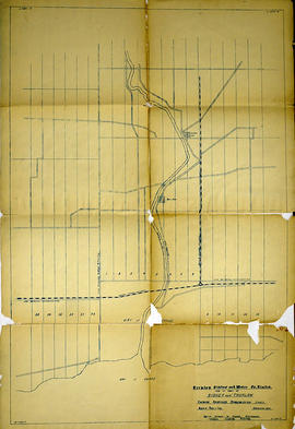
Midland District Hastings County Report on Roads, Crt. of Quarter Sess. 1810-30

This file contains a ledger recording roads passed in the Midland District in the County of Hastings from 1810 to 1830. Allan McLean Esq. was acting as Clerk of the Peace of the District. https://en.wikipedia.org/wiki/Allan_McLean_(Upper_Canada_politician)
these were recorded by James Nichollas, Clerk of the Peace, Midland District.

Sidney Township Road Programming Study

  • CA ON00156 M/M430-2590
  • Pièce
  • 1974-1983
  • Fait partie de Map collection

A road programming study within Sidney Township. From Bay of Quinte South, North Rawdon Township, East Sidney St. & West Batawa. Includes lots and concessions.

Plan of Ketcheson Block in the Township of Sidney

  • CA ON00156 M/M430-1748
  • Pièce
  • Jan 1853
  • Fait partie de Map collection

A certified reproduction of the Plan of subdivision of Ketcheson Block, west half of Lot # 31 in 2nd Concession Sidney Township, into park lots of 5 acres each for Elijah Ketcheson. Surveyed by P.V. Elmore, P.L.S. in January of 1853.

This copy was made in 1972 of plan #49, as registered in the Hastings Land Registry Office.

Donated by Walter I. Watson, O.L.S.

Sans titre

Plan of Lot 38 in the Township of Sidney

  • CA ON00156 M/M430-1746
  • Pièce
  • May 1854
  • Fait partie de Map collection

A certified reproduction of the Plan of Lot # 38, 1st Concession of Sidney Township, property of William H. Ponton and William Breakenridge. Surveyed by P.V. Elmore, P.L.S. in May of 1854.

This copy was made in 1972 of plan #63, as registered in the Hastings Land Registry Office.

Donated by Walter I. Watson, O.L.S.

Sans titre

Plan of park lots on farm Lot 38 in the Township of Sidney

  • CA ON00156 M/M430-1736
  • Pièce
  • Sep 1856
  • Fait partie de Map collection

A certified reproduction of the Plan of Park Lots in the south part of farm Lot # 38 in 5th Concession Sidney Township. Surveyed by P.V. Elmore, P.L.S. in September of 1856.

This copy was made in 1972 of plan #86, as registered in the Hastings Land Registry Office.

Donated by Walter I. Watson, O.L.S.

Sans titre

Plan of village lots on Lot 7 in the Township of Sidney

  • CA ON00156 M/M430-1709
  • Pièce
  • May 1855
  • Fait partie de Map collection

A certified reproduction of the Plan shewing the survey of village lots on Lot # 7 in 5th Concession of Sidney Township (Frankford). Shows route of Junction Railroad through village. Surveyed by J. S. Peterson, P.L.S. in May of 1855.

This copy was made in 1972 of plan #89, as registered in the Hastings Land Registry Office.

Donated by Walter I. Watson, O.L.S.

Sans titre

Ontario Hydro Aerial Photograph Plan of Lots 25-29 in Sidney Township

  • CA ON00156 M/M470-2754 - 2780/2767
  • Pièce
  • 1977
  • Fait partie de Map collection

Plan showing Sidney Township, part of Lots # 25 to 29, Concession 4, & part of Lot # 25, Concession 3 for proposed right of way for Ontario Hydro (Map # TD30199Z [paper], Corresponds to Mylar Map # TD30199Z). For Ontario Hydro, Design and Construction Branch, Surveys and Mapping.

Sans titre

Ontario Hydro Aerial Photograph Plan of Lots 29-38 in Sidney Township

  • CA ON00156 M/M470-2754 - 2780/2766
  • Pièce
  • 1977
  • Fait partie de Map collection

Plan showing parts of Lots # 29 to 38, inclusive, Concession 4, Township of Sidney showing proposed right of way for Ontario Hydro (Map # TD30197Z [Paper] Corresponds to Mylar Map # TD30197Z). For Ontario Hydro, Design and Construction Branch, Surveys and Mapping.

Sans titre

Ontario Hydro Plan of Lots 25-29 Sidney Township

  • CA ON00156 M/M470-2754 - 2780/2756
  • Pièce
  • 1977
  • Fait partie de Map collection

Plan showing Sidney Township, part of Lots # 25 to 29, concession 4 & part of Lot # 25, Concession 3, for proposed right of way for Ontario Hydro Lines (Map # TD30199Z). For Ontario Hydro, Design and Construction Branch, Surveys and Mapping. Scale 1 inch = 200 feet. Drawn by R. Sweeney.

Sans titre

Ontario Hydro Plan of Lot 31 Sidney Township

  • CA ON00156 M/M470-2754 - 2780/2755
  • Pièce
  • 1977
  • Fait partie de Map collection

Plan showing Sidney Township, part of Lot # 31, Concession 4, and the proposed right of way for Ontario Hydro Lines. (Map # TD30198D). For Ontario Hydro, Design and Construction Branch, Surveys and Mapping. Scale 1 inch = 60 feet. Drawn by R. Sweeney.

Sans titre

Ontario Hydro Plan of Lots 29-38 Sidney Township

  • CA ON00156 M/M470-2754 - 2780/2754
  • Pièce
  • 1977
  • Fait partie de Map collection

Plan showing parts of Lot # 29 -38 inclusive, Concession 4, Township Sidney and Part of Lot # 1, Concession 4, Township of Thurlow (Map # TD30197Z). For Ontario Hydro, Design and Construction Branch, Surveys and Mapping. Scale 1 inch = 200 feet. Drawn by R. Sweeney.

Sans titre

Ontario Hydro Aerial Photographs of Lennox to Oshawa Area

  • CA ON00156 M/M470-2699 - 2703
  • Série organique
  • 10 Sep 1973 - 27 Jul 1976
  • Fait partie de Map collection

5 aerial photographs of Thurlow, Tyendinaga and Thurlow Townships, in Hastings County, Ontario.
Photographed on September 10, 1973 and annotations made July 27, 1976. Scale 1 inch = 200 feet.
For the Ontario Hydro Route and site Selection Division, Orthophoto R/W Selection Plan Lennox G. S. - Oshawa Area T. S. Aerial View.
By J. E. Clements- photogrammetric production officer; D. Crozier- chief draftsman; J. Sedgwal- project engineer; C. E. Bishop- Sr R/W planning engineer.

Sans titre

Ontario Hydro Aerial Photograph of Sidney Township

  • CA ON00156 M/M470-2699 - 2703/2703
  • Pièce
  • 10 Sep 1973 - 27 Jul 1976
  • Fait partie de Map collection

An aerial photograph of Sidney Township, Concession 3 (Map # TD19689Z). The photo includes Concession 3 and part of Concession 4, Lots A, # 1 to 21, including proposed Hydro right of way and landowners names and instrument numbers. Photographed on September 10, 1973 and annotations made July 27, 1976. Scale 1 inch = 200 feet.
For the Ontario Hydro Route and site Selection Division, Orthophoto R/W Selection Plan Lennox G. S. - Oshawa Area T. S. Aerial View.
By J. E. Clements- photogrammetric production officer; D. Crozier- chief draftsman; J. Sedgwal- project engineer; C. E. Bishop- Sr R/W planning engineer.

Sans titre

Ontario Hydro Aerial Photograph of Sidney Township

  • CA ON00156 M/M470-2699 - 2703/2702
  • Pièce
  • 10 Sep 1973 - 27 Jul 1976
  • Fait partie de Map collection

An aerial photograph of Sidney Township, Concessions 3 & 4 (Map # TD 19688Z). The photo includes Concessions 3 & 4, Lots # 22 to 38, including proposed Hydro right of way and landowners names and instrument numbers Photographed on September 10, 1973 and annotations made July 27, 1976. Scale 1 inch = 200 feet.
For the Ontario Hydro Route and site Selection Division, Orthophoto R/W Selection Plan Lennox G. S. - Oshawa Area T. S. Aerial View.
By J. E. Clements- photogrammetric production officer; D. Crozier- chief draftsman; J. Sedgwal- project engineer; C. E. Bishop- Sr R/W planning engineer.

Sans titre

Aerial Photograph of Belleville and Sidney Township

  • CA ON00156 M/M440-1336
  • Pièce
  • 20 Jul 1978
  • Fait partie de Map collection

An aerial photograph of Belleville and Sidney Township by P. Sidey (photogrammetric production officer) and H. S. Wilde (chief surveyor). Published by Ontario Hydro, transmission systems division. Scale: 1:10,000.

Sans titre

Hydro-Electric Power Commission of Ontario, Frankford Section

  • CA ON00156 M/M430-2995 - 2996, 3018 - 3021, 3031/3020
  • Pièce
  • c. 1950
  • Fait partie de Map collection

An original map produced for the Hydro-Electric Power Commission of Ontario, concerning hydro power lines, stations and transformers. However, the map also features railways, roads and land boundaries.

This map is of the North Section - Frankford Rural Power District. The total area includes parts of Thurlow, Huntingdon, Sidney, Rawdon, Campbellford, Seymour, Brighton, and Percy Townships. Circa 1950.
Donated by David Pershik.

Trenton Electric & Water Co. Limited in Sidney Township

  • CA ON00156 M/M430-2998 - 3001/M430-3001
  • Pièce
  • c. 1910
  • Fait partie de Map collection

An original map produced for the Trenton Electric & Water Co. Limited, concerning proposed transmission lines within the Township of Sidney. However, the map also features railways, roads and land boundaries. Circa 1910. Scale: 50 chains = 1 inch. Map composed by Smith, Kerry and Chace Engineers located in Toronto, Winnipeg, Calgary and Vancouver.

Donated by David Pershick.

Sans titre

Trenton Electric & Water Co. Limited in Thurlow and Sidney Townships

  • CA ON00156 M/M430-2998 - 3001/M430-2999
  • Pièce
  • 31 Mar 1910
  • Fait partie de Map collection

An original map produced for the Trenton Electric & Water Co. Limited, concerning proposed transmission lines within the Townships of Thurlow and Sidney. However, the map also features railways, roads, mills and land boundaries. Dated March 31, 1910. Scale: 1/4 mile = 1 inch. Map composed by Smith, Kerry and Chace Engineers located in Toronto, Winnipeg, Calgary and Vancouver.

The map includes the first 4 concessions, Lots 33-38 in Sidney Township and Lots 1-13 in Thurlow Township.

Donated by David Pershick.

Sans titre

Map 3 from the Hydro Comission Route Inquiry

  • CA ON00156 M/M430-3063
  • Pièce
  • Apr 1975
  • Fait partie de Map collection

A map studying the proposed routes for power transmission from Lennox to Oshawa. The area covers from West Oshawa, East Mount Pleasant Jct. North Rice Lake & South Lake Ontario.

Sans titre

Alternative Hydro Routes from Lennox to Oshawa

  • CA ON00156 M/M430-3062
  • Pièce
  • 21 Mar 1973
  • Fait partie de Map collection

A map studying alternative routes for hydroelectric power. The area covers from West Oshawa, East Mount Pleasant Jct. North Rice Lake & South Lake Ontario.

Sans titre

Résultats 1 à 20 sur 23