Showing 97 results

Archival description
Transportation and utilities Image
Print preview Hierarchy View:

97 results with digital objects Show results with digital objects

Foot Bridge across Moira River Blueprint

A blueprint planning the suspension footbridge across the Moira River in Belleville, Ontario. Approved by Charles Mott - April 21, 1936. Submitted by Walter H. Patterson of the Patterson Construction Company.

Mott, Charles Allan

Digital photographs taken in the Quinte region in spring 2021

  • CA ON00156 2021-048
  • File
  • 2021

Photographs include COVID-19-related signs, building renovations on Front Street in Belleville, work on the Skyway Bridge, and damage to the concrete of the Bridge Street bridge in Belleville.

Lantz, Paul

John Fairbairn Anderson negatives

  • CA ON00156 JFA
  • Fonds
  • 1903-1918

Negatives of photographs taken by John Fairbairn Anderson. They include images of dams, electricity generating plants, the Beal family cottage on Stoney Lake and photographs of places Anderson visited, including Orillia, Los Angeles, Peterborough, Young's Point, Sulphide, Port Hope, Muskegon (Michigan), Chicago and Trenton (Ontario).

Many of the negatives are associated with an index card, on which Anderson wrote the number of the negative, the subject of the photograph and the date it was taken. There were also a number of negatives with no associated card.

Anderson, John Fairbairn

Slides of Belleville and Ontario scenes

  • CA ON00156 2021-041
  • Series
  • 1969-1971

Slides made by Rudolf Donninger during his time in Belleville, Ontario, working at Northern Electric. They include photographs of buildings in Belleville, rural scenes, cars, a parade and the Belleville Fair in 1970, winter scenes, Ottawa and Kingston views, and aircraft at the Trenton Air Show.

Donninger, Rudolf

Reproduction of a topographical Map of the New Welland Canal

A reproduction of a topographical map showing the New Welland Canal and the country lying between Allanburgh and Port Dalhousie, by Thomas Monro and John Page (Chief Engineers of Canals). The Welland Canal shows the extent of communities along the canal, government lands along the canal and private owners of lands. The information on the map is from surveys completed in 1870-1871. Scale: 5 feet to an inch.

This map was published by Stonehouse Productions as part of "Charting Our Past" from the Archives of Ontario.

Monro, Thomas

Road Map of the Province of Ontario 1967

A road map of the northern and southern portions of the Province of Ontario. Published by the Ontario Department of Highways in 1967 for the Centennial Year. Various indexes and legends are located on the map.

Ontario. Department of Highways

Road Map of the Province of Ontario 1956

A road map of the northern and southern portions of the Province of Ontario. Published by the Ontario Department of Highways in 1956. Various indexes and legends are located on the map.

Ontario. Department of Highways

Road Map of the Province of Ontario 1953

A road map of the northern and southern portions of the Province of Ontario. Published by the Ontario Department of Highways in 1953. Various indexes and legends are located on the map.

Ontario. Department of Highways

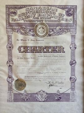
Framed charter for the Belleville Division of the Canadian Brotherhood of Railway Employees

  • CA ON00156 2020-074
  • Item
  • 31 December 1945

Charter for Belleville Local Division Number 126 of the Canadian Brotherhood of Railway Employees and Other Transport Workers.
Officers listed:
President: J. G. Shaw
Treasurer: C. Kellet
Financial Secretary: V. P. McIntyre
Local Chairman: H. J. Armstrong
Recording Secretary: C. A. Finnigan
Reporter: H. Pointer

Canadian Brotherhood of Railway Employees

Fleming family collection of Ivanhoe materials

  • CA ON00156 2020-057
  • Collection
  • 1905-c.1910
  1. Record of sales made at William Clements' general store in Ivanhoe, Ontario, with name of customer, item purchased and price of item, 8 July 1905 - 3 October 1906
  2. Reproduction photograph of C.P.R. station at Ivanhoe, Ontario, c.1920
  3. Photocopy of page of information about the Ivanhoe General Store, taken from Ode to Ivanhoe by Janice Fleming , 1983

Clements, William

Harold McMurrich Rathbun negatives

  • CA ON00156 DA HMR
  • Series
  • 1907-1940s

Two negative-holders with annotations by Harold McMurrich Rathbun for negatives he took between 1907 and 1914, with loose negatives from 1920-1940. Most of the photographs were taken in and around Deseronto, Ontario, but they also include photographs taken on a journey by rail to Alberta in 1907.

Rathbun, Harold McMurrich

Deseronto Navigation Company luggage tag

  • CA ON00156 DA 2015.17
  • Item
  • c.1895

Luggage tag for route "Local 26" of the Deseronto Navigation Company Ltd. of Deseronto, Ontario.

American Railway Supply Company

Photographs of Belleville Exhibition grounds and Stephens Adamson events

  • CA ON00156 2020-003
  • Collection
  • 1890-1963

Collection of photographs from the Scott and Cooney families of Belleville, Ontario:
1) Streetcars and Tickell furniture factory on Foundry Street in Belleville, c.1895
2) Photograph of horses at the Quinte Exhibition grounds, c.1900
3-10) Photographs of the Quinte Exhibition (James Scott (1879-1947), the donor's grandfather, was the groundskeeper), c.1925
11) Page 9 and 10 of the S-A Conveyor, with photos from the Stephen-Adamson Christmas party, 1945
12) Photograph of children with Santa at a Stephens-Adamson Christmas party, c.1950
13) Photograph of Stephens-Adamson baseball team in front of the fountain at the Quinte Exhibition grounds (including Gordon Cooney, 1912-1968), c.1950
14) Gordon Cooney (father of Fay Bradshaw) and two other men having their hair cut at Seely's barber shop on Front Street in Belleville, c.1963

Map of the Canadian National Railway System

A map of the Canadian National Railway System published in 1965. The system composed of; the Central Vermont Railway Inc., the Grand Trunk Western Railroad Co., Duluth, Winnipeg and Pacific Railways Company. Also featuring sponsored hotels, lines under construction and offline traffic offices. The total system mileage is 25,000.

Canadian National Railways

Blueprint of CNR Right of Way in Belleville

A blueprint plan showing land required by the Canadian Northern Ontario Railway for a proposed right-of-way on Lots 1-2A, Dundas Street, Belleville. The property belonging to Mary E. Ponton is coloured in pink and amounts to 1.05 acres. The plan was signed on October 23, 1911 at Toronto.

Stewart, A. F.

Photographs of locomotives

  • CA ON00156 2012-34
  • Collection
  • c.1950

Five photographs of Canadian National Railways locomotives. The engine numbers are 6100, 6065, 6066 and 6079.

Results 1 to 20 of 97