Print preview Close

Showing 754 results

Archival description
Hastings, County of Land, settlement and immigration Image With digital objects English
Print preview Hierarchy View:
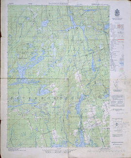
Topographical Map of Bannockburn - east half
Topographical Map of Tweed - Canada sheet
Topographical Map of Belleville - Canada sheet
Aerial View of Belleville Harbour
Soil Map of Hastings County
Topographical Map of Belleville - Canada sheet - east half
Topographic Map of Ontario - Belleville Sheet
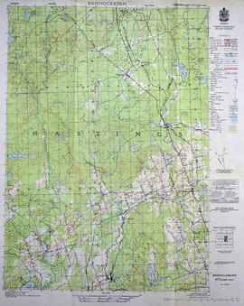
Topographical Map of Bannockburn - west half
Topographical Map of the Belleville to Kingston
Topographical Map of west Trenton - Canada sheet
Topographical Map of Ontario - Belleville Sheet
Topographical Map of west Belleville - Canada sheet
Topographical Map of east Belleville - Canada sheet
By-law Map #4 of the City of Bellleville
By-law Map #3 of the City of Bellleville
Proposed Reconstruction of Corby Park in Belleville
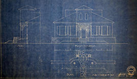
Plan of Elevations on Ponton Home in Belleville
CNR Crossing at Cannifton Road Blueprint
Plan of Market Square in Belleville
Blueprint of CNR Right of Way in Belleville
Results 1 to 20 of 754