Affichage de 54 résultats

Description archivistique
Industries Avec objets numériques
Aperçu avant impression Hierarchy Affichage :

Seymour Power & Electric Co. Limited in Murray Township

  • CA ON00156 M/M430-2998 - 3001/M430-3000
  • Pièce
  • c.1910
  • Fait partie de Map collection

An original map produced for the Seymour Power & Electric Co. Limited, concerning proposed transmission lines within the Township of Murray. However, the map also features railways, roads, mills and land boundaries. Circa 1910. Scale: 50 chains = 1 inch. Map composed by Smith, Kerry and Chace Engineers located in Toronto, Winnipeg, Calgary and Vancouver.

Donated by David Pershick.

Sans titre

Trenton Electric & Water Co. Limited in Sidney Township

  • CA ON00156 M/M430-2998 - 3001/M430-3001
  • Pièce
  • c. 1910
  • Fait partie de Map collection

An original map produced for the Trenton Electric & Water Co. Limited, concerning proposed transmission lines within the Township of Sidney. However, the map also features railways, roads and land boundaries. Circa 1910. Scale: 50 chains = 1 inch. Map composed by Smith, Kerry and Chace Engineers located in Toronto, Winnipeg, Calgary and Vancouver.

Donated by David Pershick.

Sans titre

Minerals in northern Hastings County

A map of northern Hastings County detailing different types of mineral occurrences, see Legend. Published in 1943 by the Ontario Department of Mines. Scale: 1:120,000. The map includes parts of Quebec and USA, in relation to the region. It was produced to "accompany report by Jas E. Thomson in Vol. LII Ontario Department of Mines, Annual Report, 1943."

Donated by the Ontario Department of Mines, April 1, 1965.

Sans titre

Geological Map of Madoc Gold Region

A Geological Map of the Madoc Gold Region, 1866. Geological data on map was taken principally from the reports of the Geological Survey of Canada. Secondly, by information and facts obtained on the spot by gentlemen engaged in the gold fields. What follows is a description of the general geological character of the area.

Author: Henry White, P.L.S. Published by G. B. Ware, 16 Toronto Street, Toronto, Ontario.

Sans titre

Depth of the Moira River for Channel Plan

  • CA ON00156 M/M440-1274
  • Pièce
  • 1881-1887
  • Fait partie de Map collection

A map showing, primarily, the depth of the Moira River within Belleville, Ontario. Together with a written report, it proposed a channel to the New Ferry Slip. Major streets and some lots are also labelled. By John D. Evans, P.L.S. on April 28, 1881 or 1887. Scale: 66 feet : 1". Note the interesting colouring at dimmed edges.

Donated by the Col W. N. Ponton Estate.

Sans titre

Map of Town Plot at mouth of Trent River

  • CA ON00156 M/M440-1483
  • Pièce
  • 23 Sept 1926
  • Fait partie de Map collection

A map of a town plot at the mouth of the Trent River in the Newcastle District. The map features numbered lots, present streets and water ways. Scale: 1 inch = 2 chains. Originally surveyed by F. P. Rubidge, D.P.S., in 1834. This copy was issued September 23, 1926.

Sans titre

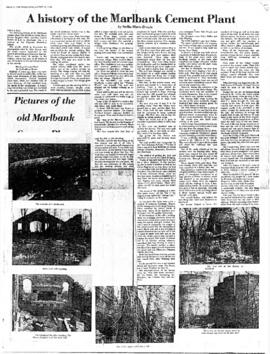
A History of the Marlbank Cement Plant

  • CA ON00156 2018-055
  • Pièce
  • 1978

Photocopy of an article by Stella-Marie Brown, a student at Napanee Secondary School, on the history of the Marlbank Cement Plant, written for an essay contest sponsored by the Lennox and Addington Historical Society and published in The Tweed News on 23 August 1978.

Sans titre

Digital copy of photograph of staff of Shannonville Canning Ltd.

  • CA ON00156 DA 2015.27
  • Pièce
  • September 1938

Staff of Shannonville Canning Ltd., Shannonville, Ontario, in September 1938.

Names supplied:

Back row: Nellie Howard, Maggie Brant, Maggie Maracle, Mae Hill, Ethel Bardy, Georgina Rupert, Edna Maracle, Beatarice Brant, John Weese, ?, Mac FitzGerald, Lena FitzGerald, Edna Fuller, Harold Burtt, Mavis John, ?, Beatrice Smart, ?, Blanche Hill, Ivan Hill, Cora Maracle, Harold Elmy, Mr. Rightmyer, Tommy Howard and Percy "Diner" Howard

Second row: Marjorie FitzGerald, Dorsey Brant, Josie FitzGerald, Ethel John, Lydia Marion, Winnifred Maracle, Julia Maracle, Lydia Maracle, Kathleen Louis, Sadie Maracle, Gladys Brant, Eva Burtt, Anita Goodfellow, Stella Breadman, ?, Mrs Burtt, Winnie Howard and Marjorie Brant

Third row: Vincent Bardy, Madeline Spencer, ?, Pearl Brant, Leola Brant, Evelyn Noye, Muriel Hill, Alice Dow, Marjorie Elmy, Marion Hill, Reta Conley, Edna McCarthy, Helena Sager, Maggie Hill, Bertha Reed, Flossie ?, and Helen Fuller

Front row: Austin Fuller, Ross Brant, Clifford Hill, Eugene Maracle, Lorne Maracle, Harry Uens, ?, William Hill, ?, Carmon Spencer, Laural Burtt, Gerald Louis, Blake Cook and Roy Sager

Cheese Board materials

File contains printed materials:

  1. Fifth Appeal from the Belleville Cheese Board Patriotic and Red Cross Association requesting farmers to donate a day's milk on 21 June 1918 for the Red Cross, 8 June 1918 [3 copies]
  2. Belleville Cheese Board of Trade flyer about the Eastern Ontario Dairymen's Association annual meeting and exhibition of 1919, 24 September 1918
  3. Booklet on 'Improved Methods of Marketing Cheese', 1923
  4. Board of Trade Journal volume 13, number 7, Summer 1923

Sans titre

Photograph of staff of Canada Cement Company Plant No. 5

  • CA ON00156 2011-48
  • Pièce
  • 1943

Photograph of staff at Plant Number 5 of the Canada Cement Company Limited, Point Anne, Ontario.

Names provided by Jackie Gilbert (formerly Hull):
Back row: Peter Stalkovistch; Bud Doxtator; ?; Mr. Roluf; Franklin Bennett; Phil Loft; Mr. Basisty?; Walter MacDonald; Joe ?; Earl Wilson?; Mr. Moslo Sr; Leonard MacDonald; Reg File; Mike Basisty?; Charles Dedore; W. Akey; Joe Sutherby; ?; ?; Bill Insley; Cummings?; Murney Carter; ?; Mr Logue; ?; ?; ?; ?; ?; ?; ?; John Maher; ?; ?; ?
Second row: Daly Cummings; Sedore ?; ?; ?; Ned Campbell; Johnnie Bennett; Sam Belack; Mr. Pitt; Tommy Bennett; Raymond Bailey; Peewee; Mr. Gurnick; Mr. Horewood; Mr. Conly; Bert Lloyd; Mr. Rosebush; Bill Gray; ?; Mr. Deforge; ?; Art Whitehead; ?; ?; ?; Tom Bowler; Sonny Legate; Stan Luffman; Chester Shepherd; ?; Mr. Bonokowski; ?; ?; Dell McConnell; Mac McKay
Third row; Jimmy Sero; ?; Chuck Lloyd; Josh Maracle; Bill Hull; Maurice Bradshaw; ?; George King; Percy Akey; Hep Payne; Ralph Payne; Dorothy King; Mr. Gaulin; Mr. Hamilton; ?; J. H. Legate; George Armstrong; Pete Hart; Herb Scholar?; Fred Clark; Mr. Brown?; John McConnell; ?; Mr. Jenkins; Joseph Huck; ?; Elijah Brent; ?; Walter Hull
Front row: Peter Moslo; Earl Deforge; Jack Insley; Mike Yosepanko; Murney Green, jr; Jack Whitehead; Murney Green, sr; Dorothy Goodfellow; Dorothy Bennett; Evenlyn Loft; ?; Marion Deforge; Euretta Juby; Gertrude Payne; Lena Hull; Irene Derushie; Mary McTurney; Madeline Bennett; Mrs Bailey?; Mrs. Gurnick; Mrs. ?; Milton Bowers; Bill Juby; ?; ?; ?; John Zurgee

Sans titre

Share certificate for Springer Lock Manufacturing Company

  • CA ON00156 2023-037
  • Pièce
  • 1915

Certificate for one share of $100 of the capital stock of the Springer Lock Manufacturing Company Limited, issued to C. A. Campbell on 24 November 1915. Signed by W. C. Springer, Managing Director, A. J. Bird, Secretary-Treasurer, and Mackenzie Bowell, President.

Sans titre

Map Hastings, Prince Edward, Northumberland and Peterborough Counties

A map of Hastings, Prince Edward, Northumberland and Peterborough counties in 1916 from the Department of Interior Canada. Published by J.E. Chalifour, Chief Geographer. Scale: 3" to 95 miles. Dimensions 63.5cm x 96.5cm.

The legend includes additional information about counties, towns, villages, boundaries, railways, canals, lots, concessions, portages, rapids and First Nations Territories.

Sans titre

Map of Lake Township in Hastings County

  • CA ON00156 M/M430-1212
  • Pièce
  • 6 May 1954
  • Fait partie de Map collection

A map of Lake Township in Hastings County showcasing the mining industry in Eastern Ontario. Concessions and lots are numbered. Plan number E. O. 57 from the Ontario Department of Mines, issued May 6, 1954. Scale: 1:30,000.

Sans titre

Zoning Map of Belleville 1959-1970

  • CA ON00156 M/M440-1324
  • Pièce
  • 1959-1970
  • Fait partie de Map collection

A map showing, primarily, zoning limits within the City of Belleville. The limits are coloured in crayon and can be referenced on the legend (left). The map was first created c. 1959 (as written in pencil). However, more recent revisions were made June 4, 1970. Scale: 1:12,000. Additional information about by-laws is available on the map's border.

Note the two names listed on the top left corner: K. Murray and D. Williams - possible authors or owners.

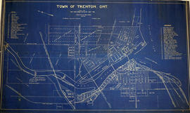
Map of the Town of Trenton 1926

  • CA ON00156 M/M440-1482
  • Pièce
  • Jun 1926
  • Fait partie de Map collection

A map of the town of Trenton, Ontario in June 1926. The map features numbered lots, present industries, CNR tracks and other important buildings. Streets and their names, as well as the River Trent are also present. Scale: 1:3000. Composed by Mayor W. A. Fraser and published by his Town Council.

Sans titre

Map of Mineral Deposits in Coehill and Jenkins

"Coehill and Jenkins Irone Ore Deposits, Lots 15, 16, 17, 18, Concession 8, Township of Wollaston, Hastings County, Ontario."

A map published by the Department of Mines of Canada, in 1911, showing contour lines, magnetic intensities and other physical features. Surveyed by E. Lindeman.

Donated by Nick January in 2016.

Sans titre

Résultats 1 à 20 sur 54