
Reproduction of a map of Upper Canada

Map of Upper Canada and United States
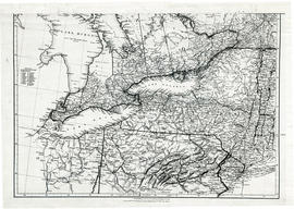
Parts of Ontario and USA in 1834

Map of Facilities within the Moira River Watershed

Map of Districts of Prince Edward and Midland

Map Hastings, Prince Edward, Northumberland and Peterborough Counties

Road Map of Hastings County 1953

Map of Hastings Highlands, Trenton and Belleville

Topographical map of Bancroft - west half

Topographical map of Bannockburn - Canada sheet
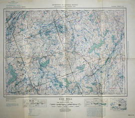
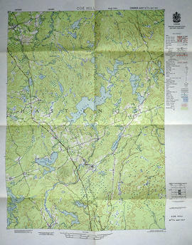
Topographical map of Coe Hill, Ontario
Topographical map of Coe Hill - east half

Topographical map of Duck Island

Topographical map of Trenton - Canada sheet

A New Map of Upper & Lower Canada

Hydrographic Map of Upper Gap to Telegraph Narrows

Richmond Township Map # 443771E

Thurlow Township Map # 443772E

Hungerford Township Map # 444772E

Hungerford Township Map # 445772W
Resultaten 1 tot 20 van 108