Showing 123 results

Archival description
Trenton Land, settlement and immigration
Print preview Hierarchy View:

76 results with digital objects Show results with digital objects

Robertson, William, Postmaster, Port Trent, 1832-1836.

File contains manuscript statements of accounts and correspondence originating from and received by William Robertson, Postmaster, Port Trent concerning land transactions. Also present are printed completed receipts issued by the Commissioner of Crown Lands' Office, Peter Robinson issued in 1834 for lands sold from the Clergy Reserves in the township of Murray, district of Newcastle.

Robertson, William; Port Trent Letters 1833, 1840, 1845, 1851

File contains manuscript correspondence originating from and received by William Robertson regarding lands at River Trent in Murray Township. Also present is a completed, printed approval of the Board of Endowment Office, Toronto, of an application for purchase of lot 28, concession 3, Township of Murray by William Robertson, 29 August 1851.

Trenton : The Evolution of Trenton

File contains a printed booklet entitled “The Evolution of Trenton Ontario,” published in 1913, providing a history of the community from the late 18th century, its incorporation as a town, and the industrial and commercial development of the centre. Also present are several newspaper articles concerning Trenton's evolution into a town in 1880.

Trenton Commercial Papers

File contains a number of newspaper articles, financial statements, and receipts of payment, ranging in years from c. 1876 to c. 1922.
The oldest item in the file is an article in an unknown newspaper, written by Eugene Schuyler c. 1876; about issues regarding the country of Turkey.
There are financial statements from The Town of Trenton, Ontario, and purchase receipts from the same municipality.

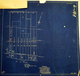
Map of Expropriated Land for Trenton Air Base

A map of Sidney Township, part of Concession #1 and Broken Front, October 18th, 1912. The map details a tract of land expropriated for Trenton Air Base. Scale: 12.5 chains : 1 inch.

Attached is a letter dated May 1st, 1931, The King versus Maitland Hutton and Leda Hutton.

Lot Division Map of Sidney Township

A lot division map of Sidney Township in Hastings County, Ontario. Published by the Department of Land Surveys on August 18th, 1944. Scale: 1=4,000.

Bottom right corner reads "Dominion of Canada, War Assets Corporation" and discusses a storage yard location on Lot 3, Concession 1.

Department of Land Surveys

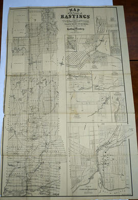
Hastings with Town of Belleville and principal villages

A map of Hastings County including the Town of Belleville and other principal villages:

Trenton, Madoc, Marmora, Tweed, Bridgewater, Stirling, Wicklow, Bangor, Herschel, Monteagle, Carl, Dungannon, Wollaston, Limerick, Cashel, Tudor, Grimsthorpe, Elzevir; Rawdon, Huntingdon, Hungerford, Sidney, Thurlow, Tyendinaga.

Scale: 3 miles =1 inch. Published by John P. Evans, P.L.S. in 1869.

Evans, John Dunlop, P.L.S.

Teacher's Guide to Quinte in 1785

Map showing the Bay of Quinte to Presqu'ile to the eastern tip of Grande Isle (Wolfe Island) used as a teacher's guide to the area in 1785. The 20th century names are in capital letters as per the Legend.

Map of Hastings with townships

A map of Hastings County outlining the twelve townships:
Marmora and Lake, Madoc, Tudor, Grimsthorpe, Elzevir; Rawdon, Huntingdon, Hungerford, Sidney, Thurlow, Tyendinaga.
As well as, the lots and concessions. Circa 1916.Scale: 4 miles: 1 inch.

Donated by K.G.M. Ross.

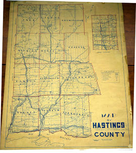
Lloyd's Map of Hastings County

A map of Hastings County outlining the twelve townships:
Marmora and Lake, Madoc, Tudor, Grimsthorpe, Elzevir; Rawdon, Huntingdon, Hungerford, Sidney, Thurlow, Tyendinaga. The northern townships are pictured on the right side.
As well as, the lots and concessions. Circa 1922. Scale: 1.5 miles: 1 inch. Published by Lloyd's Maps, Map Publisher.

Lloyd's Map, Map Publisher

Map of Belleville to North of Bancroft

A map containing focused maps of: Trenton, Belleville, Prince Edward County, Frankford, Picton, Bancroft, Deseronto, Stirling, Tweed, Marmora and Madoc. Insets refer to roads, streets and highways. Published by Millhouse Maps in 2001.

MIllhouse Maps

Map of Quinte West

A map of Quinte West, Ontario featuring streets, waterways and significant buildings - see legend for details.

Bay of Quinte Regional Mapping

Map of City of Quinte West 2004

A map of Quinte West, Ontario featuring Frankford, Murray, Sidney and Trenton areas. Dated 2004.

Bay of Quinte Regional Mapping

Map of Murray Township showing several lots

A copy of an original map by Surveyor General David W. Smith showing several lots of land in Murray Township in the District of Newcastle. Specifically, the map shows Lots 1-5 near the 1st Concession and River Trent. Published by Henry Smith on July 24, 1799.

Donated by K.G.M. Ross in 1963.

Smith, David William

Results 1 to 20 of 123