Showing 883 results

Archival description
Land, settlement and immigration With digital objects
Print preview Hierarchy View:

Digital photographs of Mohawk blockade in support of Wet'suwet'en protest

  • CA ON00156 2020-024
  • Series
  • 10 February 2020

Eleven digital photographs of the demonstration at the railway lines in the Tyendinaga Mohawk Territory in support of the Wet'suwet'en protest against the construction of the Coastal GasLink pipeline through their territory.

Morris, Bobby-Jo

An Immigrant Story

  • CA ON00156 2011-29
  • Item
  • 2010

Family history of John McIntosh (1865 – 1925) and Henrietta Calder (1867 – 1950), immigrants from Scotland to Canada who settled in Belleville, Ontario.

Saylor, Randy

Culbertson Tract Land Claim collection

  • CA ON00156 DA TD/CTLC
  • Collection
  • 2007

This collection comprises documents received in response to an Access to Information request addressed to Indian and Northern Affairs Canada (INAC) by the Corporation of the Town of Deseronto, Ontario, in 2008. The request asked for copies of documentation submitted as part of the Culbertson Tract land claim of the Mohawks of the Bay of Quinte and upon which the decision to allow the claim had been based.

The documents in this collection are all photocopies of materials located in public archives in Canada. The materials range in date from 1779 to 1959 and record the interactions between the Mohawks of the Bay of Quinte and the British and Canadian governments, in relation to lands, from the time of their departure from the Mohawk Valley to the mid-twentieth century.

Research Project of the Wards in Belleville

A part of a research project studying the evolution of wards in Belleville, from 1836 - 1874. The wards are coloured in on Charles Mott's map of the City of Belleville (circa 1950).

Donated by the Belleville Public Library in 2014.

Belleville Public Library

City of Belleville Map with Property Boundaries in 1981

A map of the City of Belleville, including property boundaries, waterways and roads. From the Moira River in the east to the Bay of Quinte south and CNR & North Front Street in the north to Avondale Road in the west. Map composed by the Quinte Planning Board and dated October 1, 1981. Scale 1:4800.

Donated by the Heritage Belleville Committee in 2017.

Quinte Planning Board

The Vandervoorts of Sidney Township

This file contains a copy of a school project written by Scott Randolph from Foxboro Sr. Elementary School. It is titled "One Hundred and Eighty Years of Service" The Vandervoorts of Sidney Township and contains information about the genealogy of the Vandervoort Family commencing in 1784 with Peter Vandervoort.

By-law Map #3 of the City of Bellleville

  • CA ON00156 M/M450-3052
  • Item
  • 4 Apr 1977 - 2 Oct 1996
  • Part of Map collection

A by-law map for the City of Belleville covering area from the Bay of Quinte to College Street & the Moira River to Sidney Street. Initially dated April 4, 1977 but revised later on October 2, 1996. Complied by the Quinte Planning Board. Scale 1;4800. Signed by Mayor J. Ben Corke and Clerk Earl M. Dafoe.

Donated by Lois Foster.

Quinte Planning Board

By-law Map #4 of the City of Bellleville

  • CA ON00156 M/M450-3053
  • Item
  • 4 Apr 1977 - 2 Oct 1996
  • Part of Map collection

A by-law map for the City of Belleville covering area from the Bay of Quinte to College Street & Station Street, Herchimer Avenue to the Moira River. Initially dated April 4, 1977 but revised later on October 2, 1996. Complied by the Quinte Planning Board. Scale 1;4800. Signed by Mayor J. Ben Corke and Clerk Earl M. Dafoe.

Donated by Lois Foster.

Quinte Planning Board

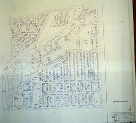
Central City of Belleville Map with Property Boundaries in 1976

A map of the City of Belleville, including property boundaries, waterways and roads. House numbers are also included. From Bridge Street East north to Station Street and from the Moira River east to Bleecker Avenue. Map composed by the Quinte Planning Board and dated February 23, 1976. Scale 1:2400.

Donated by the Heritage Belleville Committee in 2017.

Quinte Planning Board

South City of Belleville Map with Property Boundaries in 1976

A map of the City of Belleville, including property boundaries, waterways and roads. House numbers are also included. From Bay of Quinte north to Bridge Street East and from the Moira River east to Foster Avenue. Map composed by the Quinte Planning Board and dated February 23, 1976. Scale 1:2400.

Donated by the Heritage Belleville Committee in 2017.

Quinte Planning Board

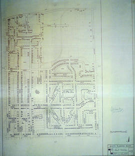
East City of Belleville Map with Property Boundaries in 1976

A map of the City of Belleville, including property boundaries, waterways and roads. House numbers are also included. From Bridge Street East north to Station Street and from the Bleecker Avenue east to Herchimer Avenue. Map composed by the Quinte Planning Board and dated February 23, 1976. Scale 1:2400.

Donated by the Heritage Belleville Committee in 2017.

Quinte Planning Board

Street Plan of the City of Belleville 1975

  • CA ON00156 M/M440-2564
  • Item
  • 6 Feb 1974 - 2 Nov 1975
  • Part of Map collection

A map detailing local streets, schools and their respective names, in Belleville, Ontario. Composed by the Quinte Planning Board in February 1974. Revised November 2, 1975.

Donated by the Belleville Public Library in 2014.

Quinte Planning Board

Registrar's Plan of Lot 12 in Sidney Township

A certified reproduction of the "Registrar”s Compiled Plan, being a graphic index of part of Lot # 12, Concession 2, Township of Sidney.” The area includes; Lots # 1 to 22 on the West side of White's Road and North between Concession 1 and 2, Township of Sidney. Surveyed by Walter I. Watson, O. L. S. and signed April 19, 1973.
Donated by Walter I. Watson, P. L. S.

Watson, Walter Irvine, O.L.S.

Subdivision of part of Lots 38-39 in the City of Belleville

A certified reproduction of the "Subdivision of part of Lots # 38 & 39. Reg. Plan No. 22, Belleville, owners Ross Robinson & Elizabeth Robinson.” The area includes; Lots # 1, 2, 3, Blocks A & B regarding widening at South East corner of Tracey St. and Lemoine Street. Surveyed by Walter I. Watson, O. L. S. and signed March 29, 1973.

Donated by Walter I. Watson, P. L. S.

Watson, Walter Irvine, O.L.S.

Results 1 to 20 of 883