Showing 810 results

Archival description
Land, settlement and immigration With digital objects Map collection
Print preview Hierarchy View:
A New Map of Upper & Lower Canada
Map of the Dominion of Canada
Map of Canada indicating Natural Resources
Map of the Dominion of Canada and Newfoundland
Philips' School-room Map of Europe
Reproduction of a map of Upper Canada
Proposed Towns and Military Roads of Upper Canada
Reproduction of a map of the province of Upper Canada
Map of the principal settlements of Upper Canada (Part 1)
Map of the principal settlements of Upper Canada (Part 2)
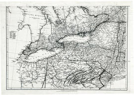
Map of Upper Canada and United States
Parts of Ontario and USA in 1834
Maps of the Districts of Upper Canada
Reproduction of a map of Canada West, formerly Upper Canada
Reproduction of map of Province of Canada, western sheet
New Railway and Commerical Map of Ontario
Map Hastings, Prince Edward, Northumberland and Peterborough Counties
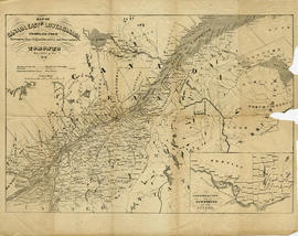
Champlain Map of 1616
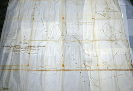
Huyck Islands claimed by Alnwick Indians
Map of Lower Canada or Canada East
Results 1 to 20 of 810