Mostrando 817 resultados

Descripción archivística
Land, settlement and immigration Imagen
Imprimir vista previa Hierarchy Ver :

817 resultados con objetos digitales Muestra los resultados con objetos digitales

Photograph of Mike Stanko and Clare Homan

  • CA ON00156 2020-014
  • Unidad documental simple
  • c.1953

Photograph taken at John and Leatha Homan's farm on Harmony Road in Corbyville, Hastings County, Ontario. It shows Mike Stanko, a displaced person from Poland who came to Canada after the Second World War, and the Homan's son, Clare, next to a car.

Digital photographs of Mohawk blockade in support of Wet'suwet'en protest

  • CA ON00156 2020-024
  • Serie
  • 10 February 2020

Eleven digital photographs of the demonstration at the railway lines in the Tyendinaga Mohawk Territory in support of the Wet'suwet'en protest against the construction of the Coastal GasLink pipeline through their territory.

Sin título

A New Map of Upper & Lower Canada

  • CA ON00156 M/M1100-1654
  • Unidad documental simple
  • 1 Dec 1807
  • Parte deMap collection

A "New Map of Upper & Lower Canada" published December 1, 1807. Scale: British statute 69.5 miles to a degree. Created by John Cary, engraver and map-seller, No. 181 strand, London.

Sin título

Map of the Dominion of Canada

  • CA ON00156 M/M1100-3048
  • Unidad documental simple
  • 1927
  • Parte deMap collection

A map of the Dominion of Canada. Map dated 1927. Published by the Department of the Interior (Canada). Scale: 100 miles to 1 inch.

Sin título

Map of Canada indicating Natural Resources

  • CA ON00156 M/M1100-3049
  • Unidad documental simple
  • 1936
  • Parte deMap collection

A "Map of Canada - Exclusive of Northern Regions - Indicating Main Natural Resources." Map revised in 1936. Published by the Department of Mines & Resources (Canada). Scale: 100 miles to 1 inch.

Sin título

Map of the Dominion of Canada and Newfoundland

  • CA ON00156 M/M1100-3078
  • Unidad documental simple
  • 1945
  • Parte deMap collection

A "Map of the Dominion of Canada and Newfoundland" published by the Copp Clark Co. Ltd. of Toronto in 1945.

The map served dual commercial and educational purposes. It advertises for a chocolate company with slogans and images: "Neilson's, The best chocolate bars in Canada [and] Neilson's Jersey milk chocolate - The best milk chocolate made." On the top right corner, an inscription writes that the map was for rural, underprivileged schools and was not to be removed from such locations.

Sin título

Philips' School-room Map of Europe

  • CA ON00156 M/M3000-3077
  • Unidad documental simple
  • c. 1921
  • Parte deMap collection

"Philips' School-room Map of Europe" as composed by George Philip & Son Ltd. and published by London Geographic Institute. The map was drawn after the Treaty of Versailles and before the formation of the Soviet Union (USSR).

Sin título

Reproduction of a map of Upper Canada

  • CA ON00156 M/M400-1000
  • Unidad documental simple
  • Mar. 1792 - Sept. 1795
  • Parte deMap collection

Reproduction of a map showing "the Routes Lt. Gov. J. G. Simcoe took on trips" throughout Upper Canada from March 1792 to September 1795. The map was charted by Lt. Gov. Simcoe. A good depiction of the area now referred to as Southern Ontario and his plans for a capital there - "London." This map was published as part of "Charting Our Past" from the Archives of Ontario by Stonehouse Publications.

Scale: about 20 miles to an inch.

Proposed Towns and Military Roads of Upper Canada

  • CA ON00156 M/M400-1001
  • Unidad documental simple
  • c. 1796
  • Parte deMap collection

Poor reproduction of a sketch of Upper Canada to show places designated by Lt. Gov. Simcoe for towns and proposed military roads, circa 1796. The map was published by B. M. Kings.

Reproduction of a map of the province of Upper Canada

  • CA ON00156 M/M400-1002
  • Unidad documental simple
  • 12 April 1800
  • Parte deMap collection

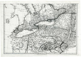
Reproduction of a map showing new settlements, townships, counties etc.in the province of Upper Canada as of April 12, 1800. The total area spans from Quebec to Lake Huron and from Lake Michigan to New Hampshire then south to Pennsylvania in the U.S.A. This was the first printed map of Upper Canada, showing all settlements since 1784. Charted by D. W. Smith, Esq., Surveyor General London and published by W. Faden.

This map was published by Stonehouse Productions as part of "Charting Our Past" from the Archives of Ontario.

Sin título

Map of the principal settlements of Upper Canada (Part 1)

  • CA ON00156 M/M400-1003
  • Unidad documental simple
  • 1817
  • Parte deMap collection

Reproduction of Part 1 of a map showing a plan of the Principal Settlements of Upper Canada in 1817. The area covers from Eastern to Midland to Home District.
This map can be found the Archives of Canada.

Map of the principal settlements of Upper Canada (Part 2)

  • CA ON00156 M/M400-1004
  • Unidad documental simple
  • 1817
  • Parte deMap collection

Reproduction of Part 2 of a map showing a plan of the Principal Settlements of Upper Canada in 1817. The area covers from Northumberland to Essex counties.
This map can be found the Archives of Canada.

Map of Upper Canada and United States

  • CA ON00156 M/M400-1006
  • Unidad documental simple
  • 1834
  • Parte deMap collection

A map showing settlements of Upper Canada and part of the United States in 1834 by J. Arrowsmith.
Received from the Archives of Canada's map collection - July 9, 1971.

Sin título

Parts of Ontario and USA in 1834

  • CA ON00156 M/M400-1007
  • Unidad documental simple
  • 15 Feb. 1834
  • Parte deMap collection

A map showing settlements of Ontario and part of the United States in February 1834 by J. Arrowsmith. The total area extends from Lake Huron East to Montreal and south Ohio to Long Island.
Received from the Archives of Canada's map collection - 11 May 1977.

Sin título

Maps of the Districts of Upper Canada

  • CA ON00156 M/M400-1010
  • Unidad documental simple
  • 1788-1849
  • Parte deMap collection

4 maps showing the Districts of Upper Canada between 1788-1849:

  1. Province of Upper Canada, original districts of 1788 and districts in 1802 (District boundaries 1788, dotted line, District boundaries 1802, solid line)
  2. Province of Upper Canada, original counties, ca. 1793
  3. Province of Upper Canada, districts in 1836
  4. Province of Canada West, districts in 1849

Reproduction of a map of Canada West, formerly Upper Canada

  • CA ON00156 M/M400-1013
  • Unidad documental simple
  • 1850
  • Parte deMap collection

Reproduction of a map showing regions within "Canada West, formerly Upper Canada " 1850. The map is divided in 3 parts: Canada West formerly Upper Canada, part 2 Vicinity of the Falls of Niagara and part 3 The City of Toronto and its environs. In 1849, the County succeeded the District as the division for municipal and judicial purposes in Canada West. That along with recent transportation developments. Composed and published by Thomas Cowperthwaite & Co. in the Clerk Office of the District Court of the Eastern District of Pennsylvania.

This map was published by Stonehouse Productions as part of "Charting Our Past" from the Archives of Ontario.

Sin título

Reproduction of map of Province of Canada, western sheet

  • CA ON00156 M/M400-1014
  • Unidad documental simple
  • 1865
  • Parte deMap collection

Reproduction of a map showing regions of the western part of the province of Canada, in 1865. It features transportation and urban developments two years before Confederation, along with increased knowledge of the topography in northern regions, particularly in Canada East. Elevations are given for the Huron and Ottawa territory. Composed by Keith Johnston F. R. S. E. Published by W. & A. K. Johnston Edinburgh.

This map was published by Stonehouse Productions as part of "Charting Our Past" from the Archives of Ontario.

Sin título

New Railway and Commerical Map of Ontario

  • CA ON00156 M/M400-1016
  • Unidad documental simple
  • 1887
  • Parte deMap collection

"New Railway and Commercial Map of Ontario:" a map showing the upper right corner of Ontario, 1887. It features information and reference to railways at the time. Published and donated by S.R.G. Penson.
Received from the Archives of Canada's map collection - 27 Jul. 1966.

Sin título

Map Hastings, Prince Edward, Northumberland and Peterborough Counties

  • CA ON00156 M/M400-1100
  • Unidad documental simple
  • 1916
  • Parte deMap collection

A map of Hastings, Prince Edward, Northumberland and Peterborough counties in 1916 from the Department of Interior Canada. Published by J.E. Chalifour, Chief Geographer. Scale: 3" to 95 miles. Dimensions 63.5cm x 96.5cm.

The legend includes additional information about counties, towns, villages, boundaries, railways, canals, lots, concessions, portages, rapids and First Nations Territories.

Sin título

Champlain Map of 1616

  • CA ON00156 M/M400-1653
  • Unidad documental simple
  • 1956
  • Parte deMap collection

The original map is a tracing of the printed map by Samuel de Champlain from "Les Voyages" in 1613. In the 1616 map, more additions were made to the north and south due to increased colonization. It shows Lake Ontario, here called Lac St. Louis today is known as Georgian Bay, Lake Huron and the Great Lakes.

The map was purchased by John Carter Brown Library, July 1953. The library had received it from Arthur Rau, an antique bookseller in Paris. Reproduced by the Meriden Gravure Society in 1956.

Sin título

Resultados 1 a 20 de 817